Rocky Ford, Oklahoma

Last updated

Rocky Ford, Oklahoma
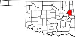
USA Oklahoma location map.svg
Red pog.svg
Rocky Ford
Usa edcp location map.svg
Red pog.svg
Rocky Ford
Coordinates: 36°09′21″N94°54′40″W / 36.15583°N 94.91111°W / 36.15583; -94.91111 [1]
Country United States
State Oklahoma
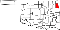
Counties Delaware
Cherokee
Area
[2]
  Total6.93 sq mi (17.94 km2)
  Land6.93 sq mi (17.94 km2)
  Water0.00 sq mi (0.00 km2)
Elevation
[1]
1,011 ft (308 m)
Population
 (2020)
  Total283
  Density40.86/sq mi (15.78/km2)
Time zone UTC-6 (Central (CST))
  Summer (DST) UTC-5 (CDT)
FIPS code 40-63715 [3]
GNIS feature ID2409198 [1]

Rocky Ford is a census-designated place (CDP) in Delaware and Cherokee counties, Oklahoma, United States. The population was 61 at the 2010 census. [4]

Contents

Geography

Rocky Ford is located in southwestern Delaware County and northern Cherokee County. It is bordered to the north and east by Leach and to the southwest by Lowrey. Rocky Ford is 9 miles (14 km) south and west of the town of Kansas.

According to the United States Census Bureau, the Rocky Ford CDP has a total area of 6.9 square miles (17.9 km2), all land. [5]

Demographics

Historical population
CensusPop.Note
2020 283
U.S. Decennial Census [6]

As of the census [3] of 2000, there were 60 people, 18 households, and 16 families residing in the CDP. The population density was 25.0 people per square mile (9.7/km2). There were 21 housing units at an average density of 8.7/sq mi (3.4/km2). The racial makeup of the CDP was 45.00% White, 46.67% Native American, and 8.33% from two or more races.

There were 18 households, out of which 61.1% had children under the age of 18 living with them, 77.8% were married couples living together, and 11.1% were non-families. 11.1% of all households were made up of individuals, and none had someone living alone who was 65 years of age or older. The average household size was 3.33 and the average family size was 3.63.

In the CDP, the population was spread out, with 41.7% under the age of 18, 8.3% from 18 to 24, 30.0% from 25 to 44, 16.7% from 45 to 64, and 3.3% who were 65 years of age or older. The median age was 26 years. For every 100 females, there were 130.8 males. For every 100 females age 18 and over, there were 118.8 males.

The median income for a household in the CDP was $31,875, and the median income for a family was $31,250. Males had a median income of $25,000 versus $40,833 for females. The per capita income for the CDP was $17,477. There were no families and 5.7% of the population living below the poverty line, including none under 18 and none of those over 64.

Related Research Articles

<span class="mw-page-title-main">Greasy, Oklahoma</span> Census-designated place in Oklahoma, United States

Greasy is a census-designated place (CDP) in Adair County, Oklahoma, United States. The population was 372 at the 2010 census.

<span class="mw-page-title-main">Briggs, Oklahoma</span> Census-designated place in Oklahoma, United States

Briggs is an unincorporated community and census-designated place (CDP) in Cherokee County, Oklahoma, United States. The population was 303 at the 2010 census.

<span class="mw-page-title-main">Dry Creek, Oklahoma</span> Census-designated place in Oklahoma, United States

Dry Creek is an unincorporated community and census-designated place (CDP) in Cherokee County, Oklahoma, United States. The population was 227 at the 2010 census.

<span class="mw-page-title-main">Tenkiller, Oklahoma</span> Census-designated place in Oklahoma, United States

Tenkiller is an unincorporated community and census-designated place (CDP) in Cherokee County, Oklahoma, United States. The population was 633 at the 2010 census.

<span class="mw-page-title-main">Welling, Oklahoma</span> Census-designated place in Oklahoma, United States

Welling is an unincorporated community and census-designated place (CDP) in Cherokee County, Oklahoma, United States. The population was 771 at the 2010 census, an increase of 15.25 percent over the figure of 669 recorded in 2000. It is home to The Salvation Army's Heart o' Hills camp and conference center.

<span class="mw-page-title-main">Woodall, Oklahoma</span> Census-designated place in Oklahoma, United States

Woodall is an unincorporated community and census-designated place (CDP) in Cherokee County, Oklahoma, United States. The population was 823 at the 2010 census.

<span class="mw-page-title-main">Zeb, Oklahoma</span> Census-designated place in Oklahoma, United States

Zeb is an unincorporated community and census-designated place (CDP) in Cherokee County, Oklahoma, United States. The population was 497 at the 2010 census.

Brush Creek is an unincorporated community and census-designated place (CDP) in Delaware County, Oklahoma, United States. The population was 35 at the 2010 census.

Bull Hollow is an unincorporated community and census-designated place (CDP) in Delaware County, Oklahoma, United States. The population was 67 at the 2010 census.

Cayuga Springs is an unincorporated community and census-designated place (CDP) in Delaware County, Oklahoma, United States. The population was 140 at the 2010 census, a 33.3 percent increase over the figure of 105 recorded in 2000.

Cloud Creek is an unincorporated community and census-designated place (CDP) in Delaware County, Oklahoma, United States. The population was 121 at the 2010 census, a 40.7 percent increase over the figure of 86 recorded in 2000 census.

Copeland is an unincorporated community and census-designated place (CDP) in Delaware County, Oklahoma, United States. The population was 1,629 at the 2010 census, a 12.5 percent increase from the figure of 1,448 recorded in 2000. Founded as a railroad community, it was named for local resident D.R. Copeland.

<span class="mw-page-title-main">Dennis, Oklahoma</span> Census-designated place in Oklahoma, United States

Dennis is an unincorporated community and census-designated place (CDP) in Delaware County, Oklahoma, near Grand Lake. The population was 195 at the 2010 census. The Dennis Post Office existed from March 25, 1914, until January 31, 1956. It is said to be named for a local resident, Peter Dennis.

<span class="mw-page-title-main">Dodge, Oklahoma</span> Census-designated place in Oklahoma, United States

Dodge is an unincorporated community and census-designated place (CDP) in Delaware County, Oklahoma, United States. The population was 115 at the 2010 census, up from the figure of 96 recorded in 2000.

New Eucha is a census-designated place (CDP) in Delaware County, Oklahoma, United States. The population was 405 at the 2010 census, up from the figure of 300 recorded in 2000.

Old Eucha is a census-designated place (CDP) in Delaware County, Oklahoma, United States. The population was 52 at the 2010 census.

Sycamore is a census-designated place (CDP) in Delaware County, Oklahoma, United States. The population was 177 at the 2010 census.

Tagg Flats is a census-designated place (CDP) in Delaware County, Oklahoma, United States. The population was 13 at the 2010 census.

<span class="mw-page-title-main">Twin Oaks, Oklahoma</span> Census-designated place in Oklahoma, United States

Twin Oaks is an unincorporated community and census-designated place (CDP) in Delaware County, Oklahoma, United States. The population was 198 at the 2010 census. A tornado hit the town on March 12, 2006, destroying 36 homes and damaging 31 others. 8 people were injured.

Dwight Mission is a census-designated place (CDP) in Sequoyah County, Oklahoma, United States. It is part of the Fort Smith, Arkansas-Oklahoma Metropolitan Statistical Area. The population was 55 at the 2010 census, a 71.9 percent gain over the figure of 32 recorded in 2000. It is currently the home of Dwight Mission Presbyterian Camp & Retreat Center.

References

  1. 1 2 3 U.S. Geological Survey Geographic Names Information System: Rocky Ford, Oklahoma
  2. "ArcGIS REST Services Directory". United States Census Bureau. Retrieved September 20, 2022.
  3. 1 2 "U.S. Census website". United States Census Bureau . Retrieved January 31, 2008.
  4. "Geographic Identifiers: 2010 Demographic Profile Data (G001): Rocky Ford CDP, Oklahoma". U.S. Census Bureau, American Factfinder. Archived from the original on February 13, 2020. Retrieved December 10, 2015.
  5. "2020 U.S. Gazetteer Files – Oklahoma". United States Census Bureau. Retrieved August 12, 2021.
  6. "Census of Population and Housing". Census.gov. Retrieved June 4, 2016.