Primrose Lake is a large lake in the Canadian provinces of Saskatchewan and Alberta in the Churchill River drainage basin. The lake straddles the Saskatchewan / Alberta border, with most of the water surface in Saskatchewan with only the south-west corner of the lake in Alberta. On the Saskatchewan side of the lake is Backes Island Wildlife Refuge, which is a small protected island near the middle of the lake that is important to birds. The entire lake plus surrounding land totalling 1,259.52 km2 (486.30 sq mi) is part of an Important Bird Area (IBA) of Canada.

The Fishing Lakes, also called the Calling Lakes or the Qu'Appelle Lakes, are a chain of four lakes in the Qu'Appelle Valley cottage country about 40 miles (64 km) to the north-east of Regina in the Canadian province of Saskatchewan. The lakes are in a region called the Prairie Pothole Region of North America, which extends throughout three Canadian provinces and five U.S. states. It is also within Palliser's Triangle and the Great Plains ecoregion. The Fishing Lakes all follow the course of the Qu'Appelle River, which flows from the west to the east and is part of the Hudson Bay drainage basin. The lakes sit in the deep-cut Qu'Appelle Valley that was formed about 14,000 years ago during the last ice age. Meltwater from the glaciers carved out the valley and as water levels rose and fell, alluvium was left in the wake. These piles of alluvium are what created the separations between the lakes.

The Antler River is located in the Prairie Pothole Region of North America's Great Plains in south-eastern Saskatchewan and south-western Manitoba in Canada in an area known as Palliser's Triangle. Its source is in Saskatchewan's Moose Mountain Upland and it is a major tributary of the Souris River. As a result, its flood levels are monitored by the United States Geological Survey.

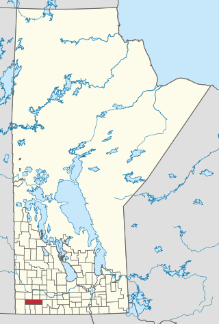
The Rural Municipality of Sifton is a rural municipality (RM) in the south-west portion of the Canadian province of Manitoba.

Last Mountain Lake, also known as Long Lake, is a prairie lake formed from glaciation 11,000 years ago. It is located in south central Saskatchewan, Canada, about 40 kilometres (25 mi) north-west of the city of Regina. It flows into the Qu'Appelle River via Last Mountain Creek, which flows past Craven. It is approximately 93 km (58 mi) long, and 3 km (1.9 mi) across at its widest point. It is the largest naturally occurring body of water in southern Saskatchewan. Only Lake Diefenbaker, which is man-made, is larger. The lake is a popular resort area for residents of south-eastern Saskatchewan.

Manitou Lake is a salt lake located mostly in the RM of Manitou Lake No. 422 in the Canadian province of Saskatchewan, about 10 kilometres (6.2 mi) east of the provincial border with Alberta. The eastern shore of the lake is in the RM of Hillsdale No. 440. Manitou Lake is located in a region called the Prairie Pothole Region of North America, which extends throughout three Canadian provinces and five U.S. states. It is also within Palliser's Triangle and the Great Plains ecoregion. Manitou Lake is part of an Important Bird Area (IBA) of Canada that covers 699.66 km2 (270.14 sq mi) of land and serval neighbouring lakes.

Narrow Hills Provincial Park is a northern boreal forest provincial recreational park in the Canadian province of Saskatchewan. It is located in a hilly plateau called the Cub Hills and contains several recreational facilities and over 25 accessible lakes within its boundaries. The geographical features of the park, including the lakes, valleys, and lowlands were formed over 10,000 years ago during the last ice age. The town of Smeaton is the closest community and it is located 70 kilometres (43 mi) to the south.

Boundary Dam Reservoir is a man-made lake in the south-east corner of the Canadian province of Saskatchewan. It is in census division 1, in the RM of Estevan. The closest city is Estevan, which is about 5.5 kilometres (3.4 mi) downstream. There are no towns or villages along the lake's shore but there are two subdivisions and a regional park. The subdivisions, which are in the RM of Estevan, are called Sunset Bay and Lakewood. The primary inflow and outflow for the reservoir is Long Creek. There is a 10-kilometre long diversion channel that goes to McDonald Lake that can take excess water in either direction.

Blackstrap Lake is a man-made reservoir in central Saskatchewan, Canada, south of Saskatoon in the Rural Municipality of Dundurn No. 314. The lake was created as a reservoir in 1967, as part of the Saskatoon South East Water Supply System. Blackstrap Lake has an area of 1,200 ha and is generally used to support irrigation, and the industrial and municipal water supply.
Indi Lake is a man-made lake in central Saskatchewan, Canada, south of Saskatoon in the Rural Municipality of Dundurn No. 314. The lake was created for irrigation and recreation in 1967 by a dam located at its south end. The lake is part of a greater irrigation and aqueduct system built in the 1960s in Saskatchewan and was named after Indi, an unincorporated railway point nearby on the Canadian National Railway (CNR).

Nanaimo River is a river on Vancouver Island, British Columbia, Canada, located near the city of Nanaimo on the island's east coast. Its headwaters are in the Vancouver Island Ranges of central Vancouver Island and its mouth, the Nanaimo River estuary, is at the south end of Nanaimo Harbour in the Strait of Georgia. The estuary is part of the Pacific Estuary Conservation Program.
The Municipality of Grassland is a rural municipality (RM) in the Canadian province of Manitoba.
Moose Mountain Upland, Moose Mountain Uplands, or commonly Moose Mountain, is a hilly plateau located in the south-east corner of the Canadian province of Saskatchewan, that covers an area of about 13,000 square kilometres (5,000 sq mi). The upland rises about 200 metres (660 ft) above the broad, flat prairie which is about 600 metres (2,000 ft) above sea level. The highest peak is "Moose Mountain" at 830 metres (2,720 ft) above sea level. The upland was named Moose Mountain because of the large number of moose that lived in the area. When it was originally used by fur traders, Métis, and the Indigenous peoples, the plateau was called Montagne a la Bosse, which is French for "The Mountain of the Bump or Knob".

Pipestone Creek is a river in the Souris River watershed. Its flow begins in southeastern Saskatchewan, just south of the town of Grenfell and travels in a southeastern direction into Manitoba in the Westman Region where it empties into Oak Lake through the Oak Lake Marsh.

Moose Mountain Creek is a river in the Canadian province of Saskatchewan. Its source is the Chapleau Lakes near Montmartre and it is a tributary of the Souris River, which, in turn, is a tributary of the Assiniboine River. The whole system is part of the Red River watershed, which is part of the Hudson Bay drainage basin and in a region called the Prairie Pothole Region of North America, which extends throughout three Canadian provinces and five U.S. states. It is also within Palliser's Triangle and the Great Plains ecoregion.

Brightwater Creek is a river in south central part of the Canadian province of Saskatchewan. It is a tributary of the South Saskatchewan River in a region called the Prairie Pothole Region of North America, which extends throughout three Canadian provinces and five U.S. states. It is also within Palliser's Triangle and the Great Plains ecoregion. Along the river's course there is a dam and reservoir and a regional park. There are no communities along its course.

Plum Creek is the primary outflow for the Plum Lakes and travels in an easterly direction for about 28 kilometres until it meets up with the Souris River, which is part of the Hudson Bay drainage basin, at the community of Souris in the Canadian province of Manitoba. Plum Lakes and the beginning of Plum Creek are in the Rural Municipality of Sifton and the mouth is in the Municipality of Souris – Glenwood.
Greenwater Lake is a lake in the Canadian province of Saskatchewan. The lake is at the heart of Greenwater Lake Provincial Park in the Porcupine Provincial Forest on the Porcupine Hills. The RM of Bjorkdale No. 426 surrounds the lake and Highway 38 provides access to it. The lake is so named not because of the colour of the water but rather the colour of the trees reflecting off the water.
Marean Lake is a spring fed lake in the Canadian province of Saskatchewan. The lake is located at the western end of Greenwater Lake Provincial Park in the Porcupine Provincial Forest on the Porcupine Hills. The RM of Bjorkdale No. 426 surrounds the lake and it is accessed off Highway 679.
Eyebrow Lake is a man-made marshy lake that parallels the Qu'Appelle River in the southern region of the Canadian province of Saskatchewan. Located in the RM of Huron No. 223, it is the first lake in a series of lakes along the Qu'Appelle River after Qu'Appelle River Dam and Lake Diefenbaker. The next lake downstream is Buffalo Pound Lake. The closest community is the village of Tugaske and, while there are no public recreation sites at the lake, it can be accessed by Highway 627. The lake gets its name from the nearby Eyebrow Hills, which are shaped like an eyebrow. The nearby town of Eyebrow and RM of Eyebrow No. 193 are also named after these hills.


