Normanton is an inner city suburb and ward of the city of Derby in Derbyshire, England, situated approximately 2 miles (3.2 km) south of the city centre. Neighbouring suburbs include Littleover, Pear Tree, Rose Hill and Sunny Hill. The original village of Normanton-by-Derby, which now forms the southern part of the suburb, dates back to the medieval period. As the Normanton area became rapidly urbanised in the 19th century, the New Normanton area to the north was developed for housing, linking the old village to Derby, into which it was eventually absorbed. The area is characterised by high density late 19th century terraced housing in New Normanton and mid-20th century housing estates elsewhere, and has the most ethnically diverse population in Derby. The Normanton ward had a population of 17,071 in 2011.

St Mellons is a district and suburb of eastern Cardiff, the capital city of Wales. Prior to 1996 St Mellons was the name given to the community largely north of Newport Road (B4487) which included the old St Mellons village. After 1996 the old community was divided and renamed as Old St Mellons and Pontprennau, with the newer, much larger area of modern housing and business parks to the south of Newport Road retaining the St Mellons name. Historically in Monmouthshire, St Mellons became part of South Glamorgan and Cardiff in 1974.

Chaddesden, also known locally as Chadd, is a large residential suburb of Derby, United Kingdom. Historically a separate village centred on Chaddesden Hall and the 14th century St Mary's Church, the area was significantly expanded by 20th-century housing developments, and became part of the then County Borough of Derby in 1968, prior to Derby's city status in 1977.

Seacroft is an outer-city suburb/township consisting mainly of council estate housing covering an extensive area of east Leeds, West Yorkshire, England. It lies in the LS14 Leeds postcode area, around 4 miles (6.4 km) east of Leeds city centre.

Gipton is a suburb of east Leeds, West Yorkshire, England, between the A58 to the north and the A64 to the south.

West Park is a suburb of north-west Leeds, West Yorkshire, England, north of Headingley. It is a mixed area of private suburban housing and suburban council estates. The name derives from its main park containing playing fields together with a conservation area of grassy meadow ending in woodland. The largest housing estate in West Park is Moor Grange.
Allestree is a suburb and ward of the city of Derby, a unitary authority area, in Derbyshire, England. It is the northernmost ward and is on the A6 road, about 2 miles (3 km) north of Derby city centre. It is bordered by the district of Amber Valley along its western and northern edges and Erewash in its north-east corner. To the south it borders the ward of Mackworth and to the east the ward of Darley Abbey.

Alvaston is a village and ward of Derby, England. Alvaston is on the A6 three miles south-east of Derby city centre and probably owes its name to an individual called Ælfwald.

Mackworth is a suburb and electoral ward of the city of Derby, England. Is it located on the north-west of the city near to Markeaton Park and the suburb of Mickleover. It is also known as Mackworth Estate, to distinguish it from the nearby Mackworth village. The Mackworth ward also covers the New Zealand area as well as Mackworth itself.

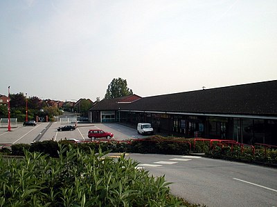
Leigh Park is a large suburb of Havant, in Hampshire, England. It currently forms the bulk or whole of four electoral wards: Battins, Bondfields, Barncroft and Warren Park.

Mosborough is an electoral ward of the City of Sheffield, England, in the eastern part of the city, on the border with North East Derbyshire District. The population in 2011 was 17,097. It is one of the wards that make up the Sheffield South East constituency.

Firth Park ward—which includes the districts of Firth Park, Longley, Parson Cross and parts of Wincobank—is one of the 28 electoral wards in City of Sheffield, England located in the northern part of the city and covering an area of 1.66 square miles (4.3 km2). The population of this ward in 2011 was 21,141 people in 8,602 households.

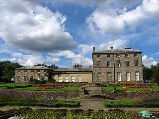
Wollaton is a suburb and former civil parish in the western part of Nottingham, in the Nottingham district, in the ceremonial county of Nottinghamshire, England. Wollaton has two wards in the City of Nottingham, with a total population of 24,693 at the 2011 census. It is home to Wollaton Hall, with its museum, deer park, lake, walks and golf course.

Kenton is a suburb and electoral ward in the north west of Newcastle upon Tyne, England. It borders the Town Moor and Gosforth. Kenton also has close road links to Newcastle Airport. The ward population at the 2011 Census was 11,605.
Oakwood is a suburb of north-east Leeds, West Yorkshire, England, that lies between Gipton and Roundhay Park.

Carleton is a suburb of the town of Penrith, Cumbria, England, that has seen a huge growth in housing since the 1960s and is, of 2018, still expanding due to the Carleton Meadows, Carleton Manor and Woodberry Heights developments. It was formerly a separate small village or hamlet one mile east of the centre of Penrith.
Redditch is a town and local government district in north-east Worcestershire, England. The town is divided into separate districts. All street-name signs in Redditch have the street name in white lettering on a blue background and the district name in black lettering on a white background at the bottom of the sign. In the New Town areas the roads are usually named in alphabetical order and house numbering in the cul-de-sac closes is consecutive, starting with number 1 as the first house on the left as you enter, and the highest house number will be on the opposite side of the road as you leave.

Arboretum is an electoral ward in the city of Derby, England. It includes Derby city centre and the inner city suburbs of Pear Tree and Rose Hill, as well as part of Normanton. It covers much of the area of the historic township of Litchurch. The ward, which takes its name from Derby Arboretum in Rose Hill, had a population of 18,590 in 2011.