Octon, East Riding of Yorkshire

Last updated

Octon
East Riding of Yorkshire UK location map.svg
Red pog.svg
Octon
Location within the East Riding of Yorkshire
OS grid reference TA033698
  London 180 mi (290 km)  S
Civil parish
Unitary authority
Ceremonial county
Region
Country England
Sovereign state United Kingdom
Post town DRIFFIELD
Postcode district YO25
Dialling code 01262
Police Humberside
Fire Humberside
Ambulance Yorkshire
UK Parliament
List of places
UK
England
Yorkshire
54°06′52″N0°25′13″W / 54.114324°N 0.420153°W / 54.114324; -0.420153

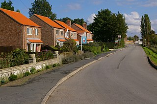
Octon is a hamlet and shrunken medieval village in the East Riding of Yorkshire, England.

Contents

History

Farm buildings, Octon Old Octon Farm - geograph.org.uk - 1258460.jpg
Farm buildings, Octon

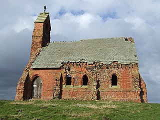
Octon is recorded in the 11th-century Domesday Book as "Ocheton". [1] The village contained a chapel dedicated to St. Michael (noted in 1327). [2] After around 1400 no records exist relating to the chapel, and the village is thought likely to have been depopulated as a result of the Black Death. [3]

By the 19th century the village was reduced to a small farming hamlet. In 1823 three farmers and a gamekeeper were recorded as resident in Octon, with a further two farmers at Octon Grange just over 1 mile (1.6 km) to the north. [4] The extent of the hamlet remained unexpanded throughout the 19th and 20th centuries. [5]

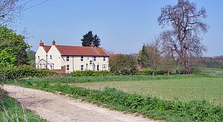
The modern village is at the same location as the reduced medieval village; earthworks of the medieval church and village were scheduled as an ancient monument in 1994. [6] The 'Old farmhouse' at Glebe farm, Octon, a cruck framed longhouse dating from the 17th century is a Grade II* listed building. [7]

Geography

Octon is located approximately 1.25 miles (2 km) west of Thwing in the civil parish of Thwing. It is situated in the Yorkshire Wolds at a height of over 330 feet (100 m) above sea level approximately 9.5 miles (15 km) west of Bridlington on the North Sea coast. The village includes a large house 'Octon Manor'. [8]

Notable people

Related Research Articles

<span class="mw-page-title-main">Flamborough</span> Village and civil parish in the East Riding of Yorkshire, England

Flamborough is a village and civil parish in the East Riding of Yorkshire, England. It is situated approximately 4 miles (6 km) north-east of Bridlington town centre on the prominent coastal feature of Flamborough Head.

<span class="mw-page-title-main">Kilham, East Riding of Yorkshire</span> Village and civil parish in the East Riding of Yorkshire, England

Kilham is a village and civil parish in the East Riding of Yorkshire, England. It is situated about 5 miles (8 km) north-east of Driffield town centre. According to the 2011 UK census, Kilham parish had a population of 1,088, an increase on the 2001 UK census figure of 1,010.

<span class="mw-page-title-main">Garton on the Wolds</span> Village and civil parish in the East Riding of Yorkshire, England

Garton on the Wolds is a village and civil parish on the Yorkshire Wolds in the East Riding of Yorkshire, England. It is situated approximately 3 miles (5 km) north-west of Driffield town centre and lies on the A166 road.

<span class="mw-page-title-main">Eastrington</span> Village and civil parish in the East Riding of Yorkshire, England

Eastrington is a small village and civil parish in the East Riding of Yorkshire, England. It is situated approximately 3 miles (5 km) to the east of Howden and 17 miles (27 km) south east of York.

<span class="mw-page-title-main">Harpham</span> Village and civil parish in the East Riding of Yorkshire, England

Harpham is a small village and civil parish in the East Riding of Yorkshire, England. It is located just south of the A614 road, approximately 5 miles (8 km) north-east of Driffield and 7 miles (11 km) south-west of Bridlington.
<span class="mw-page-title-main">Wressle</span> Village and civil parish in the East Riding of Yorkshire, England

Wressle is a village and civil parish in the East Riding of Yorkshire, England, lying on the eastern bank of the River Derwent approximately 3 miles (5 km) north-west of Howden.
<span class="mw-page-title-main">Cottam, East Riding of Yorkshire</span> Human settlement in England

Cottam is a hamlet and civil parish in the East Riding of Yorkshire, England. The hamlet is west of the B1249 Skipsea to Staxton road, and in the Yorkshire Wolds. It is 16 miles (30 km) north from the county town of Beverley, and approximately 4 miles (6 km) east from the village of Sledmere.

<span class="mw-page-title-main">Thwing, East Riding of Yorkshire</span> Village in the East Riding of Yorkshire, England

Thwing is a village and civil parish in the Yorkshire Wolds, in the East Riding of Yorkshire, England.

<span class="mw-page-title-main">Holme on the Wolds</span> Village in the East Riding of Yorkshire, England

Holme on the Wolds is a village and former civil parish, now in the parish of Dalton Holme, in the East Riding of Yorkshire, England. It is situated approximately 6 miles (10 km) north-east of the market town of Market Weighton and 5.5 miles (9 km) north-west of the market town of Beverley. In 1931 the parish had a population of 132. On 1 April 1935 the parish was abolished and merged with South Dalton to form "Dalton Holme". It lies to west of the B1248 road.
<span class="mw-page-title-main">Wauldby</span> Area of the East Riding of Yorkshire, England

Wauldby is a region in the Yorkshire Wolds within the civil parish of Welton in the East Riding of Yorkshire, England. It contains the gentrified hamlet around Wauldby Manor Farm, and a few other minor dwellings including Little Wauldby Farm.

<span class="mw-page-title-main">Elloughton</span> Village in the East Riding of Yorkshire, England

Elloughton is a village in the East Riding of Yorkshire, England. It is situated approximately 12 miles (19 km) to the west of Hull to the south of the A63 road. It lies on the southern end of the Yorkshire Wolds. It is conjoined with Brough that lies to the south-east, with which it forms the civil parish of Elloughton-cum-Brough.

<span class="mw-page-title-main">Nunburnholme</span> Village and civil parish in the East Riding of Yorkshire, England

Nunburnholme is a village and civil parish in the East Riding of Yorkshire, England. It is approximately 3 miles (5 km) east of the market town of Pocklington. The civil parish is formed by the village of Nunburnholme and the hamlet of Kilnwick Percy. According to the 2011 UK census, Nunburnholme parish had a population of 234, a decrease on the 2001 UK census figure of 253.

<span class="mw-page-title-main">High Hunsley</span> Hamlet in the East Riding of Yorkshire, England

High Hunsley is a small hamlet in the East Riding of Yorkshire, England. It is situated in the Yorkshire Wolds approximately 6 miles (10 km) south-west of Beverley town centre and 2 miles (3 km) north-west of the village of Little Weighton.

<span class="mw-page-title-main">Huggate</span> Village and civil parish in the East Riding of Yorkshire, England

Huggate is a village and civil parish in the East Riding of Yorkshire, England. It is situated approximately 13 miles (21 km) north-west of Beverley town centre and 9 miles (14 km) west of Driffield town centre. The village of North Dalton lies 4 miles (6 km) to the south-east.

<span class="mw-page-title-main">Eastburn, East Riding of Yorkshire</span> Hamlet in the East Riding of Yorkshire, England

Eastburn is a hamlet and former civil parish, now in the parish of Kirkburn, in the East Riding of Yorkshire, England. It is situated in the Yorkshire Wolds on the A164 road, approximately 2.5 miles (4 km) south-west of Driffield town centre and 3 miles (5 km) north-west of the village of Hutton Cranswick. In 1931 the parish had a population of 27.

<span class="mw-page-title-main">Fridaythorpe</span> Village and civil parish in the East Riding of Yorkshire, England

Fridaythorpe is a village and civil parish in the East Riding of Yorkshire, England. It is situated approximately 8 miles (13 km) north-east of Pocklington town centre and lies on the A166 road. It is 550 feet (170 m) above sea level, making it the highest village in the Yorkshire Wolds.

<span class="mw-page-title-main">Foston on the Wolds</span> Village and civil parish in the East Riding of Yorkshire, England

Foston on the Wolds is a village and civil parish in the East Riding of Yorkshire, England. It is situated approximately 8 miles (13 km) south-west of Bridlington town centre and 2 miles (3 km) north of the village of North Frodingham.

<span class="mw-page-title-main">Fordon, East Riding of Yorkshire</span> Village in the East Riding of Yorkshire, England

Fordon is a village and former civil parish, now in the parish of Wold Newton, in the East Riding of Yorkshire, England, near the border with North Yorkshire. It is situated approximately 8 miles (13 km) south of Scarborough and 10 miles (16 km) north-west of Bridlington. In 1931 the parish had a population of 29.

<span class="mw-page-title-main">Drewton</span> Hamlet in the East Riding of Yorkshire, England

Drewton is a hamlet in the East Riding of Yorkshire, England. It is situated on the A1034 road, 6 miles (10 km) south-east from Market Weighton and 11 miles (18 km) west from Hull city centre, and forms part of the civil parish of South Cave.

West Lutton is a village in North Yorkshire, England. It is situated approximately 9 miles (14 km) east from Malton, and within the Yorkshire Wolds. The hamlet of East Lutton is 0.5 miles (0.8 km) to the east. The village lies in the Great Wold Valley and the course of the winterbourne stream the Gypsey Race passes through it.

References

  1. Octon in the Domesday Book . Retrieved 14 November 2012.
  2. Lawton, George (1840), Collectio rerum ecclesiasticarum de Dioecesi Eboracensi: or, Collections relative to churches and chapels within the Diocese of York. To which are added, Collections relative to churches and chapels within the Diocese of Ripon, vol. 2, J. G. F & J. Rivington, Octon, p.314
  3. Jennings, Bernard (2002), "A Longer View of the Wolds", in Thirsk, Joan (ed.), Rural England: A history of the landscape, Oxford University Press, p. 68, ISBN   978-0-19-860619-2
  4. Baines, Edward (1823), History, directory & gazetteer, of the county of York ..., vol. 2, E. Baines, p. 374
  5. Ordnance Survey. 1854, 1892, 1912–3, 1952–3, 1972–83. 1:10560 and 1:10000
  6. Historic England. "Octon shrunken village (79871)". Research records (formerly PastScape). Retrieved 13 January 2013.
  7. Historic England. "The Old farmhouse, Glebe Farm (1309563)". National Heritage List for England . Retrieved 6 December 2012.
  8. Ordnance Survey. 1:25000. 2009
  9. Hobson, Bernard (1924). "26. The Roll of Honour". The East Riding of Yorkshire. Cambridge County Geographies. p. 149. Retrieved 29 April 2013.

Sources

  • Gazetteer — A–Z of Towns Villages and Hamlets. East Riding of Yorkshire Council. 2006. p. 9.