History
In lean years of the early 1630s, when the Massachusetts Bay Colony ran short of grain, Nipmuck farmers in the Connecticut River Valley loaded some of their abundant surplus maize into birch-bark backpacks and trod a familiar route to the settlements at the mouth of the Charles River, where they traded food for European goods made of copper and iron and woollen cloth. [1] Fur traders and the exploratory party of John Oldham (1633) penetrated this first of the trails west into the continent's interior. In 1635, some settlers from Watertown took this route when they removed to Wethersfield, Connecticut.
In 1636, the dissenting minister Thomas Hooker a hundred of his congregation, and 160 cattle, followed the Old Connecticut Path in a two-weeks' journey to the Connecticut River. There they settled in a place the native Tunxis peoples called Saukiog , because of the blackness of its earth. They founded the English settlement of Hartford. By 1643, documents in the village of Sudbury called this trail the "Old Connecticut Path." In 1672, with the establishment of a postal system, it became the first colonial post road.
Route
Long native usage had emphasized the easiest route, [2] skirting the water meadows of the river bottoms and crossing streams at the most dependable fords. During the trip to Connecticut the Path crosses the Blackstone River, that crossing was known as the North Bridge and the Quinebaug River crossing was known as the South Bridge, both Northbridge and Southbridge were named after those well-known landmark locations.
Massachusetts
The Path led west along the north bank of the Charles River from New Town (Cambridge) to newly settled Watertown and passed through what are now Waltham and Weston, curving southward where it entered the southeasterly section of the new town of Sudbury, now set apart as Wayland, where a section of the route still bears the name "Old Connecticut Path". [3] At Wayland, the Bay Path, later the Boston Post Road, [4] diverged from the Connecticut Path and headed west through Marlborough, Worcester, and Brookfield straight toward the Connecticut River. [5] In Sudbury the Connecticut Path was known as "the road from Watertown to the Dunster Farm", since after passing along the north side of Cochituate Pond, it crossed the tract beyond that was granted to Henry Dunster, president of Harvard College, and the lands of Edmund Rice and Philemon Whale. [6] The trail crossed the Sudbury River at "Danforth's Farm", since 1700 incorporated as Framingham, where another section (Route 126) retains the name "Old Connecticut Path", threading past the northern shore of Lake Cochituate. The Connecticut Path headed west, threading between the Charles and Sudbury rivers on its way to the Connecticut River. "From Framingham the Old Connecticut Path runs southward through South Framingham, Ashland (Megunko), Hopkinton (Quansigamog), then through Westborough and over Fay Mountain, to the praying town of Hassanamesit/Hassanamisco, now Grafton, through Sutton and then beyond to Connecticut.

The Boston Post Road was a system of mail-delivery routes between New York City and Boston, Massachusetts, that evolved into one of the first major highways in the United States.

Cochituate is a census-designated place (CDP) in the town of Wayland in Middlesex County, Massachusetts, United States. The population was 6,927 at the 2020 census, out of 13,943 in the entire town of Wayland.

Framingham is a city in the Commonwealth of Massachusetts, United States. Incorporated in 1700, it is located in Middlesex County and the MetroWest subregion of the Greater Boston metropolitan area. The city proper covers 25 square miles (65 km2) with a population of 72,362 in 2020, making it the 14th most populous municipality in Massachusetts. Residents voted in favor of adopting a charter to transition from a representative town meeting system to a mayor–council government in April 2017, and the municipality transitioned to city status on January 1, 2018. Before it transitioned, it had been the largest town by population in Massachusetts.

The Quabbin Reservoir is the largest inland body of water in Massachusetts, United States, and was built between 1930 and 1939. Along with the Wachusett Reservoir, it is the primary water supply for Boston, 65 miles (105 km) to the east, and 40 other cities and towns in Greater Boston. The Quabbin also supplies water to three towns west of the reservoir and acts as backup supply for three others. By 1989, it supplied water for 2.5 million people, about 40% of the state's population at the time. It has an aggregate capacity of 412 billion US gallons (1,560 GL) and an area of 38.6 square miles (99.9 km2).

The Mass Central Rail Trail (MCRT) is a partially completed rail trail between Northampton, Massachusetts and Boston along the former right-of-way (ROW) of the Massachusetts Central Railroad. It currently has 59 miles (95 km) open, and 94.5 miles (152.1 km) are open or protected for trail development. When complete, it will be 104 miles (167 km) long through Central Massachusetts and Greater Boston, forming the longest rail trail in New England. Many sections of the trail, including the Norwottuck Branch of the Mass Central Rail Trail and the Somerville Community Path, have been developed as separate projects but serve as part of the complete Mass Central Rail Trail. The Norwottuck Network, a 501(c)(3) nonprofit that supports the build and operation of the MCRT, maintains an interactive map of the MCRT and other Massachusetts trails.

Route 30 is a 36.3817-mile-long (58.5507 km) east–west arterial route, connecting Grafton with Packard's Corner in Boston. Route 30 runs roughly parallel to the Massachusetts Turnpike and Route 9, but unlike those two larger highways, takes a more meandering path from town to town. Between Boston and the Charles River it is known as Commonwealth Avenue, along most of this route is part of the course of the Boston Marathon.

Route 27 is a 73.44-mile-long (118.19 km) south–north state highway in eastern Massachusetts. Its southern terminus is at Route 106 in Kingston and its northern terminus is at Route 4 in Chelmsford. Along the way it intersects several major highways including Route 24 in Brockton, U.S. Route 1 in Walpole, Route 9 in Natick, US 20 in Wayland, and Route 2 in Acton.

Route 126 is a 33.5704-mile-long (54.0263 km) north–south state highway in Massachusetts. Its southern terminus is a continuation of Rhode Island Route 126 by Woonsocket, Rhode Island and its northern terminus is at Route 2 and Route 2A in Concord. Along the way it intersects several major routes including Interstate 495 (I-495) in Bellingham, Route 9 in Framingham, and U.S. Route 20 in Wayland.
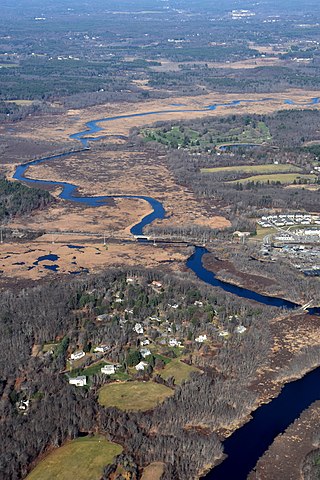
The Sudbury River is a 32.7-mile-long (52.6 km) tributary of the Concord River in Middlesex County, Massachusetts, in the United States.

The Cochituate Aqueduct was an aqueduct in Massachusetts that brought water to Boston from 1848 to 1951.
This is a list of historic sites in Framingham, Massachusetts. There are several notable historic sites in Framingham, according to the Framingham Historical Society. This local society asserts:
While there are many historic spaces in Framingham, the Centre Common is the focal point for the town's past. Three of the town's most historic buildings on the Centre Common face "demolition by neglect." The Village Hall, the Edgell Memorial Library, and the Old Academy building not only house over 10,000 artifacts spanning four centuries of the town's history, but they are symbols of Framingham's commitment to educational excellence, civic engagement, and community pride.

Edmund Rice, was an early settler to Massachusetts Bay Colony born in Suffolk, England. He lived in Stanstead, Suffolk and Berkhamsted, Hertfordshire before sailing with his family to America. He landed in the Colony in summer or fall of 1638, thought to be first living in the town of Watertown, Massachusetts. Shortly thereafter he was a founder of Sudbury in 1638, and later in life was one of the thirteen petitioners for the founding of Marlborough in 1656. He was a deacon in the Puritan Church, and served in town politics as a selectman and judge. He also served five years as a member of the Great and General Court, the combined colonial legislature and judicial court of Massachusetts.
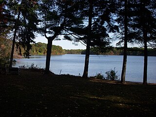
Lake Cochituate is a body of water in Natick, Wayland, and Framingham, Massachusetts, United States. Originally a reservoir serving Boston, it no longer serves that function, and is now a local recreational resource and home to Cochituate State Park.

The Bay Circuit Trail and Greenway or Bay Circuit is a Massachusetts rail trail and greenway connecting the outlying suburbs of Boston from Plum Island in Newburyport to Kingston Bay in Duxbury, a distance of 200 miles (320 km).

The Nipmuck Trail is a Blue-Blazed hiking trail system which meanders through 34.5 miles (55.5 km) of forests in northeast Connecticut. It is maintained by the Connecticut Forest and Park Association and is considered one of the Blue-Blazed hiking trails. There are two southern trail heads in the south of the town of Mansfield, Connecticut. The southwestern terminus is at a road shoulder parking place on Puddin Lane, and the southeastern terminus is a DEEP parking lot on North Windham Road at the southeast corner of Mansfield Hollow State Park. The northern terminus is at the north end of Breakneck Pond along the Massachusetts border in Nipmuck State Forest. Camping permits may be obtained for up to five separate locations for backpacking.

U.S. Route 20 (US 20) runs its easternmost 153 miles (246 km) in the U.S. state of Massachusetts. The highway crosses the state border from New Lebanon, New York, into Hancock and runs eastward to Boston, where it ends at Route 2 in Kenmore Square. It spends the vast majority of its journey paralleling I-90, which has largely superseded US 20 for through travel. Still, US 20 directly serves many towns and local business areas which the turnpike bypasses.

The Bruce Freeman Rail Trail (BFRT) is a partially-completed rail trail in Massachusetts. The path is a 10-foot-wide (3.0 m) paved multi-use trail, available for walking, running, biking, rollerblading, and other non-motorized uses. It follows the right-of-way of the disused Framingham and Lowell Line of the New York, New Haven and Hartford Railroad. The constructed route connects with the Bay Circuit Trail, and Phase 2D will connect with the Mass Central Rail Trail - Wayside. The total planned length of the trail—which will eventually run continuously between Lowell and Framingham—is just under 25 miles (40 km). The trail is named for Bruce Freeman, a state representative from Chelmsford who was an early political supporter of the project. The trail is owned by the Massachusetts Department of Transportation from Lowell to South Sudbury. In July 2020, MassTrails awarded Sudbury $300,000 to purchase the right-of-way from South Sudbury to the Framingham line, and Sudbury became the railbanking trail sponsor for this section in December 2020. In December 2022, Framingham signed a purchase-and-sale agreement with CSX to purchase the right-of-way in Framingham, and Framingham became the railbanking trail sponsor for this section in December 2023. The trail is maintained by the Massachusetts Department of Transportation and the communities through which the trail runs.
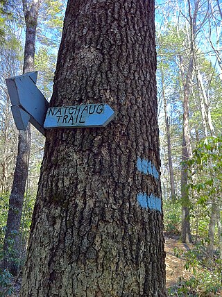
The Natchaug Trail is a Blue-Blazed hiking trail "system" which meanders through 19.5 miles (31.4 km) of forests in northeast Connecticut—primarily in Windham County. It is maintained by the Connecticut Forest and Park Association. Its southern trailhead begins in the James L. Goodwin State Forest in the towns of Chaplin, Connecticut and Hampton, Connecticut and the northern terminus is at its intersection with the Nipmuck Trail in Natchaug State Forest in Eastford, Connecticut.

Stone's Bridge is a historic stone arch bridge in Framingham and Wayland, Massachusetts. It is located just north of Stonebridge Road, and partially crosses the Sudbury River. Built in 1858, it is a well-preserved example of mid-19th century stone bridge construction, despite its truncation in 1955 due to a shift in the river channel. The bridge was listed on the National Register of Historic Places in 1975. It is closed to all access.
