Oregonia, Ohio

Last updated

Location of Oregonia, Ohio OHMap-doton-Oregonia.png
Location of Oregonia, Ohio

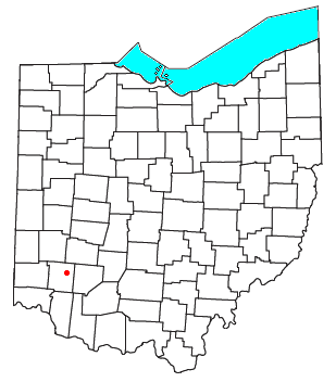
Oregonia is an unincorporated community in northwestern Washington Township, Warren County, Ohio, United States, [1] on the east shore of the Little Miami River about five miles northeast of Lebanon and six miles south of Waynesville. The ZIP Code for Oregonia is 45054. [2]

The first settlement there was around 1802, where there was a mill operated at various times by Nebo Gaunt, Ignatius Brown, and David Brown. Around 1820, it was known as Freeport. [3] The Little Miami Railroad reached the village c. 1845. A post office called Oregon was established in 1846, and the name was changed to Oregonia in 1882. [4] The post office has since been consolidated with the Lebanon post office.

Today, Oregonia is a stop on the Little Miami Bike Trail which follows the former train route along the Little Miami River. Bikers, hikers, and canoers often stop at the market or a restaurant along the trail which follows the river on the former train route. In October of each year, the "Devils Staircase" motorcycle hill climb is held on a hill just south of the main settlement.

Related Research Articles

<span class="mw-page-title-main">Warren County, Ohio</span> County in Ohio, United States

Warren County is a county located in the southwestern part of the U.S. state of Ohio. As of the 2020 census, the population was 242,337. Its county seat is Lebanon and largest city is Mason. The county is one of Ohio's most affluent, with the highest median income of the state's 88 counties. The county was established on May 1, 1803, from Hamilton County; it is named for Dr. Joseph Warren, a hero of the Revolution who sent Paul Revere and the overlooked William Dawes on their famous rides and who died at the Battle of Bunker Hill. Warren County is part of the Cincinnati, OH-KY-IN Metropolitan Statistical Area.

<span class="mw-page-title-main">Loveland, Ohio</span> City in Hamilton, Clermont, and Warren counties in Ohio, United States

Loveland is a city in Hamilton, Clermont, and Warren counties in the southwestern part of the U.S. state of Ohio. The population was 13,307 at the 2020 census. Considered part of the Cincinnati metropolitan area, Loveland is located near exit 52 off Interstate 275, about 15 miles (24 km) northeast of the Cincinnati city limits. It borders Symmes, Miami and Hamilton townships and straddles the Little Miami River. Once a busy railroad town, Loveland is now a major stop along the Little Miami Scenic Trail.

<span class="mw-page-title-main">Little Miami River</span> River in the United States of America

The Little Miami River is a Class I tributary of the Ohio River that flows 111 miles (179 km) through five counties in southwestern Ohio in the United States. The Little Miami joins the Ohio River east of Cincinnati. It forms parts of the borders between Hamilton and Clermont counties and between Hamilton and Warren counties. The Little Miami River is one of 156 American rivers designated by the U.S. Congress or the Secretary of the Interior as a National Wild and Scenic River and lends its name to the adjacent Little Miami Scenic Trail.

<span class="mw-page-title-main">Symmes Purchase</span>

The Symmes Purchase, also known as the Miami Purchase, was an area of land totaling roughly 311,682 acres in what is now Hamilton, Butler, and Warren counties of southwestern Ohio, purchased by Judge John Cleves Symmes of New Jersey in 1788 from the Continental Congress.

<span class="mw-page-title-main">Little Miami Scenic Trail</span>

The Little Miami Scenic Trail is the fourth longest paved trail in the United States, running 78.1 miles (125.7 km) through five southwestern counties in the state of Ohio. The multi-use rail trail sees heavy recreational use by hikers and bicyclists, as well as the occasional horseback rider. Over 700,000 people made use of the trail in 2014.

<span class="mw-page-title-main">Turtlecreek Township, Warren County, Ohio</span> Township in Ohio, United States

Turtlecreek Township is one of the eleven townships of Warren County, Ohio, United States. It is in the central part of the county and surrounds the county seat of Lebanon. Turtlecreek is the largest township in the county, originally containing sixty-three whole and seven fractional sections. The population was 17,644 as of the 2020 census.

<span class="mw-page-title-main">Union Township, Warren County, Ohio</span> Township in Ohio, United States

Union Township is one of the eleven townships of Warren County, Ohio, United States, located in the central part of the county. It was established January 3, 1815 and named Union as it was formed from parts of Deerfield and Turtlecreek Townships. The population was 6,251 as of the 2020 census.

<span class="mw-page-title-main">Salem Township, Warren County, Ohio</span> Township in Ohio, United States

Salem Township is one of the eleven townships of Warren County, Ohio, United States, located in the central part of the county. The population was 5,215 at the 2020 census. It is the second smallest township in the county with 13,459 acres (54 km2). It is one of fourteen Salem Townships statewide.

<span class="mw-page-title-main">Washington Township, Warren County, Ohio</span> Township in Ohio, United States

Washington Township is one of the eleven townships of Warren County, Ohio, United States. Located in the east-central part of the county, it is the only one of the eleven that does not contain a municipality. The population was 2,752 at the 2020 census.

<span class="mw-page-title-main">Wayne Township, Warren County, Ohio</span> Township in Ohio, United States

Wayne Township is one of the eleven townships of Warren County, Ohio, United States. It is located in the northeast part of the county and includes the village of Waynesville, Ohio. The population was 8,658 at the 2020 census. Caesar Creek State Park is located in the township.

<span class="mw-page-title-main">Hamilton Township, Warren County, Ohio</span> Township in Ohio, United States

Hamilton Township is one of the eleven townships of Warren County, Ohio, United States. It is located in the south central portion of the county. The population was 30,587 at the 2020 census.

<span class="mw-page-title-main">Kings Mills, Ohio</span> Census-designated place in Ohio, United States

Kings Mills is a census-designated place in the northeastern corner of Deerfield Township of Warren County, Ohio, United States, on the western shore of the Little Miami River. The population was 1,336 at the 2020 census.

<span class="mw-page-title-main">Fort Ancient (Lebanon, Ohio)</span> United States historic place

Fort Ancient is a Native American earthworks complex located in Washington Township, Warren County, Ohio, along the eastern shore of the Little Miami River about seven miles (11 km) southeast of Lebanon on State Route 350. The site is the largest prehistoric hilltop enclosure in the United States with three and one-half miles (18,000 ft) of walls in a 100-acre (0.40 km2) complex. Built by the Hopewell culture, who lived in the area from the 200 BC to AD 400, the site is situated on a wooded bluff 270 feet (82 m) above the Little Miami. It is the namesake of a culture known as Fort Ancient who lived near the complex long after it was constructed.

<span class="mw-page-title-main">Fosters, Ohio</span> Unincorporated community in Ohio, U.S.

Fosters is an unincorporated community in southern Warren County, Ohio, United States. It straddles the Little Miami River in Deerfield and Hamilton Townships. It is located about two miles southwest of Hopkinsville, two miles west of Maineville, and two miles northeast of Twenty Mile Stand just off U.S. Route 22/State Route 3, the 3C Highway. The community is in the Kings Local School District and is served by the Maineville post office. The settlement was originally called Foster's Crossing. The community was named after the local Foster family.

<span class="mw-page-title-main">Warren County Canal</span>

The Warren County Canal was a branch of the Miami and Erie Canal in southwestern Ohio about 20 miles (32 km) in length that connected the Warren County seat of Lebanon to the main canal at Middletown in the mid-19th century. Lebanon was at the crossroads of two major roads, the highway from Cincinnati to Columbus and the road from Chillicothe to the College Township (Oxford), but Lebanon businessmen and civic leaders wanted better transportation facilities and successfully lobbied for their own canal, part of the canal fever of the first third of the 19th century. The Warren County Canal was never successful, operating less than a decade before the state abandoned it.

<span class="mw-page-title-main">Lebanon Countryside Trail</span>

The Lebanon Countryside Trail is a rail trail in Ohio.

<span class="mw-page-title-main">Mathers Mill, Ohio</span> Unincorporated community in Ohio, U.S.

Mathers Mill, alternately called Mathers Mills or Mather's Mills, is an unincorporated community in Warren County, Ohio, United States. It is approximately five miles east of Lebanon, and two miles south of Oregonia in eastern Turtlecreek Township. The area is served by the Oregonia post office, and Lebanon phone exchange and school district. Wilmington Road crosses the Little Miami River and intersects Corwin Road in this area. The bridge is known as the Mathers Mill bridge and the steep hill up out of the valley is sometimes referred to as Mathers Mill Hill.

<span class="mw-page-title-main">Miamiville, Ohio</span> Unincorporated community in Ohio, United States

Miamiville is an unincorporated community and census-designated place (CDP) in western Miami Township, Clermont County, Ohio, United States, along the Little Miami River and the Loveland Bike Trail. It had a population of 205 at the 2020 census. It has a post office with the ZIP code 45147.

<span class="mw-page-title-main">San Mar Gale, Ohio</span> Unincorporated community in Ohio, U.S.

San Mar Gale is an unincorporated community and was a planned development by the Hines-Griffin Land Development Company in Turtlecreek of Warren County, Ohio, United States. This 2500+ home planned unit development was approved by the Warren County Commissioners in February 2006. Zoning approval included a central business district and multi-family housing near the center. A public referendum challenging the approval was placed on the ballot in November 2006, and the Commissioners approval was ratified by voters. Construction was to have begun in 2007, however the development was cancelled as of February 2011.

Turtle Creek is a 13.7-mile-long (22.0 km) tributary of the Little Miami River in Turtlecreek Township, Warren County, Ohio, which takes its name from this creek. Turtle Creek is named for Chief Little Turtle, of the Miami Indian Tribe Turtle Creek is a tributary within the Little Miami and Ohio River watersheds.

References

  1. U.S. Geological Survey Geographic Names Information System: Oregonia, Ohio
  2. "Oregonia ZIP Code". zipdatamaps.com. 2022. Retrieved November 11, 2022.
  3. The History of Warren County, Ohio: Containing a History of the County ; Its Townships, Towns ; General and Local Statistics. W.H. Beers & Company. 1882. p. 708.
  4. "Warren County". Jim Forte Postal History. Retrieved January 17, 2016.

39°27′03″N84°05′46″W / 39.45083°N 84.09611°W / 39.45083; -84.09611