Twenty Mile Stand, Ohio

Last updated

Location of Twenty Mile Stand, Ohio OHMap-doton-Twenty Mile Stand.png
Location of Twenty Mile Stand, Ohio

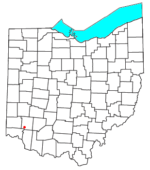
Twenty Mile Stand is an unincorporated community in southeastern Deerfield Township, Warren County, Ohio, United States. [1] It lies on the old 3C Highway in Town 4 East, Range 2 North, Section 21 of the Symmes Purchase and in the center of the area known as "Landen". It is about three miles south-south west of Kings Mills, two miles southwest of Fosters, and twenty miles northeast of Cincinnati.

A post office called Twenty Mile Stand was established in 1819, the name was changed to Twentymile Stand in 1895, and the post office closed in 1904. [2] In the 19th century, the town was a stagecoach stop 20 miles (32 km) from downtown Cincinnati, hence the name. [3] In April 2013, the original stagecoach stop, known as the Twenty Mile House, was demolished and replaced with a modern strip mall and gas station. The house had been a fine and casual restaurant, bar and tavern for generations. [4]

Related Research Articles

<span class="mw-page-title-main">Hagemans Crossing, Ohio</span> Unincorporated community in Ohio, U.S.

Hagemans Crossing is an unincorporated community in Union Township, Warren County, Ohio, United States. Located in the western part of the township, it is located on the old Cincinnati and Xenia Pike, now U.S. Route 42, about halfway between Lebanon and Mason. It was at the crossing of the Middletown and Cincinnati Railroad and the Cincinnati, Lebanon and Northern Railway and was about two miles northwest of the M&C's eastern terminus at Middletown Junction.

<span class="mw-page-title-main">Oregonia, Ohio</span> Unincorporated community in Ohio, US

Oregonia is an unincorporated community in northwestern Washington Township, Warren County, Ohio, United States, on the east shore of the Little Miami River about five miles northeast of Lebanon and six miles south of Waynesville. The ZIP Code for Oregonia is 45054.

<span class="mw-page-title-main">Hopkinsville, Ohio</span> Unincorporated community in Ohio, U.S.

Hopkinsville is an unincorporated community in northern Hamilton Township, Warren County, Ohio, United States. It lies about one mile north of Maineville, two miles south of South Lebanon, and three miles northwest of Fosters at the crossroads of State Route 48 and the 3C Highway.

<span class="mw-page-title-main">Murdoch, Ohio</span> Unincorporated community in Ohio, U.S.

Murdoch is an unincorporated community in southern Hamilton Township, Warren County, Ohio, United States. It is located about two miles southeast of Maineville and two miles northwest of Cozaddale.

<span class="mw-page-title-main">Fosters, Ohio</span> Unincorporated community in Ohio, U.S.

Fosters is an unincorporated community in southern Warren County, Ohio, United States. It straddles the Little Miami River in Deerfield and Hamilton Townships. It is located about two miles southwest of Hopkinsville, two miles west of Maineville, and two miles northeast of Twenty Mile Stand just off U.S. Route 22/State Route 3, the 3C Highway. The community is in the Kings Local School District and is served by the Maineville post office. The settlement was originally called Foster's Crossing. The community was named after the local Foster family.

<span class="mw-page-title-main">Dodds, Ohio</span> Unincorporated community in Ohio, U.S.

Dodds is an unincorporated community in eastern Clearcreek Township, Warren County, Ohio, United States. It was formerly on the Cincinnati, Lebanon and Northern Railway.

<span class="mw-page-title-main">Hillcrest, Ohio</span> Unincorporated community in Ohio, U.S.

Hillcrest is an unincorporated place in central Warren County, Ohio, United States on U.S. Route 42 about halfway between Mason, 4 miles to the southwest, and Lebanon, 3 mi (5 km) to the northeast. The community straddles the township line between Turtlecreek and Union Townships. The former Cincinnati, Lebanon and Northern Railway runs just east of the community and once had a stop here called "Turtlecreek". It is in the Lebanon City School District and is served by the Lebanon telephone exchange and post office.

<span class="mw-page-title-main">Level, Ohio</span> Unincorporated community in Ohio, U.S.

Level is an unincorporated community in southern Harlan Township, Warren County, Ohio, United States, which in the 19th century was a station on the Marietta and Cincinnati Railroad and had its own post office, since closed. According to the U.S. Geographic Names Information System (GNIS), an alternate name for this community is Windsor.

<span class="mw-page-title-main">Bethany, Ohio</span> Unincorporated community in Ohio, U.S.

Bethany is an unincorporated community in southeastern Liberty Township, Butler County, Ohio, United States, located in the southwestern part of Ohio. It lies about three miles south of Monroe.

<span class="mw-page-title-main">Poast Town, Ohio</span> Unincorporated community in Ohio, U.S.

Poast Town is an unincorporated community located in northeastern Madison Township, Butler County, Ohio, United States, on State Route 4, about one mile north of Middletown in Section 12 of T2R4 of the Congress Lands. It was laid out in 1818 by Peter Post as the town of West Liberty. A post office with the name Poast Town was established in 1848 but closed in 1934. Mail is provided through the Middletown post office, it is located in the Middletown telephone exchange. It is in the Madison Local School District.

<span class="mw-page-title-main">Woodsdale, Ohio</span> Unincorporated community in Ohio, U.S.

Woodsdale is an unincorporated community in Madison and St. Clair Townships in central Butler County, Ohio, United States, about three miles northeast of Hamilton. It was established in 1867 by the Beckett Paper Company and was formerly a stop on the Cincinnati, Hamilton, and Dayton Railroad. An electric generation plant of the Cincinnati Gas and Electric Company is located in Woodsdale. Woodsdale is also the location of the Samuel Augspurger House & Farm and The Augspurger Schoolhouse both of which are on the National Register of Historic Places. Woodsdale was also known for the Woodsdale Island Amusement Park.

<span class="mw-page-title-main">Okeana, Ohio</span> Unincorporated community in Ohio, U.S.

Okeana, originally known as Tariff, is an unincorporated community in central Morgan Township, Butler County, Ohio, United States. It is located on Dry Fork Creek, a tributary of the Great Miami River, on State Route 126 about three miles northwest of Shandon in sections 21 and 26 of R1ET3N of the Congress Lands. It is a mile north of Alert, a mile east of Macedonia, and ten miles southwest of Hamilton. The bulk of addresses served by the Okeana post office are in the Ross Local School District, but parts of the region are in the Southwest Local School District.

<span class="mw-page-title-main">McGonigle, Ohio</span> Unincorporated community in Ohio, U.S.

McGonigle is an unincorporated community in northwestern Hanover Township, Butler County, Ohio, United States about seven miles northwest of Hamilton at the intersection of U.S. Route 27 and State Route 130 in sections 17 and 18 of R2ET4N of the Congress Lands. It was formerly a stop on the Cincinnati, Hamilton, and Dayton Railroad's Indianapolis branch. It was named for Philip McGonigle, an early settler, and is spelled in various ways.

<span class="mw-page-title-main">Port Union, Ohio</span> Unincorporated community in Ohio, U.S.

Port Union is an unincorporated community in western West Chester Township, Butler County, Ohio, United States, on State Route 747 about three miles north of Springdale and three miles southeast of Hamilton. The town was laid out in 1827 by William Elliott alongside the turning basin for the Miami and Erie Canal and was about midway between Crescentville and Hamilton on the canal. It was originally known as McMaken's Bridge, but took the name its township.. The Cincinnati, Hamilton, and Dayton Railroad later laid tracks through Port Union.

<span class="mw-page-title-main">Red Lion, Ohio</span> Unincorporated community in Ohio, U.S.

Red Lion is an unincorporated community in southwestern Clearcreek Township, Warren County, Ohio, United States, at the intersection of State Routes 741, 122, and 123. Red Lion is approximately five miles south of Springboro and five miles northwest of Lebanon.

<span class="mw-page-title-main">Mathers Mill, Ohio</span> Unincorporated community in Ohio, U.S.

Mathers Mill, alternately called Mathers Mills or Mather's Mills, is an unincorporated community in Warren County, Ohio, United States. It is approximately five miles east of Lebanon, and two miles south of Oregonia in eastern Turtlecreek Township. The area is served by the Oregonia post office, and Lebanon phone exchange and school district. Wilmington Road crosses the Little Miami River and intersects Corwin Road in this area. The bridge is known as the Mathers Mill bridge and the steep hill up out of the valley is sometimes referred to as Mathers Mill Hill.

<span class="mw-page-title-main">Pyrmont, Ohio</span> Unincorporated community in Ohio, U.S.

Pyrmont is an unincorporated community in northwestern Perry Township, Montgomery County, Ohio, United States. It centers at the intersection of Brookville–Pyrmont Pike and Sulphur Springs Road, extending to the intersection of Brookville–Pyrmont Pike and Providence Pike. Located in the far west of the county, it lies several miles from the city of Dayton; the nearest city is Brookville, three miles to the northeast. Pyrmont is a part of the Brookville Local School District. Pyrmont, which was on a stagecoach route, was a busy town before Interstate 70 was built near Brookville.

Pekin is an unincorporated community in Clearcreek Township, Warren County, Ohio, United States, at the intersection of State Route 48 and Pekin Road. Pekin is approximately 3 miles south of Springboro and 7 miles northwest of Lebanon.

Willowdell is an unincorporated community in Darke County, in the U.S. state of Ohio. Home of the Willowdell Wienerfest; a nonprofit festival to benefit Special Olympics.

Fifteen is an unincorporated community in Washington County, in the U.S. state of Ohio.

References

  1. U.S. Geological Survey Geographic Names Information System: Twenty Mile Stand, Ohio
  2. "Warren County". Jim Forte Postal History. Retrieved January 17, 2016.
  3. Peacefull, Leonard (1996). A Geography of Ohio. Kent State University Press. p. 217. ISBN   9780873385251 . Retrieved December 8, 2013.
  4. "Photos: 20-Mile House torn down". WLWT. April 16, 2013. Retrieved October 18, 2020.

39°18′23″N84°16′48″W / 39.30639°N 84.28000°W / 39.30639; -84.28000