
Clearcreek Township is one of the eleven townships of Warren County, Ohio, United States, located in the north central portion of the county. It had a population of 20,974 in 2000, up from 13,344 in 1990; of this total, 8,747 lived in the unincorporated portions of the township. It was originally about forty-two square miles in area. The highest point in the county is in Clearcreek Township, near the community of Five Points. Statewide, the only other Clearcreek Townships are located in Fairfield County and in Ashland County.

Hagemans Crossing is an unincorporated community in Union Township, Warren County, Ohio, United States. Located in the western part of the township, it is located on the old Cincinnati and Xenia Pike, now U.S. Route 42, about halfway between Lebanon and Mason. It was at the crossing of the Middletown and Cincinnati Railroad and the Cincinnati, Lebanon and Northern Railway and was about two miles northwest of the M&C's eastern terminus at Middletown Junction.

Crosswick is an unincorporated community in central Wayne Township, Warren County, Ohio, United States, located just outside Waynesville.

Cozaddale is an unincorporated community in southeastern Hamilton Township, Warren County, Ohio, United States. It is about one mile south of Comargo, one mile southeast of Hickory Corner, and two miles west of Pleasant Plain, and three miles north of Goshen, Ohio.

Hammel and Millgrove are extinct towns in western Warren County, Ohio, United States. They are located along the Little Miami River, about 2 miles (3 km) south of Fort Ancient and 1 mile north of Roachester at the Strout Road crossing of the river. Hammel lies on the eastern shore of the river, in southwestern Washington Township, and Millgrove lies on the western shore of the river, in northeastern Salem Township.

Greentree Corners is an unincorporated community in northern Turtlecreek Township, Warren County, Ohio, United States. It is located at the intersection of State Route 741 and Greentree Road about one and one-half miles north of Otterbein, two miles south of Red Lion, and three miles northwest of Lebanon.

Murdoch is an unincorporated community in southern Hamilton Township, Warren County, Ohio, United States. It is located about two miles southeast of Maineville and two miles northwest of Cozaddale.
Dallasburg is an unincorporated community in southern Hamilton Township, Warren County, Ohio, United States. It is located in Virginia Military Reserve Military Survey 3790, about one mile west of Cozaddale and two miles southeast of Murdoch.
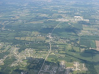
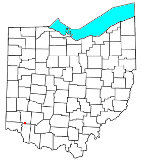
Red Lion is an unincorporated community in southwestern Clearcreek Township, Warren County, Ohio, United States, at the intersection of State Routes 741, 122, and 123. Red Lion is approximately five miles south of Springboro and five miles northwest of Lebanon.
Pekin is an unincorporated community in Clearcreek Township, Warren County, Ohio, United States, at the intersection of State Route 48 and Pekin Road. Pekin is approximately 3 miles south of Springboro and 7 miles northwest of Lebanon.
Crosstown is an unincorporated community in Brown County, in the U.S. state of Ohio.
New Harmony is an unincorporated community in Brown County, in the U.S. state of Ohio.
Edwardsville is an unincorporated community in Warren County, in the U.S. state of Ohio. Edwardsville is the oldest community in Harlan Township.
Mount Holly is an unincorporated community in Warren County, in the U.S. state of Ohio.
Rossburg is an unincorporated community in Warren County, in the U.S. state of Ohio.
Socialville is an unincorporated community in Warren County, in the U.S. state of Ohio.
Newman Run is a stream in the U.S. state of Ohio. It is a tributary to the Little Miami River.
Blackhawk is an unincorporated community in Warren County, in the U.S. state of Ohio. A variant spelling is "Black Hawk".
Butterworth is an extinct town in Warren County, Ohio.
Wellman is an unincorporated community in Massie Township, Warren County, in the U.S. state of Ohio.

