
Clearcreek Township is one of the eleven townships of Warren County, Ohio, United States, located in the north central portion of the county. It had a population of 36,238 in 2020. It was originally about forty-two square miles in area. The highest point in the county is in Clearcreek Township, near the community of Five Points. Statewide, the only other Clearcreek Townships are located in Fairfield County and in Ashland County.

Hagemans Crossing is an unincorporated community in Union Township, Warren County, Ohio, United States. Located in the western part of the township, it is located on the old Cincinnati and Xenia Pike, now U.S. Route 42, about halfway between Lebanon and Mason. It was at the crossing of the Middletown and Cincinnati Railroad and the Cincinnati, Lebanon and Northern Railway and was about two miles northwest of the M&C's eastern terminus at Middletown Junction.

Oregonia is an unincorporated community in northwestern Washington Township, Warren County, Ohio, United States, on the east shore of the Little Miami River about five miles northeast of Lebanon and six miles south of Waynesville. The ZIP Code for Oregonia is 45054.

Greentree Corners is an unincorporated community in northern Turtlecreek Township, Warren County, Ohio, United States. It is located at the intersection of State Route 741 and Greentree Road about one and one-half miles north of Otterbein, two miles south of Red Lion, and three miles northwest of Lebanon.

Hopkinsville is an unincorporated community in northern Hamilton Township, Warren County, Ohio, United States. It lies about one mile north of Maineville, two miles south of South Lebanon, and three miles northwest of Fosters at the crossroads of State Route 48 and the 3C Highway.

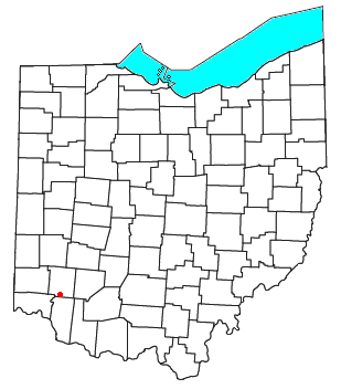
Zoar is an unincorporated community in northern Hamilton Township, Warren County, Ohio, United States. It is located on the 3C Highway about one mile east of Hopkinsville and three miles west of Morrow in Virginia Military District Military Survey 1546.
Murdoch is an unincorporated community in southern Hamilton Township, Warren County, Ohio, United States. It is located about two miles southeast of Maineville and two miles northwest of Cozaddale.

Dallasburg is an unincorporated community in southern Hamilton Township, Warren County, Ohio, United States. It is located in Virginia Military Reserve Military Survey 3790, about one mile west of Cozaddale and two miles southeast of Murdoch.

Fosters is an unincorporated community in southern Warren County, Ohio, United States. It straddles the Little Miami River in Deerfield and Hamilton Townships. It is located about two miles southwest of Hopkinsville, two miles west of Maineville, and two miles northeast of Twenty Mile Stand just off U.S. Route 22/State Route 3, the 3C Highway. The community is in the Kings Local School District and is served by the Maineville post office. The settlement was originally called Foster's Crossing. The community was named after the local Foster family.

Dodds is an unincorporated community in eastern Clearcreek Township, Warren County, Ohio, United States. It was formerly on the Cincinnati, Lebanon and Northern Railway.

Level is an unincorporated community in southern Harlan Township, Warren County, Ohio, United States, which in the 19th century was a station on the Marietta and Cincinnati Railroad and had its own post office, since closed. According to the U.S. Geographic Names Information System (GNIS), an alternate name for this community is Windsor.

Mathers Mill, alternately called Mathers Mills or Mather's Mills, is an unincorporated community in Warren County, Ohio, United States. It is approximately five miles east of Lebanon, and two miles south of Oregonia in eastern Turtlecreek Township. The area is served by the Oregonia post office, and Lebanon phone exchange and school district. Wilmington Road crosses the Little Miami River and intersects Corwin Road in this area. The bridge is known as the Mathers Mill bridge and the steep hill up out of the valley is sometimes referred to as Mathers Mill Hill.
Pekin is an unincorporated community in Clearcreek Township, Warren County, Ohio, United States, at the intersection of State Route 48 and Pekin Road. Pekin is approximately 3 miles south of Springboro and 7 miles northwest of Lebanon.

Clear Creek is a tributary of the Great Miami River in southwestern Ohio. The creek forms in the southeastern portion of Clearcreek Township, with major tributaries including Mad Run, Beech Run, Bull Run, Richards Run, Twin Creek, Gander Run, Goose Run, and Dearth Run. The watershed includes the highest point in Warren County east of Five Points. It drains most of Clearcreek Township, Springboro, Ohio, much of Franklin Township, and then discharges into the Great Miami River in Franklin, Ohio.
Edwardsville is an unincorporated community in Warren County, in the U.S. state of Ohio. Edwardsville is the oldest community in Harlan Township.
Mount Holly is an unincorporated community in Warren County, in the U.S. state of Ohio.
Rossburg is an unincorporated community in Warren County, in the U.S. state of Ohio.
Socialville is an unincorporated community in Warren County, in the U.S. state of Ohio.
Blackhawk is an unincorporated community in Warren County, in the U.S. state of Ohio. A variant spelling is "Black Hawk".
Wellman is an unincorporated community in Massie Township, Warren County, in the U.S. state of Ohio.


