Ottawa, KwaZulu-Natal

Last updated

Ottawa
South Africa KwaZulu-Natal location map.svg
Red pog.svg
Ottawa
South Africa adm location map.svg
Red pog.svg
Ottawa
Coordinates: 29°40′S31°02′E / 29.667°S 31.033°E
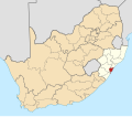
 / -29.667; 31.033
Country South Africa
Province KwaZulu-Natal
Municipality eThekwini
Main Place Verulam
Area
[1]
  Total
2.39 km2 (0.92 sq mi)
Population
 (2011) [1]
  Total
4,706
  Density1,970/km2 (5,100/sq mi)
Racial makeup (2011)
[1]
   Black African 17.4%
   Coloured 1.8%
   Indian/Asian 79.2%
   White 0.4%
  Other1.1%
First languages (2011)
[1]
   English 82.3%
   Zulu 12.1%
   Afrikaans 1.4%
   Southern Ndebele 1.1%
  Other3.2%
Time zone UTC+2 (SAST)
Postal code (street)
4339
PO box
4345

Ottawa is a suburb of Verulam situated in the KwaZulu-Natal Province of South Africa, approximately 26 kilometres (16.2 mi) north of Durban.

Contents

History

Ottawa was originally a sugarcane estate, founded in 1861 by Anthony Wilkinson. [2] On the site was a cane spirits distillery and sugar mill on the oHlanga River, which runs through the area. [2]

The name Ottawa, from the Canadian capital city, was chosen as a homage to Wilkinson's wife, who was Canadian. [2]

Geography

Ottawa is situated on the northern banks of the oHlanga River and sits as the southernmost suburb of Verulam, approximately 1 kilometre (0.6 mi) south of the CBD. It is bounded by Phoenix to the south, Cornubia to the east, Southridge to the north, Mzomuhle to the west and Mountview to the north-west.

Transport

Roads

Ottawa is traversed by the R102 which connects oThongathi to the north with Mount Edgecombe to the south. Alternatively, Old Main Road is another main road in Ottawa connecting the M27 Jabu Ngcobo Drive (to Verulam CBD and eMdloti) to the north with Phoenix and Mount Edgecombe to the south.

References

  1. 1 2 3 4 "Sub Place Ottawa". Census 2011.
  2. 1 2 3 Osborne, Robert F. (1964). Valiant Harvest - The founding of the South African Sugar Industry 1848-1926. Durban: South African Sugar Association. pp. 227–228.