Oxkutzcab

Last updated • 1 min readFrom Wikipedia, The Free Encyclopedia
Oxkutzcab
Municipal Seat
Palacio Municipal, Oxkutzcab, Yucatan, Mexico Abril 2021.jpg
City hall in April 2021
Escudo oxkutzcab.png
Oxkutzcab
Mexico Yucatan location map.svg
Red pog.svg
Oxkutzcab
Coordinates: 20°18′20″N89°25′06″W / 20.30556°N 89.41833°W / 20.30556; -89.41833
CountryFlag of Mexico.svg  Mexico
State Yucatán
Municipality Oxkutzcab
Elevation
23 m (75 ft)
Population
 (2015)
  Total
21,508 [1]
Time zone UTC-6 (Central Standard Time)
Postal code
97880
Area code 997
Demonym Oxkutzcabense

Oxkutzcab (Mayan pronunciation: [oʃkʼutsˈkab] ) is a small city and the municipal seat of the Oxkutzcab Municipality, Yucatán in Mexico. As of 2015, the city has a population of 33,854. [1] Oxkutzcab is an agricultural center, focused mainly on the production of tropical fruits such as citrus, sapote, avocado, mango, papaya, mamey, huaya, saramuyo and plums.

Contents

Monumento a Oxkutzcab.jpg

History

Oxkutzcab was a town dating back to pre-Columbian times. With the fall of Mayapán in the 1440s, Oxkutzcab became a regional capital ruled by the Xiu family. After the Spanish conquest of Yucatán it was re-established as a Spanish colonial town in 1550; the Maya temples were demolished and a large Franciscan church built.

Oxkutzcab was granted the legal status of a city in the early 19th century. In 1847 the city was sacked in the Caste War of Yucatán. In 1879 the city was linked to the capital of Mérida by railroad.

Culture

Each year during the last days of November, the city hosts a "Festival of Oranges". There are two markets of tropical fruits: the "20 de Noviembre" market and "Solidarity" market, better known as "La central".

Demographics

Climate

Oxkutzkab
Climate chart (explanation)
J
F
M
A
M
J
J
A
S
O
N
D
 
 
58
 
 
25
17
 
 
25
 
 
28
19
 
 
25
 
 
30
20
 
 
100
 
 
32
22
 
 
157
 
 
33
23
 
 
191
 
 
29
21
 
 
202
 
 
28
21
 
 
231
 
 
27
22
 
 
259
 
 
26
21
 
 
201
 
 
25
20
 
 
72
 
 
26
18
 
 
42
 
 
24
17
Average max. and min. temperatures in °C
Precipitation totals in mm
Source: [2] [3]
Imperial conversion
JFMAMJJASOND
 
 
2.3
 
 
77
63
 
 
1
 
 
82
66
 
 
1
 
 
86
68
 
 
3.9
 
 
90
72
 
 
6.2
 
 
91
73
 
 
7.5
 
 
84
70
 
 
8
 
 
82
70
 
 
9.1
 
 
81
72
 
 
10
 
 
79
70
 
 
7.9
 
 
77
68
 
 
2.8
 
 
79
64
 
 
1.7
 
 
75
63
Average max. and min. temperatures in °F
Precipitation totals in inches

Related Research Articles

<span class="mw-page-title-main">Poso River</span> River in Sulawesi, Indonesia

The Poso is a river of Central Sulawesi on Sulawesi island, Indonesia, about 1600 km northeast of the capital Jakarta. The Poso is approximately 100 km long and flows from Lake Poso, about 2 km west of the town of Tentena to the city of Poso and then into the Gulf of Tomini.

<span class="mw-page-title-main">Siak River</span> River in Indonesia

The Siak is a river of Riau province, in the east of Sumatra, Indonesia, about 1000 km northwest of the capital Jakarta. Approximately 370 kilometres in length, the Siak is a blackwater river which owes its brown color to dissolved organic matter (DOM) leached from surrounding, heavily disturbed peat soils; it is heavily polluted, notably by the petroleum industry. It flows through the town of Pekanbaru before emptying into the Strait of Malacca.

<span class="mw-page-title-main">Hunucmá</span> Municipal Seat in Yucatán, Mexico

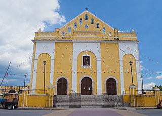
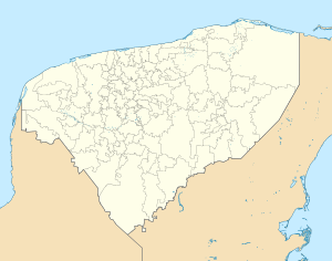
Hunucmá is a town and the municipal seat of the Hunucmá Municipality, Yucatán in Mexico. As of 2020, the town has a population of 28,412.

<span class="mw-page-title-main">Melawi River</span> River in West Kalimantan, Indonesia

Melawi River is a river in north-western Borneo, Indonesia, about 900 km northeast of the capital Jakarta. It is a tributary of the Kapuas River.

Arut River is a river in the province of Kalimantan Tengah, island of Borneo, Indonesia, about 700 km northeast of the capital Jakarta. It is a tributary of the Lamandau River. The river flows through the north side of Pangkalan Bun town.

Serang River is a river in northern Central Java, Indonesia, about 400 km east of the capital Jakarta. The largest tributary is Lusi River, which discharges into Serang River after passing the city of Purwodadi.

<span class="mw-page-title-main">Palu River</span> River in Sulawesi, Indonesia

The Palu River is a river in Central Sulawesi, Sulawesi island, Indonesia, about 1600 km northeast of the capital Jakarta.

The Karama River is a river on the island of Sulawesi, in the province of West Sulawesi, Indonesia, about 1400 km northeast of the capital Jakarta.

Kalaena River is a river in South Sulawesi, Sulawesi island, Indonesia, about 1600 km northeast of the capital Jakarta.

Tripa River is a river in the province of Aceh, northern Sumatra island, Indonesia, about 1,600 km northwest of the capital Jakarta.

Simpang-kanan River is a river in northern Sumatra, Indonesia, about 1400 km northwest of the capital Jakarta.

Tungkal River is a river in Jambi province, Sumatra island, Indonesia, about 700 km northwest of the capital Jakarta.

The Banyuasin River is a river in southern Sumatra, Indonesia, about 500 km northwest of the capital Jakarta.

Mandau River is a river in Riau province of central Sumatra island, Indonesia, about 1,000 km northwest of the capital Jakarta. It is a tributary of the Siak River.

Rokan-kiri River is a river in Riau province, central part of Sumatra island, Indonesia, about 1,100 km northwest of the capital Jakarta. It is a tributary of the Rokan River.

Rokan-kanan River is a river in Riau province, in central part of Sumatra island, Indonesia, about 1,100 km northwest of the capital Jakarta. It is a tributary of the Rokan River.

Kumu River is a river in Riau province, central-eastern Sumatra, Indonesia, about 1,100 km northwest of the capital Jakarta. It is a tributary of the Rokan River.

<span class="mw-page-title-main">Tembesi River</span> River in Jambi, Indonesia

Tembesi River is a river in Jambi province, Sumatra island, Indonesia, about 600 km northwest of the capital Jakarta. It is a tributary of the Batang Hari River. Tributaries include the Merangin River.

<span class="mw-page-title-main">Rokan River</span> River in Riau, Indonesia

Rokan River is a river in Riau province, central-eastern Sumatra, Indonesia, about 1,100 km northwest of the capital Jakarta.

<span class="mw-page-title-main">Chongru She Ethnic Township</span> Town

Chongru She Ethnic Township (崇儒畲族乡) is an ethnic township in Xiapu County.

References

  1. 1 2 Oxkutzkab sa Geonames.org (cc-by); post updated 2015-06-22; database download sa 2016-10-22
  2. "NASA Earth Observations Data Set Index". NASA. Retrieved 30 January 2016.
  3. Peel, M C; Finlayson, B L (2007). "Updated world map of the Köppen-Geiger climate classification" (PDF). Hydrology and Earth System Sciences. 11 (5): 1633–1644. Bibcode:2007HESS...11.1633P. doi: 10.5194/hess-11-1633-2007 . Retrieved 30 January 2016.