Telchac Pueblo Municipality

Last updated • 6 min readFrom Wikipedia, The Free Encyclopedia
Telchac Pueblo Municipality
Escudo de Telchac Pueblo.svg
Telchac Pueblo en Yucatan.svg
Location of Telchac Pueblo within State of Yucatan
Mexico States blank map.svg
Red pog.svg
Telchac Pueblo Municipality
Location of the Municipality in Mexico
Coordinates: 21°12′21″N89°15′29″W / 21.20583°N 89.25806°W / 21.20583; -89.25806
Country Flag of Mexico (1934-1968).svg  Mexico
State Flag of the Republic of Yucatan.svg  Yucatán
Municipality Telchac Pueblo
IDH Increase2.svg 0.818 [1] high
Government
  Type Ayuntamiento
  BodyH. Ayuntamiento de Telchac Pueblo
   Municipal president Heyder Alfredo Maldonado Lopez PRI Party (Mexico).svg
Area
  Total31.564 sq mi (81.75 km2)
Elevation
32 ft (10 m)
Population
 (2005)
  Total3,557
  Density110/sq mi (44/km2)
Demonym Telchaqueño(a)
Time zone UTC-6 (Central Standard Time)
  Summer (DST) UTC-5 (Central Daylight Time)
ZIP
97400
Calling Code 991

The Telchac Pueblo Municipality (es: Municipio de Telchac Pueblo) is a municipality in the Mexican state of Yucatán. It is located to the north of the Yucatán Peninsula.

Contents

Toponymy

Downtown from top of Church Downtown of Telchac Pueblo.jpg
Downtown from top of Church

The name of municipality comes from the Maya language and officially translated into Spanish means "Rain or necessary water", as the result of the words Tel, contraction of teel, indispensable or necessary and chac, contraction of chaac, rain or water. Erroneously it is said that meaning is "Red Rooster" (Tel means rooster and Chac means red).

The denomination "Pueblo" (English: Town), is used to differentiate it from the nearby town called Telchac Puerto (English: Port of Telchac). Both were once a single municipality, but in 1932, for political problems, it split into two municipalities. When Telchac Puerto was part of Telchac Pueblo its name was Miramar, and even now there is an area that keeps that name in Telchac Puerto, Telchac Pueblo kept that area after the separation, but eventually, lost that part and the town lost all the territory bordering the sea.

Geography

Telchac Pueblo is located in the north-central part of the state of Yucatán, and has a land area of 81.75 square kilometers. It shares borders on the north with the Telchac Puerto Municipality, on the east with the Sinanché Municipality, on the south with Motul Municipality and on the west with Dzemul Municipality.

Topography and hydrography

As in most of the Yucatán Peninsula, the territory is quite flat, reaching a maximum altitude of 10 meters above sea level, and slopes gently downward from south to north, towards the Gulf of Mexico; [2] physiographically the whole territory belongs to the Yucatecan Carso. [3]

All over town there are no rivers due to high soil permeability, [4] this is a characteristic of the Yucatan area: water seeps into the ground where it forms underground rivers that form cenotes, which are outcrops to the surface of these subterranean river, in Telchac Pueblo there are 11 cenotes, 10 of which are open and a 1 semi-open. [5] The entire town is part of the Yucatan Basin belonging to the Northern Yucatan hydrological region. [6]

Climate and Ecosystems

In Telchac Pueblo there are two kind of climate, in the extreme south the climate is classified as Warm humid with rains in summer, less humid, and the rest of the municipality is Semidry warm and very warm; [7] annual average temperature recorded is greater than 26 °C; [8] Average annual precipitation increases from north to south, ergo, away from the coast in successive bands, the first from 500 to 600 mm, second from 600 to 700 mm, third from 700 to 800 mm and the last from 800 to 1,000 mm. [9]

Telchac Pueblo is covered by tropical rainforest, but significant parts have been converted to agricultural and urban areas. [10] Tree species include pochote ( Ceiba pentandra ), cedro ( Cedrela odorata ) and chacá ( Bursera simaruba ). Fauna includes rabbits, opossums, pocket gophers, eared dove, white-winged dove, and the endemic species of white owl and pájaro tho.

Geographic Maps of Telchac Pueblo
Telchac Pueblo hidrologia.svg Telchac Pueblo climas.svg
Topography and hydrologyClimates

Demography

According to the results of the 2005 Census realized by the Instituto Nacional de Estadística y Geografía, the total population was 3,404 inhabitants, which 1,730 are men and 1,674 are women;, [11] the annual population growth rate from 2000 to 2005 was 0.5%, 24.1% of the population is under 15 years of age, 62.9% from 15 to 64 years and 13% of over 64, 99.2% of inhabitants live in the county seat and 19.9% of the population over 5 years are speakers of an indigenous language, in this case, the Mayan language. [12]

Urban areas Telchac Pueblo localidades.svg
Urban areas

Urban areas

In Telchac Pueblo are a total of seven locations, the major and its total population in 2005 were:

SeatPopulation
Total3,404
Telchac Pueblo3,377
San Roque 9
San Isidro 7

Infrastructure

Infrastructure and communications Telchac Pueblo comunicaciones.svg
Infrastructure and communications

Communications

The municipality of Telchac Pueblo is connected to the rest of the state of Yucatan by land. Within its territory there are no ports, airports or airstrips.

The main road is the 172 state-owned, This road connects in north with Telchac Puerto, in south with the city of Motul where it connects with 176 federal highway; the second state-owned road connects in west with Dzemul and Baca, in east with Sinanché, Yobaín and Dzidzantún where it connects with 178 federal highway. There is also at the southern end of the municipality a secondary road from road 172 that communicates with the village of Uci, which belongs to the neighboring city of Motul.

Education

In education the town has two kindergartens, three elementary, one secondary and one high school. There is a library with free online computers and free wireless internet.

Park Dedicated to the Flag of Mexico. Parque Bandera.jpg
Park Dedicated to the Flag of Mexico.

Churches

The Catholic Church of San Francisco de Asís (St. Francis of Assisi) was originally dedicated to St. Lawrence Martyr, it is now dedicated to St. Francis of Assisi, the patron saint of the village. It is located on the east side of the communities center. The exact timeframe of construction is not known, but the building dates from the end of the 17th century. Many theories suggest the year 1693, but is not official.

While the majority of the population is Catholic, other churches are present in the community, including Presbyterian and Evangelical churches, a Jehovah's Witnesses Kingdom Hall and most recently a meetinghouse for the Church of Jesus Christ of Latter-day Saints.

Flag Park

This park is dedicated to the Mexican flag, which it proudly waves at its center monument. Its also a meeting and gathering point for the "Telchaqueños", most every day and night of the year you can find Telchaqueños out in the park "breathing fresh air" or just chatting, is a deeply rooted tradition among the residents, which in municipalities of the surrounding area is not seen as often. In addition, this park has 4 posts; two of them serve food, where people tend to eat at night, one serves snacks like "granisados" and "Machacados" the 4th is a small convenience store. The park has free wireless internet.

There are also another park called the "park to the mother", a gas station, a bank, three sports fields, two basketball courts and playground

Economy

Most of the town's population is engaged in primary sector of the economy, particularly to agriculture. Animal husbandry is also important, particularly livestock.

Trade and manufacturing activity are other important sectors of economic activity in the municipality.

The professionals who work in the city of Mérida, other municipalities, other states or countries, strengthen the local economy via remittances. Professionals who work in the state, usually still live in Telchac Pueblo and only move to work.

Politics

City Council of Telchac Pueblo PalaciodeTelchac.jpg
City Council of Telchac Pueblo

The government of the municipality of Telchac Pueblo corresponds to the Ayuntamiento, composed of five council members, the first holds the post of Municipal President and the second the Syndic. Of the five council members, three are elected by relative majority and two by proportional representation; [13] all are elected by direct and secret vote for a period of three years without the possibility of immediate reelection and take office on July 1 of the year in which they are elected. [14]

Legislative representation

For purposes of the geographical division in state and federal electoral district for the election of deputies, the municipality of Telchac Pueblo is divided as follows:

State:

Federal:

Mayors

Telchac Pueblo
Iglesia de San Francisco Telchac Pueblo, Yucatan Mexico Feb 2008.jpg Arco de Telchac.jpg San Francisco de Asis Telchac.jpg LizzieFlor.jpg
Church to St. Francis of AssisiThe Mayan ArcImage of St. Francis of Assisi Lizzie Jimenez La flor mas bella of the state 2006

See also

Related Research Articles

<span class="mw-page-title-main">Tunkás Municipality</span> Municipality in the Mexican state of Yucatán

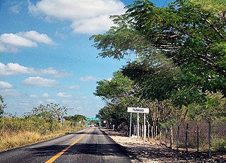
Tunkás Municipality is a municipality in the Mexican state of Yucatán containing 514.79 square kilometres (198.76 sq mi) of land and located roughly 98 kilometres (61 mi) east of the city of Mérida.

<span class="mw-page-title-main">Halachó Municipality</span> Municipality in the Mexican state of Yucatán

Halachó Municipality is a municipality in the Mexican state of Yucatán containing (671.91 km2) of land and located roughly 68 km southwest of the city of Mérida.

<span class="mw-page-title-main">Tixkokob Municipality</span> Municipality in the Mexican state of Yucatán

Tixkokob Municipality is a municipality in the Mexican state of Yucatán. Its municipal seat is located in the City of Tixkokob. The town of Tixkokob is famous within the area for high quality hammock weaving. The municipality made up largely of working class communities.

<span class="mw-page-title-main">Omitlán de Juárez</span> Municipality and town in Hidalgo, Mexico

Omitlán de Juárez is a town and one of the 84 municipalities of Hidalgo, in central-eastern Mexico. The municipality covers an area of 110.5 km².

Tekom Municipality is a municipality in the Mexican state of Yucatán. Tekom is also the name of the municipality's largest settlement and seat of the municipal government. In the XII national census conducted by INEGI in 2000, Tekom municipality recorded a population of 2,660 inhabitants. In the intermediate census count undertaken by INEGI in 2005, the total municipal population was recorded as 2,933 inhabitants, 2,413 of whom spoke one of the recognised indigenous languages of Mexico.

<span class="mw-page-title-main">Chemax Municipality</span> Municipality in the Mexican state of Yucatán

Chemax Municipality is a municipality in the Mexican state of Yucatán containing 1,098.6 km2 of land and located roughly 185 km east of the city of Mérida.

<span class="mw-page-title-main">Homún Municipality</span> Municipality in the Mexican state of Yucatán

Homún Municipality is a municipality in the Mexican state of Yucatán containing (192.89 km2) of land and located roughly 50 km southeast of the city of Mérida.

Hacienda Kancabchén is located in the Homún Municipality in the state of Yucatán in southeastern Mexico. It is one of the properties that arose during the nineteenth century henequen boom. There are numerous other properties of this name in the Yucatán including Hacienda Kancabchén in Baca, Hacienda Kancabchén (Halachó), Hacienda Kancabchén (Motul), Hacienda Kankabchén (Seyé), Hacienda Kankabchén (Tixkokob), Hacienda Kancabchén (Tunkás), Hacienda Kancabchén Ucí and Hacienda Kancabchén de Valencia.

<span class="mw-page-title-main">Motul Municipality</span> Municipality in the Mexican state of Yucatán

Motul Municipality is a municipality in the Mexican state of Yucatán. It contains 297.63 km2 (114.92 sq mi) of land and is roughly 45 km (28 mi) east of the city of Mérida.

<span class="mw-page-title-main">Hacienda Kancabchén Ucí</span> Place in Yucatán, Mexico

Hacienda Kancabchén Ucí is located in the Motul Municipality in the state of Yucatán in southeastern Mexico. It is one of the properties that arose during the nineteenth century henequen boom. There are numerous other properties of this name in the Yucatán including Hacienda Kancabchén in Baca, Hacienda Kancabchén (Halachó), Hacienda Kancabchén (Homún), Hacienda Kancabchén (Motul), Hacienda Kankabchén (Seyé), Hacienda Kankabchén (Tixkokob), Hacienda Kancabchén (Tunkás) and Hacienda Kancabchén de Valencia.

<span class="mw-page-title-main">Timucuy Municipality</span> Municipality in the Mexican state of Yucatán

Timucuy Municipality is a municipality in the Mexican state of Yucatán containing (63.15 km2) of land and located roughly 25 km southeast of the city of Mérida.

<span class="mw-page-title-main">Muxupip Municipality</span> Municipality in the Mexican state of Yucatán

Muxupip Municipality is a municipality in the Mexican state of Yucatán containing 54.93 square kilometres (21.21 sq mi) of land and located roughly 30 kilometres (19 mi) northeast of the city of Mérida. It is bounded on the north by Motul town, on the south by Cacalchén Municipality and on the east and the west by Yaxkukul Municipality and Tixkokob Municipality.

<span class="mw-page-title-main">Chikindzonot Municipality</span> Municipality in the Mexican state of Yucatán

Chikindzonot Municipality is a municipality in the Mexican state of Yucatán containing (352.56 km2) of land and located roughly 170 km southeast of the city of Mérida.

<span class="mw-page-title-main">Cantamayec Municipality</span> Municipality in the Mexican state of Yucatán

Cantamayec is a municipality in the Mexican state of Yucatán containing (502.02 km2) of land and located roughly 110 km southeast of the city of Mérida.

<span class="mw-page-title-main">Buctzotz Municipality</span> Municipality in the Mexican state of Yucatán

Buctzotz Municipality is a municipality in the Mexican state of Yucatán containing (543.45 km2) of land and is located roughly 95 kilometres (59 mi) northeast of the city of Mérida. It contains several churches and a hospital, Centre de Salud Buctzotz, in the eastern part of the main town.

<span class="mw-page-title-main">Calotmul Municipality</span> Municipality in the Mexican state of Yucatán

Calotmul Municipality is a municipality in the Mexican state of Yucatán containing (361.50 km2) of land and is located roughly 185 kilometres (115 mi) east of the city of Mérida.

<span class="mw-page-title-main">Cenotillo Municipality</span> Municipality in the Mexican state of Yucatán

Cenotillo Municipality is a municipality in the Mexican state of Yucatán containing (614.43 km2) of land and is located roughly 115 kilometres (71 mi) east of the city of Mérida.

<span class="mw-page-title-main">Río Lagartos Municipality</span> Municipality in the Mexican state of Yucatán

Río Lagartos Municipality is a municipality in the Mexican state of Yucatán containing (249.09 km2) of land and is located roughly 215 kilometres (134 mi) northeast of the city of Mérida.

<span class="mw-page-title-main">Sucilá Municipality</span> Municipality in the Mexican state of Yucatán

Sucilá Municipality is a municipality in the Mexican state of Yucatán containing 256.76 km2 of land and is located roughly 150 kilometres (93 mi) northeast of the city of Mérida.

<span class="mw-page-title-main">Tinúm Municipality</span> Municipality in the Mexican state of Yucatán

Tinúm Municipality is a municipality in the Mexican state of Yucatán containing of land and is located roughly 140 kilometres (87 mi) east of the city of Mérida.

References

  1. "Indicadores de Desarrollo Humano y Género en México 2000-2005" (PDF). Programa de las Naciones Unidas para el Desarrollo. Archived from the original (PDF) on 22 July 2011. Retrieved 16 August 2010.
  2. Instituto Nacional de Estadística y Geografía. "Yucatán. Mapa de Elevaciones Principales". Archived from the original on 2007-07-14. Retrieved 2010-05-22.
  3. Instituto Nacional de Estadística y Geografía. "Yucatán. Mapa de Fisiografía". Archived from the original on 2011-07-22. Retrieved 2010-05-22.
  4. Instituto Nacional de Estadística y Geografía. "Yucatán. Mapa con Principales ríos". Archived from the original on 2007-07-14. Retrieved 2010-05-22.
  5. Gobierno del Estado de Yucatán, Secretaría de Desarrollo Urbano y Medio Ambiente. "Censo de cenotes y grutas de Yucatán" . Retrieved 2010-05-22.
  6. Instituto Nacional de Estadística y Geografía. "Yucatán. Mapa de Regiones Hidrológicas". Archived from the original on 2007-07-14. Retrieved 2010-05-22.
  7. Instituto Nacional de Estadística y Geografía. "Yucatán. Mapa de Climas". Archived from the original on 2007-07-14. Retrieved 2010-05-22.
  8. Instituto Nacional de Estadística y Geografía. "Yucatán. Mapa de Temperatura Media Anual". Archived from the original on 2007-07-14. Retrieved 2010-05-22.
  9. Instituto Nacional de Estadística y Geografía. "Yucatán. Mapa de Precipitación Promedio Anual". Archived from the original on 2007-07-14. Retrieved 2010-05-22.
  10. Instituto Nacional de Estadística y Geografía. "Yucatán. Mapa de Agricultura y Vegetación". Archived from the original on 2009-07-27. Retrieved 2010-05-22.
  11. Instituto Nacional de Estadística y Geografía. "Yucatán. Población total por municipio según grandes grupos de edad, 2005" . Retrieved 2010-05-22.
  12. Instituto Nacional de Estadística y Geografía. "Yucatán. Indicadores seleccionados de la población por municipio, 2005" . Retrieved 2010-05-22.
  13. H. Congreso del Estado de Yucatán. "Ley de Instituticiones y Procedimientos electoral del Estado de Yucatán, Artículo 7, Párrafo IV" (PDF). Archived from the original (PDF) on 2009-12-28. Retrieved 2010-05-21.
  14. Instituto Nacional para el Federalismo y el Desarrollo Municipal. "Periodos de gobierno municipal". Archived from the original on 2014-10-17. Retrieved 2010-05-21.
  15. Instituto de Procedimientos Electorales y Participación Ciudadana de Yucatán. "Geografía electoral" . Retrieved 2010-05-21.
  16. Instituto Federal Electoral. "Condensado de Yucatán" (PDF). Archived from the original (PDF) on 2008-11-18. Retrieved 2010-05-21.

Sources