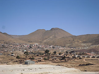
Llallagua or Llallawa is a town in the Potosí Department in Bolivia. It is the seat of the Llallagua Municipality, the third municipal section of the Rafael Bustillo Province.

Kimsa Kunturiri is a group of three mountains in the Andes of Bolivia in the Potosí Department at the border of Tomás Frías Province and Cornelio Saavedra Province. The peaks are about 5,020 m, 4,980 m and 4,960 m high. The Kimsa Kunturiri group is situated in the Khari Khari mountain range east of Potosí. It lies north of the Kimsa Waylla group, between the lakes Jatun Wak'ani (Jatun Huacani) and Juch'uy Wak'ani (Juchuy Huacani) in the west and the Jatun Tiyu Lakes in the east.
Wayna Potosí is a mountain in the Andes of Bolivia, about 4,969 metres (16,302 ft) high. It is located in the Oruro Department, Sajama Province, Turku Municipality, Turku Canton, northwest of Turku (Turco). The Turku River originates near the mountain. It is a left tributary of the Lauca River.
Wayna Tanka Tanka is a 4,858-metre-high (15,938 ft) mountain in the Andes of Bolivia. It is situated in the Cochabamba Department, Bolívar Province, near the border with the Potosí Department. Wayna Tanka Tanka lies southwest of the slightly higher mountain Machu Tanka Tanka.
Imilla Apachita is a 5,184-metre-high (17,008 ft) mountain in the Cordillera Real in the Bolivian Andes. It is situated in the La Paz Department, Los Andes Province, Pucarani Municipality. Imilla Apachita lies between the mountains Huayna Potosí in the northeast and Wila Kunka Pata in the southwest.
Chuqi Warani is a 5,388-metre-high (17,677 ft) mountain in Bolivia. It is located in the Potosí Department, Antonio Quijarro Province, Tomave Municipality. It lies southwest of the Jatun Mundo Quri Warani volcano. In the map of the Bolivian Instituto Geográfico Militar the term Chaupi Mundo is added under Cerro Choquehuarani. This may be an alternate name or a supplement.
Wila Salla is a 4,784-metre-high (15,696 ft) mountain in the Andes of Bolivia. It is located in the Potosí Department, Tomás Frías Province, on the border of the municipalities of Tinguipaya and Yocalla.
Wila Salla is a 4,616-metre-high (15,144 ft) mountain in the Andes of Bolivia. It is located in the Oruro Department, Eduardo Abaroa Province, Challapata Municipality, and in the Potosí Department, Tomás Frías Province, Tinguipaya Municipality. It lies southeast of Kuntur Nasa.
Yana Qaqa is a 3,742 m (12,277 ft) mountain in the Andes of Bolivia. It is located in the Potosí Department, Nor Chichas Province, Cotagaita Municipality. Yana Qaqa lies at the Caiti River.
Apachita is a 4,061-metre-high (13,323 ft) mountain in the Bolivian Andes. It is located in the Potosí Department, Chayanta Province, Ravelo Municipality. It lies northeast of the village of Wari Pampa (Huari Pampa).
Lluxita is a mountain in the Bolivian Andes which reaches a height of approximately 4,100 m (13,500 ft). It is located in the Potosí Department, Chayanta Province, Ocurí Municipality. It lies southeast of the village of Ch'aki Mayu (Chaqui Mayu).
Siwinqani is a 4,202-metre-high (13,786 ft) mountain in the Bolivian Andes. It is located in the Potosí Department, Chayanta Province, Ocurí Municipality. It lies northwest of Lluxita, northeast of the village of Ch'aki Mayu (Chaqui Mayu).
Phutunqu is a 3,090-metre-high (10,140 ft) mountain in the Bolivian Andes. It is located in the Chuquisaca Department, Azurduy Province, Tarvita Municipality. It lies west of the San Antonio River which is a left tributary of the Pillku Mayu.
Siku or Siq'u is a mountain in the Bolivian Andes which reaches a height of approximately 4,740 m (15,550 ft). It is located in the Potosí Department, Antonio Quijarro Province, Tomave Municipality.
Qullqi Chaka Punta is a mountain in the Bolivian Andes which reaches a height of approximately 4,380 m (14,370 ft). It is located in the Potosí Department, Antonio Quijarro Province, Porco Municipality. It lies northwest of K'uyka and west of Phujuni.
T'ula Qullu is a mountain in the Bolivian Andes which reaches a height of approximately 4,560 m (14,960 ft). It is located in the Potosí Department, Tomás Frías Province, Potosí Municipality. It lies southwest of Cerro Rico and east of Qutaña Qullu.
Pukara is a mountain in the Bolivian Andes which reaches a height of approximately 4,100 m (13,500 ft). It is located in the Potosí Department, Antonio Quijarro Province, Porco Municipality. It lies east of the village of Challwiri (Challviri).
Wila Sirka is a 4,508-metre-high (14,790 ft) mountain in the Bolivian Andes. It is located in the Potosí Department, Tomás Frías Province, Yocalla Municipality.
Wañuma is a 4,202-metre-high (13,786 ft) mountain in the Andes of Bolivia. It is located in the Potosí Department, Cornelio Saavedra Province, Tacobamba Municipality. Wañuma lies on the right bank of the Ch'aki Mayu. Its waters flow to the Pillku Mayu :
Qiñwa Qullu is a mountain in the Andes of Bolivia which reaches a height of approximately 4,160 m (13,650 ft). It is located in the Potosí Department, Cornelio Saavedra Province, Tacobamba Municipality. Qiñwa Qullu lies on the left bank of the Ch'aki Mayu. Its waters flow to the Pillku Mayu :


