
The Ash Wednesday bushfires, known in South Australia as Ash Wednesday II, were a series of bushfires that occurred in south-eastern Australia on 16 February 1983, which was Ash Wednesday. Within twelve hours, more than 180 fires fanned by hot winds of up to 110 km/h (68 mph) caused widespread destruction across the states of Victoria and South Australia. Years of severe drought and extreme weather combined to create one of Australia's worst fire days in a century. The fires were the deadliest bushfire in Australian history until the Black Saturday bushfires in 2009.
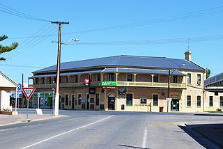
Yorketown is a town and a locality in the Australian state of South Australia located in the southern Yorke Peninsula about 91 kilometres (57 mi) west of the state capital of Adelaide and about 70 kilometres (43 mi) south of the municipal seat of Maitland. At the 2016 census, the locality had a population of 969 of which 642 lived in its town centre.
Jabuk is a locality in the Australian state of South Australia located about 142 kilometres (88 mi) south-east of the state capital of Adelaide and respectively about 78 kilometres (48 mi) west and 58 kilometres (36 mi) east of the municipal seats of Pinnaroo and Tailem Bend.
Kersbrook is a town near Adelaide, South Australia. It is located in the Adelaide Hills Council local government area. At the 2006 census, Kersbrook had a population of 367.

Meningie is a town on the south-east side of Lake Albert in South Australia. It is on the Princes Highway near The Coorong and was surveyed in 1866. At the 2016 census, the locality of Meningie had a population of 1118 with a median age of 51 while its town centre had a population of 852.

The lands administrative divisions of South Australia are the cadastral units of counties and hundreds in South Australia. They are located only in the south-eastern part of the state, and do not cover the whole state. 49 counties have been proclaimed across the southern and southeastern areas of the state historically considered to be arable and thus in need of a cadastre. Within that area, a total of 540 hundreds have been proclaimed, although five were annulled in 1870, and, in some cases, the names reused elsewhere.

Mount Magnificent Conservation Park is a protected area in the Australian state of South Australia located in the Mount Lofty Ranges about 58 kilometres south of the state capital of Adelaide. It is located within the gazetted locality of Mount Magnificent.
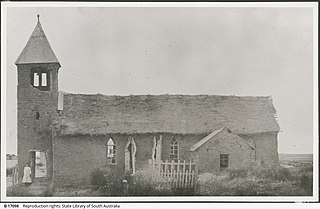
The first Ash Wednesday fires were a series of bushfires that began in the Adelaide Hills, South Australia, on Ash Wednesday, 20 February 1980. 51 homes and 25 other buildings were destroyed, including the Anglican Christ Church, Longwood, and 75 farms were affected. 40 people were injured, with 150 left homeless. The fire burnt an area of 3,770 ha (14.6 sq mi), and caused an estimated $34,000,000 damage.
Nepean Bay is a locality in the Australian state of South Australia located on the southern shore of Western Cove in Nepean Bay on the north coast of Kangaroo Island and about 128 kilometres south-west of the state capital of Adelaide and about 10 kilometres south-south-west of the municipal seat of Kingscote.
Stockyard Creek is a locality between Hamley Bridge and Owen, South Australia in the Mid North region of South Australia. It was established on the Hamley Bridge to Balaklava railway at the site of stockyards used by CB Fisher, 51+3⁄4 miles (83.3 km) north of Adelaide railway station.
Killalpaninna Mission, also known as just Killalpaninna, or alternatively Bethesda Mission, was a Lutheran mission for Aboriginal people in northeast South Australia, whose site is now located in the locality of Etadunna. It existed from 1866 to 1915.
The Hundred of Kuitpo is a cadastral unit of hundred in the Adelaide Hills. It is one of the 11 hundreds of the County of Adelaide. It was named in 1846 by Governor Frederick Robe and is presumed to be derived from an indigenous term ku-it-po, meaning reeds and referring to Blackfellow Creek in the contemporary locality of Yundi.
Coles is a locality in the Australian state of South Australia located in the state's south-east within the Limestone Coast region about 316 kilometres (196 mi) south east of the state capital of Adelaide and about 39 kilometres (24 mi) south-west of the municipal seat of Naracoorte.
Moockra is a locality in the Australian state of South Australia located on the eastern side of the Flinders Ranges about 274 kilometres (170 mi) north of the state capital of Adelaide and about 47 kilometres (29 mi) north-east and 36 kilometres (22 mi) south-east respectively of the municipal seats of Melrose and Quorn.
Reedy Creek Conservation Park is a protected area located in the Australian state of South Australia in the localities of Clay Wells and Greenways about 300 kilometres (190 mi) south-east of the state capital of Adelaide and about 28 kilometres (17 mi) north of the town of Beachport.
Kyeema Conservation Park is a protected area located in the Australian state of South Australia in the locality of Kyeema about 38 kilometres (24 mi) south of the state capital of Adelaide and about 12 kilometres (7.5 mi) east of the town of Willunga.
Ramco Point Conservation Park is a protected area located in the Australian state of South Australia in the locality of Sunlands about 150 kilometres (93 mi) north-east of the state capital of Adelaide and about 7 kilometres (4.3 mi) north-west of the municipal seat of Waikerie.
Messent Conservation Park, formerly the Messent National Park and the Messent Wildlife Reserve, is a protected area in the Australian state of South Australia located in the state’s south-east in the gazetted localities of Colebatch and Deepwater about 164 kilometres (102 mi) south-east of the state capital of Adelaide and about 6 kilometres (3.7 mi) north-east of the town centre in Salt Creek.
Prospect Hill is a small town in the southern Adelaide Hills of South Australia, Its major industries are forestry in Kuitpo Forest and dairy farming. There are also mountain bike trails in the area.

