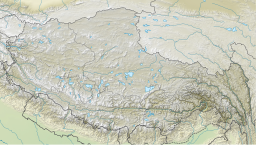
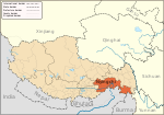
Dragsum Tsho (Tibetan: བྲག་གསུམ་མཚོ་, Wylie: brag gsum mtsho, THL: Draksum Tso, Pagsum Co (simplified Chinese:八松错, 巴松措; traditional Chinese:八松錯; pinyin:Bāsōng Cuò), literally meaning “three rocks” in Tibetan,[1] is a lake covering 28 square kilometres in Gongbo'gyamda County, Nyingchi of the Tibet Autonomous Region, China, approximately 300km (190mi) east of Lhasa. At 3,700metres over sea level it is about 18km long and has an average width of approximately 1.5km (0.93mi). The deepest point of the green lake measures 120metres. The lake is also known as Gongga Lake.[2]
Surrounded by dense primary forests of fir, spruce, and rhododendron, the lake hosts 195 native animal species and 242 phytoplankton varieties, including endemic fish like the naked carp (Gymnocypris spp.), which thrive in its oligotrophic waters. The northwestern shore features a 5 m² sacred boulder with a central perforation, believed to cleanse sins and cure illnesses through ritual passage.[3][4]
Culturally, Dragsum Tsho is central to the Kongpo people, a Tibetan subgroup known for unique traditions like polyandrous marriages and silver-ornamented attire35. The 7th-century Tsodzong Monastery on Drowa Island (Chinese:扎西岛) exemplifies Nyingma school architecture, dedicated to Padmasambhava and adorned with ancient carvings of the deity Hayagriva.[5] Annually on the 15th day of the fourth Tibetan month, pilgrims circumambulate the lake, tracing routes marked by King Gesar’s legendary arrow strikes and hoofprints of his warhorse embedded in shoreline rocks. The lake's designation as Tibet's first AAAAA-rated scenic area in 1994 underscores its dual role as an ecological sanctuary and living cultural archive.[6][7]
↑ 国家测绘局地名研究所 (National Surveying and Naming Research Institute) (1995). Xizang Diming: Bod ljoṅs sa miṅ; Place Names of the Xizing Autonomous Region西藏地名 | བོད་ལྗོངས་ས་མིང།[Tibetan Place Names]. Beijing: China Tibetology Press (中国藏学出版社). p.15. ISBN7-80057-284-6.; The name is sometimes confused with Basum (Basong Xiang巴松乡 / dba’ gsumདབའ་གསུམ) in Tingri County, Shigatse, due to the similarity of the Chinese names.
This page is based on this Wikipedia article Text is available under the CC BY-SA 4.0 license; additional terms may apply. Images, videos and audio are available under their respective licenses.