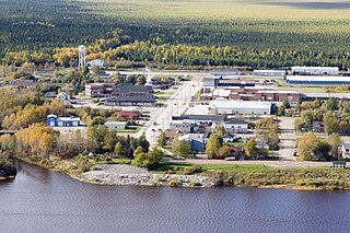
Moosonee is a town in northern Ontario, Canada, on the Moose River approximately 19 km (12 mi) south of James Bay. It is considered to be "the Gateway to the Arctic" and has Ontario's only saltwater port. Nearby on Moose Factory Island is the community of Moose Factory to which it is connected by water taxi in the summer and ice road in the winter.

The Kenogami River is a river in the James Bay drainage basin in Thunder Bay and Cochrane districts in Northern Ontario, Canada, which flows north from Long Lake near Longlac to empty into the Albany River. The river is 320 kilometres (199 mi) in length and its name means "long water" in the Cree language. A portion of the river's headwaters have been diverted into the Lake Superior drainage basin.

The Ogoki River is a river in the Thunder Bay and Cochrane Districts of Ontario. It springs from the wilderness just east of Savant Lake, flowing north of Lake Nipigon to Ogoki, where it joins the Albany River which empties into James Bay. The river is 480 kilometres (300 mi) long.

Lake Nipigon is part of the Great Lakes drainage basin. It is the largest lake entirely within the boundaries of the Canadian province of Ontario.
Moose Factory is a community in the Cochrane District, Ontario, Canada. It is located on Moose Factory Island, near the mouth of the Moose River, which is at the southern end of James Bay. It was the first English-speaking settlement in lands now making up Ontario and the second Hudson's Bay Company post to be set up in North America after Fort Rupert. On the mainland, across the Moose River, is the nearby community of Moosonee, which is accessible by water taxi in the summer, ice road in the winter, and chartered helicopter in the off-season.
The Albany River is a river in Northern Ontario, Canada, which flows northeast from Lake St. Joseph in Northwestern Ontario and empties into James Bay. It is 982 kilometres (610 mi) long to the head of the Cat River, tying it with the Severn River for the title of longest river entirely in Ontario. Major tributaries include the Kenogami River and Ogoki River.
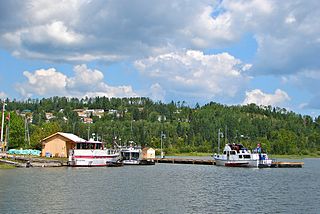
Nipigon is a township in Thunder Bay District, Northwestern Ontario, Canada, located along the west side of the Nipigon River and south of the small Helen Lake running between Lake Nipigon and Lake Superior. Lake Nipigon is located approximately 25 kilometres (16 mi) north of Nipigon. Located at latitude 49.0125° N, Nipigon is the northernmost community on the Great Lakes.
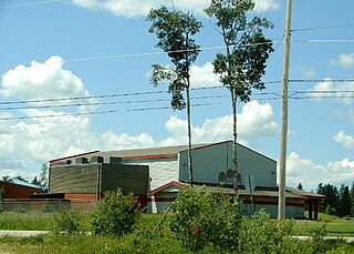
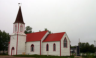
Constance Lake First Nation is an Oji-Cree First Nations band government located on the shores of Constance Lake near Hearst, Cochrane District in northeastern Ontario, Canada. It is directly north of the community of Calstock along a continuation of Ontario Highway 663. Constance Lake First Nation is home to close to 1605 members of Cree and Ojibway with approximately 820 living on reserve. The reserves, Constance Lake 92 and English River 66, total 7,686 acres (3,110 ha) in size.

Longlac is a community in the municipality of Greenstone, in northwestern Ontario, Canada. It is located along Highway 11 and the Canadian National Railway, on the namesake Longlac Bay at the northern end of Long Lake.
The Kabinakagami River is a river in Cochrane and Algoma Districts in northeastern Ontario, Canada. It is part of the James Bay drainage basin and is a right tributary of the Kenogami River.
Summit Lake is a lake in Unorganized Thunder Bay District in Northwestern Ontario, Canada, about 75 kilometres (47 mi) northwest of the community of Nakina, and 22 kilometres (14 mi) northeast of the Auden and Ombabika stops on the Canadian National Railway transcontinental mainline.

Revillon Frères was a French fur and luxury goods company, founded in Paris in 1723. Then called la Maison Givelet, it was purchased by Louis-Victor Revillon in 1839 and soon, as Revillon Frères, became the largest fur company in France. Branches were opened in London in 1869 and in New York in 1878. At the end of the 19th century, Revillon had stores in Paris, London, New York City, and Montreal.

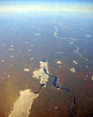
Mammamattawa is a dispersed rural community and unincorporated place in the Unorganized North Part of Cochrane District in northeastern Ontario, Canada. It is located at the mouth of the Kabinakagami River at the Kenogami River, just 2 kilometres (1.2 mi) downstream of the mouth of the Nagagami River at the Kenogami, in the James Bay drainage basin.
Ogahalla is an unincorporated place and railway point in geographic Barlow Township in the Unorganized North Part of Cochrane District in northeastern Ontario, Canada.
Flintdale is an unincorporated place and railway point in geographic Selwyn Township in Unorganized North Cochrane District in northeastern Ontario, Canada.
Blanche is an unincorporated place and railway point in geographic Selwyn Township in the Unorganized North Part of Cochrane District in northeastern Ontario, Canada.
Wilgar is an unincorporated place and railway point in geographic Henderson Township in Unorganized North Cochrane District in northeastern Ontario, Canada.
Lynx is an unincorporated place and railway point in the Unorganized North Part of Cochrane District in northeastern Ontario, Canada.
Jobrin is an unincorporated place and community in the Unorganized North Part of Cochrane District in northeastern Ontario, Canada.
English River 66 is a First Nations reserve in Cochrane District, Ontario, Canada, located adjacent to the settlement of Mammamattawa and just downstream of the mouth of the Kabinakagami River at the Kenogami River. It is one of two reserves of the Constance Lake First Nation, and has an area of 3,108 hectares.


