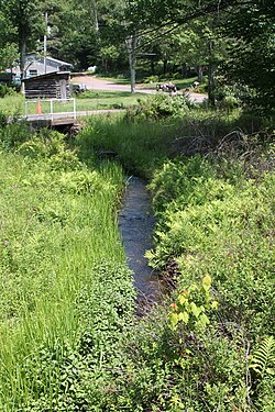
Rocky Run is a tributary of the Susquehanna River in Luzerne County, Pennsylvania, in the United States. It is approximately 2.3 miles (3.7 km) long and flows through Salem Township. The watershed of the stream has an area of 1.83 square miles (4.7 km2). In the early 1900s, the stream had a high level of water quality and was proposed for use as a water supply. The construction of a dam on it was proposed, but no formal plans were ever made. There are coal mines in the watershed, but they have been abandoned since the late 1800s. Wisconsinan Till, Wisconsinan Ice-Contact Stratified Drift, Boulder Colluvium, Wisconsinan Bouldery Till, coal dumps, and bedrock consisting of sandstone and shale all occur in the watershed. The drainage basin is designated as a Coldwater Fishery.

Turtle Creek is a tributary of the Susquehanna River in Luzerne County, Pennsylvania, in the United States. It is approximately 2.5 miles (4.0 km) long and flows through Conyngham Township. The watershed of the creek has an area of 1.59 square miles (4.1 km2). Wisconsinan Bouldery Till, Wisconsinan Ice-Contact Stratified Drift, Wisconsinan Outwash, alluvium, alluvial terrace, fill, and coal dumps all occur in the vicinity of the creek. The creek has been the subject of a flood protection project. Its watershed is designated as a Coldwater Fishery and a Migratory Fishery.
Reyburn Creek is a tributary of Shickshinny Creek in Luzerne County, Pennsylvania. It is approximately 6.2 miles (10.0 km) long and flows through Union Township. The watershed of the creek has an area of 9.52 square miles (24.7 km2). It is designated as a Coldwater Fishery and a Migratory Fishery. Alluvium, Wisconsinan Outwash, Wisconsinan Till, Wisconsinan Ice-Contact Stratified Drift, Wisconsinan Bouldery Till, Wisconsinan Till Moraine, and bedrock consisting of shale and sandstone all occur near the creek.
Fades Creek is a tributary of Pikes Creek in Luzerne County, Pennsylvania, in the United States. It is approximately 3.2 miles (5.1 km) long and flows through Lake Township. The watershed of the creek has an area of 2.07 square miles (5.4 km2). It has one unnamed tributary and is designated as a High-Quality Coldwater Fishery and Class A Wild Trout Waters for part of its length. The creek is crossed by a pipeline and a bridge carrying Pennsylvania Route 118. Wisconsinan Ice-Intact Stratified Drift, alluvium, Wisconsinan Till, Wisconsinan Bouldery Till, and bedrock consisting of sandstone and shale all occur in the surficial geology in the creek's vicinity.

Bear Hollow Creek is a tributary of Harveys Creek in Luzerne County, Pennsylvania, in the United States. It is approximately 2.0 miles (3.2 km) long and flows through Lake Township. The creek was used as a water supply in the early 1900s. During glacial times, its valley, Bear Hollow, served as a glacial sluiceway. The surficial geology near the creek features alluvium, Wisconsinan Till, Wisconsinan Boulder Till, a peat bog, and bedrock consisting of sandstone and shale. Bear Hollow is listed on the Luzerne County Natural Areas Inventory.

Boston Run is a tributary of Kitchen Creek in Luzerne County, Pennsylvania, in the United States. It is approximately 1.2 miles (1.9 km) long and flows through Fairmount Township. The watershed of the creek has an area of 0.66 square miles (1.7 km2). Old-growth forests are in the vicinity and wild trout naturally reproduce in the stream. The surficial geology nearby features Wisconsinan Outwash, Wisconsinan Till, fill, and bedrock consisting of sandstone and shale.

Laurel Run is a tributary of Huntington Creek, in Luzerne County, Pennsylvania, in the United States. It is approximately 1.8 miles (2.9 km) long and flows through Ross Township. The watershed of the stream has an area of 1.29 square miles (3.3 km2). Wild trout naturally reproduce in the stream. The surficial geology in the area mainly consists of Wisconsinan Till, Wisconsinan Ice-Contact Stratified Drift, and bedrock consisting of sandstone and shale. The stream is designated as a Least Disturbed Stream.
Conety Run is a tributary of Little Nescopeck Creek in Luzerne County, Pennsylvania, in the United States. It is approximately 3.6 miles (5.8 km) long and flows through Fairview Township and Dennison Township. The watershed of the stream has an area of 2.32 square miles (6.0 km2). The stream is designated as Class A Wild Trout Waters, but was historically stocked. It has an alkalinity concentration of 2 milligrams per liter, but is slightly acidic. The surficial geology in its vicinity mainly consists of alluvium, Wisconsinan Till, Wisconsinan Ice-Contact Stratified Drift, and bedrock consisting of sandstone and shale.

Kingsbury Brook is a tributary of Huntington Creek in Luzerne County, Pennsylvania, in the United States. It is approximately 1.5 miles (2.4 km) long and flows through Huntington Township. The watershed of the stream has an area of 1.27 square miles (3.3 km2) and it has two unnamed tributaries. Wild trout naturally reproduce in the stream. The surficial geology in its vicinity mainly consists of alluvium, Wisconsinan Till, Wisconsinan Ice-Contact Stratified Drift, bedrock, and wetlands.
Rattlesnake Creek is a tributary of Spring Brook in Lackawanna County, Pennsylvania, in the United States. It is approximately 5.0 miles (8.0 km) long and flows through Spring Brook Township. The watershed of the creek has an area of 9.18 square miles (23.8 km2). The creek has one named tributary, which is known as Six Springs Creek. Rattlesnake Creek is inhabited by wild trout and part of it is considered to be Class A Wild Trout Waters. A dammed lake known as Maple Lake is located near its headwaters. The surficial geology in the area mainly consists of Wisconsinan Till and bedrock, with some alluvium, Wisconsinan Ice-Contact Stratified Drift, wetlands, and peat bogs.
Lake Run is a tributary of Roaring Brook in Lackawanna County, Pennsylvania, in the United States. It is approximately 1.6 miles (2.6 km) long and flows through Covington Township. The watershed of the stream has an area of 3.44 square miles (8.9 km2). It has one named tributary, which is known as Emerson Run. Lake Run is considered to be Class A Wild Trout Waters. The surficial geology in its vicinity consists of Wisconsinan Ice-Contact Stratified Drift, Wisconsinan Till, Boulder Colluvium, alluvium, bedrock, sand and gravel pits, fill, wetlands, peat bogs, and a lake.
Emerson Run is a tributary of Lake Run in Lackawanna County, Pennsylvania, in the United States. It is approximately 1.8 miles (2.9 km) long and flows through Covington Township. The watershed of the stream has an area of 1.58 square miles (4.1 km2). Wild trout naturally reproduce in the stream. The surficial geology in its vicinity consists of Wisconsinan Ice-Contact Stratified Drift, Wisconsinan Till, bedrock, wetlands, peat bogs, and sand and gravel pits.

Roaring Run is a tributary of Bowman Creek in Wyoming County, Pennsylvania, in the United States. It is approximately 4.9 miles (7.9 km) long and flows through Forkston Township, Noxen Township, and Monroe Township. It has two named tributaries: Newton Run and South Branch Roaring Run. The watershed of Roaring Run has an area of 11.4 square miles (30 km2). It is designated as a High-Quality Coldwater Fishery and a Migratory Fishery and the stream is Class A Wild Trout Waters. The surficial geology in its vicinity consists of alluvium, alluvial terrace, alluvial fan, bedrock, Wisconsinan Till, and Wisconsinan Ice-Contact Stratified Drift. A bridge carrying Pennsylvania Route 29 crosses the stream.
South Branch Roaring Run is a tributary of Roaring Run in Wyoming County, Pennsylvania, in the United States. It is approximately 2.0 miles (3.2 km) long and flows through Noxen Township and Forkston Township. The watershed of the stream has an area of 3.31 square miles (8.6 km2). The surficial geology in its vicinity consists of bedrock, Wisconsinan Till, Wisconsinan Bouldery Till, Wisconsinan Ice-Contact Stratified Drift, and alluvium. South Branch Roaring Run is classified as Class A Wild Trout Waters.

Beaver Run is a tributary of Bowman Creek in Luzerne County and Wyoming County, in Pennsylvania, in the United States. It is approximately 7.7 miles (12.4 km) long and flows through Lake Township in Luzerne County and Noxen Township in Wyoming County. The watershed of the stream has an area of 10.6 square miles (27 km2). It is not designated as an impaired waterbody. The surficial geology in its vicinity includes alluvial fan, alluvial terrace, alluvium, Wisconsinan Till, Wisconsinan Ice-Contact Stratified Drift, fill, wetlands, and bedrock.

Stone Run is a tributary of Bowman Creek in Wyoming County, Pennsylvania, in the United States. It is approximately 2.2 miles (3.5 km) long and flows through Noxen Township. The watershed of the stream has an area of 2.43 square miles (6.3 km2). The stream is not designated as an impaired waterbody. The surficial geology in its vicinity consists of alluvium, Wisconsinan Ice-Contact Stratified Drift, Wisconsinan Till, and Wisconsinan Bouldery Till. The stream is classified as Class A Wild Trout Waters and its watershed is designated as a High-Quality Coldwater Fishery and a Migratory Fishery.
Sugar Run is a tributary of Bowman Creek in Luzerne County and Wyoming County, in Pennsylvania, in the United States. It is approximately 1.8 miles (2.9 km) long and flows through Lake Township in Luzerne County and Noxen Township in Wyoming County. The watershed of the stream has an area of 1.02 square miles (2.6 km2). The surficial geology in its vicinity consists of alluvium, alluvial fan, Wisconsinan Till, and bedrock. The stream's watershed is designated as a High-Quality Coldwater Fishery and a Migratory Fishery.

Beth Run is a tributary of Bowman Creek in Luzerne County, Pennsylvania, in the United States. It is approximately 1.9 miles (3.1 km) long and flows through Ross Township and Lake Township. The watershed of the stream has an area of 2.34 square miles (6.1 km2). The surficial geology along it consists of Wisconsinan Till and alluvium. The stream's watershed is designated as a High-Quality Coldwater Fishery and a Migratory Fishery and the stream is Class A Wild Trout Waters.
Bean Run is a tributary of Bowman Creek in Luzerne County, Pennsylvania, in the United States. It is approximately 1.3 miles (2.1 km) long and flows through Ross Township. The watershed of the stream has an area of 1.69 square miles (4.4 km2). The stream's watershed is designated as a High-Quality Coldwater Fishery and a Migratory Fishery.
South Branch Bowman Creek is a tributary of Bowman Creek in Luzerne County, Pennsylvania, in the United States. It is approximately 3.0 miles (4.8 km) long and flows through Fairmount Township and Ross Township. The watershed of the creek has an area of 3.92 square miles (10.2 km2). The surficial geology in its vicinity consists of alluvial fan, alluvium, Wisconsinan Ice-Contact Sratified Drift, fill, lakes, Boulder Colluvium, Wisconsinan Till, Wisconsinan Bouldery Till, wetlands, and bedrock. Most of the creek is in Ricketts Glen State Park. It has one named tributary, which is known as Cherry Run. The creek's watershed is designated as a High-Quality Coldwater Fishery and a Migratory Fishery.