Palo (IPA: [pɐ'loʔ]), officially the Municipality of Palo
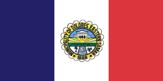
 (Waray : Bungto han Palo; Tagalog : Bayan ng Palo), is a First Income Class municipality in the province of Leyte, Philippines. According to the 2020 census, it has a population of 76,213 people, making it the most populous municipality (non-city) in the province. [3]
The municipality is the seat of most government departments, bureaus, and regional offices of Region VIII, although some are situated at the neighboring city of Tacloban. The municipality is also home to the offices of the ecclesiastical government of the Archdiocese of Palo; the archbishop's residence; as well as the secondary, tertiary, and theology seminaries of the archdiocese.
On March 17, 2022, the new Leyte Provincial Capitol in Palo was inaugurated by President Rodrigo Duterte, [5] officially moving the seat of provincial government to the municipality pending an enabling law changing the provincial capital from the current highly urbanized city of Tacloban.
According to existing records those who went to Kutay after the tribal war in Bunga were all equipped with palo, a sort of club for fighting or self-protection. Being the settlement of a tribe with palos, this is likely the reason why the community was known as "Palo".
However, the late Justice Norberto Romualdez, in an issue of Noli Me Tangere, a Tacloban-based newspaper of that time, asserted on June 9, 1909, that this town was named Palo because of its many carpenters sporting hammers (mazo or palo).
Believers in superstition and the supernatural ascribe the origin of the Palo name to the town's experience during pre-Spanish time often being visited by typhoons every eight (walo) days. They called the phenomenon walo-walo, hence walo-palo (eight-hammer).
The first settlers of Palo were the tribes Panganuron, Kadampog, Manlangit, Kamagung, Kawaring, Kabalhin, Kumagang Maglain, Bilyo and Dilyo. They lived peacefully in an area resembling the shape of a bridge in what is now Barrio Bunga (present-day San Joaquin), which spanned an area on both sides of the river bearing the same name. As the population increased, tribal feuds would cause the people to disperse. Survivors would settle in Payapay, and others in Canpetik. The bulk went to Kutay. Those in Kutay would eventually establish the town of Palo.
The settlers in Kutay moved to Bangon river and there started the first barrio, Barangay de Palo, in 1521. Barangay de Palo would then become Pueblo de Palo in 1768. Its first elected gobernadorcillo was Capitan Balasabas. The first curate was R. P. Fray Matias Rosel, O.S.A., an Augustinian friar from Andalucia, Spain.[ citation needed ]
The Missions
In October 1596, the Jesuit Frs. Cristobal Jimenez and Francisco Encinas left Dulag traversing to Palo along the eastern coasts They were accompanied by principales Don Alonso Ambuyao and four others. They found there only two small houses used by the two servants of the encomenderos. A few boys that attended the mission schools in Dulag welcomed the two priests and taught them the dialect. These missionaries opened the first school in Palo and taught the children to play the flute. Later when Fr. Encinas was called to Carigara, Fr. Jimenez carried on alone until Bro. Miguel Gomez arrived to help him.
Fr. Jimenez learned enough of the local language to be understood but his influence was limited in "his mission area" to only a few. The people probably suspected him of being a tax collector. For a long time the natives avoided him and resisted all his attempts at friendship. Nothing he did or offered to do for them seemed to breakdown their distrust him and he was distressed and worried at their antipathy.
In his rounds of the villages, he noticed that there were many sick of which the greater the number succumbed to diseases for lack of medical attention. This observation gave him an idea. At that time, medical service was very expensive and available only to families of means for they alone could afford to pay work animals, slaves, or the equivalent of the patient's ransom. if he were captured.
Palo is well known as the site of Gen. Douglas MacArthur's return to the Philippines together with Philippine and American military forces after a period of exile in 1944. [6] [7] Hill 522, a hill located near the town center, was the site of fierce fighting between Allied and Japanese forces during the Second World War. The metropolitan cathedral of the archdiocese, located right across Palo's municipal hall, was used as a hospital for wounded Filipino and American forces. A memorial now stands at the beach site where MacArthur and his troops landed, locally known as MacArthur Park. The first Gabaldon Building is also situated in Barangay San Joaquin, Palo, Leyte. It was inaugurated by President Sergio Osmeña.
Palo was also once the capital of Leyte. The town's Purissima Bridge was the first steel bridge built in the province.
In 1957, sitio Campitic was converted into a barrio, [8] while barrio Baras-Candahug was divided into two: Baras and Candahug. [9] Barrio Malirong was renamed as Libertad. [10]
On November 8, 2013, Palo was severely struck by Typhoon Haiyan (Yolanda), which destroyed a large portion of Eastern Visayas and killed a number of residents in the town. [11] On January 17, 2015, Pope Francis visited the town as part of his papal visit to the Philippines to meet with the surviving victims of the typhoon. He also blessed the Pope Francis Center for the Poor and met with priests, seminarians, other religious figures, and surviving victims of the typhoon at the Palo Cathedral before leaving Leyte. [12]
The municipality is located in the north-eastern part of the province of Leyte, 8 miles from the capital city of Tacloban.
Palo is politically subdivided into 33 barangays. [13] Each barangay consists of puroks and some have sitios.
Climate data for Palo, Leyte | |||||||||||||
---|---|---|---|---|---|---|---|---|---|---|---|---|---|
Month | Jan | Feb | Mar | Apr | May | Jun | Jul | Aug | Sep | Oct | Nov | Dec | Year |
Mean daily maximum °C (°F) | 28 (82) | 28 (82) | 29 (84) | 30 (86) | 30 (86) | 30 (86) | 29 (84) | 30 (86) | 30 (86) | 29 (84) | 29 (84) | 28 (82) | 29 (84) |
Mean daily minimum °C (°F) | 22 (72) | 22 (72) | 22 (72) | 23 (73) | 24 (75) | 24 (75) | 24 (75) | 24 (75) | 24 (75) | 24 (75) | 23 (73) | 23 (73) | 23 (74) |
Average precipitation mm (inches) | 90 (3.5) | 67 (2.6) | 82 (3.2) | 70 (2.8) | 97 (3.8) | 145 (5.7) | 142 (5.6) | 127 (5.0) | 132 (5.2) | 152 (6.0) | 169 (6.7) | 144 (5.7) | 1,417 (55.8) |
Average rainy days | 17.0 | 13.5 | 16.0 | 16.5 | 20.6 | 24.3 | 26.0 | 25.4 | 25.2 | 26.4 | 23.0 | 21.0 | 254.9 |
Source: Meteoblue [14] |
|
| |||||||||||||||||||||||||||||||||||||||||||||||||||
Source: Philippine Statistics Authority [15] [16] [17] [18] |
In the 2020 census, the population of palo, Leyte, was 76,213 people, [3] with a density of 340 inhabitants per square kilometre or 880 inhabitants per square mile.
Literacy rate in Palo is 99.5%.
The town's native language is Waray-Waray, the major language and lingua franca in the Eastern Visayas region.
Palo is the seat of the ecclesiastical province, the Archdiocese, where the Roman Catholic archbishop resides in Bukid Tabor. One can also find the archdiocese's Metropolitan Cathedral in Palo. Meanwhile, Palo is also a seedbed of vocations to the priesthood with the Sacred Heart Seminary and the St. John the Evangelist School of Theology. Two Paloan nuns also became Superiors General in their respective congregations. To date, there are 158 ordained priests and 106 nuns from the town alone.
Poverty incidence of Palo
Palo is the seat of the 6.8-hectare Leyte Information and Communications Technology (ICT) Park and the 22-hectare Leyte Mikyu Economic Zone. [27] The Leyte ICT Park hosts two BPOs while the Leyte Mikyu Ecozone is undergoing development.
The town's historic municipal building was the former seat of the Provincial Government of Leyte.
Agriculture is the municipality's dominant industry. The area produces and ferments the local coconut wine called tuba. [28] [29]
Palo is sister city with Palo Alto, California, USA, since 1963. [32] [33]
Leyte, officially the Province of Leyte, is a province in the Philippines located in the Eastern Visayas region occupying the northern three-quarters of Leyte Island. Its capital is the city of Tacloban, administered independently from the province, as well as the regional center of Eastern Visayas. Leyte is thus north of Southern Leyte, south of Biliran, and west of Samar Island. To the west across the Camotes Sea is the province of Cebu.
Balangiga, officially the Municipality of Balangiga, is a municipality in the province of Eastern Samar, Philippines. According to the 2020 census, it has a population of 14,341 people.
Alangalang, officially the Municipality of Alangalang, is a First Class municipality in the province of Leyte, Philippines. According to the 2020 census, it has a population of 57,185 people.
Tacloban, officially the City of Tacloban, is a highly urbanized city on Leyte island in the Eastern Visayas region of the Philippines. According to the 2020 census, Tacloban has a population of 251,881, making it the most populous city in the Eastern Visayas. The city is located 360 miles (580 km) southeast of Manila.
Dagami, officially the Municipality of Dagami, is a municipality in the province of Leyte, Philippines. According to the 2020 census, it has a population of 36,178 people.
Dulag, officially the Municipality of Dulag, is a municipality in the province of Leyte, Philippines. According to the 2020 census, it has a population of 48,992 people.
Basey, officially the Municipality of Basey, is a municipality in the province of Samar, Philippines. According to the 2020 census, it has a population of 56,685 people.
Dolores, officially the Municipality of Dolores, is a municipality in the province of Eastern Samar, Philippines. According to the 2020 census, it has a population of 44,626 people.
Malitbog, officially the Municipality of Malitbog, is a municipality in the province of Southern Leyte, Philippines. According to the 2020 census, it has a population of 23,256 people.
Bato, officially the Municipality of Bato, is a municipality in the province of Leyte, Philippines. According to the 2020 census, it has a population of 38,505 people.
Baybay, officially the City of Baybay, is a component city in the province of Leyte, Philippines. It has a population of 111,848 people.
Capoocan, officially the Municipality of Capoocan, is a municipality in the province of Leyte, Philippines. According to the 2020 census, it has a population of 33,721 people.
Carigara, officially the Municipality of Carigara, is a First Income Class municipality in the province of Leyte, Philippines. According to the 2020 census, it has a population of 54,656 people.
Hilongos, officially the Municipality of Hilongos, is a First Income Class municipality in the province of Leyte, Philippines. According to the 2020 census, it has a population of 64,514 people.
Kananga, officially the Municipality of Kananga, is a First Income Class municipality in the province of Leyte, Philippines. According to the 2020 census, it has a population of 59,696 people.
Mayorga, officially the Municipality of Mayorga, is a municipality in the province of Leyte, Philippines. According to the 2020 census, it has a population of 18,071 people.
Pastrana, officially the Municipality of Pastrana, is a municipality in the province of Leyte, Philippines. According to the 2020 census, it has a population of 19,359 people.
Santa Fe, officially the Municipality of Santa Fe, is a municipality in the province of Leyte, Philippines. According to the 2020 census, it has a population of 22,102 people.
Tabango, officially the Municipality of Tabango, is a municipality in the province of Leyte, Philippines. According to the 2020 census, it has a population of 33,868 people.
Tunga, officially the Municipality of Tunga, is a municipality in the province of Leyte, Philippines. According to the 2020 census, it has a population of 7,656 people.