Calubian

Last updated
Calubian
Municipality of Calubian
Calubian Leyte Philippines Hilltop View.jpg
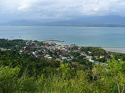
Hilltop view of Calubian
Flag of Calubian, Leyte.png
Ph locator leyte calubian.png
Map of Leyte with Calubian highlighted
OpenStreetMap
Calubian
Philippines location map (square).svg
Red pog.svg
Calubian
Location within the Philippines
Coordinates: 11°26′48″N124°25′40″E / 11.4467°N 124.4278°E / 11.4467; 124.4278
Country Philippines
Region Eastern Visayas
Province Leyte
District 3rd district
Barangays 53 (see Barangays)
Government
[1]
  Type Sangguniang Bayan
   Mayor Marciano A. Batiancela Jr.
   Vice Mayor Gilbert S. Ponce
   Representative Vicente Sofronio E. Veloso III
  Councilors
List
   Electorate 24,291 voters (2022)
Area
[2]
  Total100.95 km2 (38.98 sq mi)
Elevation
82 m (269 ft)
Highest elevation
1,336 m (4,383 ft)
Lowest elevation
0 m (0 ft)
Population
 (2020 census) [3]
  Total31,646
  Density310/km2 (810/sq mi)
   Households
8,670
Economy
   Income class 4th municipal income class
   Poverty incidence
29.35
% (2018) [4]
   Revenue 179.9 million (2020)
   Assets 267.8 million (2020)
   Expenditure 145.2 million (2020)
   Liabilities 127.9 million (2020)
Service provider
  ElectricityLeyte 5 Electric Cooperative (LEYECO 5)
Time zone UTC+8 (PST)
ZIP code
6534
PSGC
IDD : area code +63(0)53
Native languages Cebuano
Tagalog

Calubian, officially the Municipality of Calubian (Waray : Bungto han Calubian; Cebuano : Lungsod sa Calubian; Tagalog : Bayan ng Calubian), is a 4th class municipality in the province of Leyte, Philippines. According to the 2020 census, it has a population of 31,646 people. [3]

Contents

History

On January 8, 1919, Governor Charles E. Yeater issued Executive Order No. 4, creating the town of Calubian which is formerly a barrio of the Municipality of Leyte, Leyte. Originally, its name was Eulalia in honor of a prominent lady resident. Later it was changed to Calubian due to the vast coconut plantation of the place (Photo shown is the Eulalia Monument located at the foot of the Veloso hill on the way to the Municipal Hall).

The Local Government of Calubian was formerly organized on January 22, 1919, with Felix Garganera as its first town executive. In 1922, he was succeeded by Nepumoceno Torlao, a generous resident of the locality. Then Alejandro Baronda took the reign as Local Chief Executive from 1931 to 1934. From 1934 to 1937, Felix Lafuente became the Town Chief followed by Francisco Enage in 1938 to 1940 and later on Enrique Q. Enage led the town from 1941 to 1942. They were followed by Lorenzo Mendoza from 1942 to 1944. Honorato Agas Sr led his people from 1945 to April 15, 1986, except for one term 1952-1953 when he was defeated by Rosendo Eamiguel, a popular landlord of Barangay Villalon.

The popular EDSA Revolution on February 25, 1986, brought an end to Agas’ term and Victorio Loygos Sr was eventually appointed as the OIC Mayor from April 16, 1986, to May 1987. Engr. Rolando R. Amparado succeeded him by appointment from June 24, 1987, to November 30, 1987, followed by Marciano Batiancela Jr from December 1, 1987, until the newly elected Local Chief Executive in the person of Dr. Carlos C. Cotiangco Jr. assumed office on February 8, 1988. He has done tremendous accomplishment in the Metro-Calubian by accomplishing several infrastructure projects such as concreting of municipal and barangay roads, public markets, waiting sheds, completion of municipal hall, improvement of the drainage system, multi-purpose pavements and water works projects. [5]

Geography

Barangays

Calubian is politically subdivided into 53 barangays. Each barangay consists of puroks and some have sitios.

  • Abanilla
  • Anislagan
  • Bunacan
  • Cabalquinto
  • Herrera (Cabalhin)
  • Cabradilla
  • Caneja
  • Cantonghao
  • Caroyocan
  • Casiongan
  • Cristina
  • Dalumpines
  • Don Luis
  • Dulao
  • Efe (Ul-og)
  • Enage
  • Espinosa
  • Ferdinand E. Marcos
  • Garganera
  • Garrido
  • Guadalupe
  • Gutosan
  • Igang
  • Inalad
  • Jubay
  • Juson
  • Kawayan Bogtong
  • Kawayanan
  • Kokoy Romualdez
  • Labtic
  • Laray
  • Limite (Agas)
  • Manuel Veloso
  • Mahait
  • Malobago
  • Matagok
  • Nierras
  • Nipa
  • Obispo
  • Pagatpat
  • Pangpang
  • Patag
  • Pates
  • Pal-og
  • Padoga
  • Petrolio
  • Poblacion
  • Railes
  • Tabla
  • Tagharigue
  • Tuburan
  • Villahermosa
  • Villalon
  • Villanueva

Climate

Climate data for Calubian, Leyte
MonthJanFebMarAprMayJunJulAugSepOctNovDecYear
Average high °C (°F)28
(82)
29
(84)
29
(84)
31
(88)
31
(88)
30
(86)
30
(86)
30
(86)
30
(86)
29
(84)
29
(84)
29
(84)
30
(85)
Average low °C (°F)22
(72)
22
(72)
22
(72)
23
(73)
24
(75)
25
(77)
25
(77)
25
(77)
25
(77)
24
(75)
24
(75)
25
(77)
24
(75)
Average precipitation mm (inches)73
(2.9)
56
(2.2)
75
(3.0)
71
(2.8)
114
(4.5)
174
(6.9)
172
(6.8)
163
(6.4)
167
(6.6)
161
(6.3)
158
(6.2)
125
(4.9)
1,509
(59.5)
Average rainy days15.212.516.217.323.927.328.426.926.927.123.819.3264.8
Source: Meteoblue (Use with caution: this is modeled/calculated data, not measured locally.) [6]

Demographics

Population census of Calubian
YearPop.±% p.a.
1939 14,027    
1948 19,423+3.68%
1960 30,354+3.79%
1970 26,661−1.29%
1975 25,821−0.64%
1980 26,564+0.57%
1990 25,968−0.23%
YearPop.±% p.a.
1995 31,074+3.42%
2000 28,421−1.89%
2007 29,945+0.72%
2010 29,619−0.40%
2015 31,228+1.01%
2020 31,646+0.26%
Source: Philippine Statistics Authority [7] [8] [9] [10]

In the 2020 census, the population of Calubian, Leyte, was 31,646 people, [3] with a density of 310 inhabitants per square kilometre or 800 inhabitants per square mile.

Economy

Related Research Articles

<span class="mw-page-title-main">Albuera, Leyte</span> Municipality in Leyte, Philippines

Albuera, officially the Municipality of Albuera, is a 3rd class municipality in the province of Leyte, Philippines. According to the 2020 census, it has a population of 47,151 people.

<span class="mw-page-title-main">Villaba</span> Municipality in Leyte, Philippines

Villaba, officially the Municipality of Villaba, is a 3rd class municipality in the province of Leyte, Philippines. According to the 2020 census, it has a population of 42,859 people.

<span class="mw-page-title-main">Jipapad</span> Municipality in Eastern Samar, Philippines

Jipapad, officially the Municipality of Jipapad, is a 5th class municipality in the province of Eastern Samar, Philippines. According to the 2020 census, it has a population of 8,439 people.

<span class="mw-page-title-main">Maslog</span> Municipality in Eastern Samar, Philippines

Maslog, officially the Municipality of Maslog, is a 5th class municipality in the province of Eastern Samar, Philippines. According to the 2020 census, it has a population of 5,463 people.

<span class="mw-page-title-main">Salcedo, Eastern Samar</span> Municipality in Eastern Samar, Philippines

Salcedo, officially the Municipality of Salcedo, is a 5th class municipality in the province of Eastern Samar, Philippines. According to the 2020 census, it has a population of 22,136 people.

<span class="mw-page-title-main">Anahawan</span> Municipality in Southern Leyte, Philippines

Anahawan, officially the Municipality of Anahawan, is a 5th class municipality in the province of Southern Leyte, Philippines. According to the 2020 census, it has a population of 8,429 people.

<span class="mw-page-title-main">Limasawa</span> Municipality in Southern Leyte, Philippines

Limasawa, officially the Municipality of Limasawa, is an island municipality in the province of Southern Leyte, Philippines. According to the 2020 census, it has a population of 6,191 people.

<span class="mw-page-title-main">Pintuyan</span> Municipality in Southern Leyte, Philippines

Pintuyan, officially the Municipality of Pintuyan, is a 5th class municipality in the province of Southern Leyte, Philippines and was established in 1865. During the American regime, the seat of Pintuyan was moved to Pintuyan from San Ricardo upon the election of Perfecto Vazquez as Municipal President. From then on the residents of barrio San Ricardo petitioned for a separate municipality. According to the 2020 census, it has a population of 10,202 people.

<span class="mw-page-title-main">San Francisco, Southern Leyte</span> Municipality in Southern Leyte, Philippines

San Francisco, officially the Municipality of San Francisco, is a 5th class municipality in the province of Southern Leyte, Philippines. According to the 2020 census, it has a population of 13,436 people.

<span class="mw-page-title-main">San Ricardo</span> Municipality in Southern Leyte, Philippines

San Ricardo, officially the Municipality of San Ricardo, is a 5th class municipality in the province of Southern Leyte, Philippines. According to the 2020 census, it has a population of 10,500 people.

<span class="mw-page-title-main">Tomas Oppus</span> Municipality in Southern Leyte, Philippines

Tomas Oppus, officially the Municipality of Tomas Oppus, is a 5th class municipality in the province of Southern Leyte, Philippines. According to the 2020 census, it has a population of 16,990 people.

<span class="mw-page-title-main">Isabel, Leyte</span> Municipality in Leyte, Philippines

Isabel, officially the Municipality of Isabel, is a 1st class municipality in the province of Leyte, Philippines. According to the 2020 census, it has a population of 46,781 people.

<span class="mw-page-title-main">Javier, Leyte</span> Municipality in Leyte, Philippines

Javier, officially the Municipality of Javier, is a 4th class municipality in the province of Leyte, Philippines. According to the 2020 census, it has a population of 26,658 people.

<span class="mw-page-title-main">Julita, Leyte</span> Municipality in Leyte, Philippines

Julita, officially the Municipality of Julita, is a 5th class municipality in the province of Leyte, Philippines. According to the 2020 census, it has a population of 15,598 people.

<span class="mw-page-title-main">Leyte, Leyte</span> Municipality in Leyte, Philippines

Leyte, officially the Municipality of Leyte, is a 4th class municipality in the province of Leyte, Philippines. According to the 2020 census, it has a population of 40,397 people.

<span class="mw-page-title-main">La Paz, Leyte</span> Municipality in Leyte, Philippines

La Paz, officially the Municipality of La Paz, is a 5th class municipality in the province of Leyte, Philippines. According to the 2020 census, it has a population of 19,174 people.

<span class="mw-page-title-main">San Isidro, Leyte</span> Municipality in Leyte, Philippines

San Isidro, officially the Municipality of San Isidro, is a 4th class municipality in the province of Leyte, Philippines. According to the 2020 census, it has a population of 30,722 people.

<span class="mw-page-title-main">San Miguel, Leyte</span> Municipality in Leyte, Philippines

San Miguel, officially the Municipality of San Miguel, is a 4th class municipality in the province of Leyte, Philippines. According to the 2020 census, it has a population of 19,753 people.

<span class="mw-page-title-main">Tabango</span> Municipality in Leyte, Philippines

Tabango, officially the Municipality of Tabango, is a 4th class municipality in the province of Leyte, Philippines. According to the 2020 census, it has a population of 33,868 people.

<span class="mw-page-title-main">Tabontabon</span> Municipality in Leyte, Philippines

Tabontabon, officially the Municipality of Tabontabon, is a 5th class municipality in the province of Leyte, Philippines. According to the 2020 census, it has a population of 11,902 people.

References

  1. Municipality of Calubian | (DILG)
  2. "2015 Census of Population, Report No. 3 – Population, Land Area, and Population Density" (PDF). Philippine Statistics Authority. Quezon City, Philippines. August 2016. ISSN   0117-1453. Archived (PDF) from the original on May 25, 2021. Retrieved July 16, 2021.
  3. 1 2 3 Census of Population (2020). "Region VIII (Eastern Visayas)". Total Population by Province, City, Municipality and Barangay. Philippine Statistics Authority . Retrieved 8 July 2021.
  4. "PSA Releases the 2018 Municipal and City Level Poverty Estimates". Philippine Statistics Authority. 15 December 2021. Retrieved 22 January 2022.
  5. "BRIEF HISTORY OF CALUBIAN". calubiansite.blogspot.com. 20 January 2010. Retrieved January 15, 2019.
  6. "Calubian: Average Temperatures and Rainfall". Meteoblue. Retrieved 9 February 2020.
  7. Census of Population (2015). "Region VIII (Eastern Visayas)". Total Population by Province, City, Municipality and Barangay. Philippine Statistics Authority . Retrieved 20 June 2016.
  8. Census of Population and Housing (2010). "Region VIII (Eastern Visayas)". Total Population by Province, City, Municipality and Barangay. National Statistics Office . Retrieved 29 June 2016.
  9. Censuses of Population (1903–2007). "Region VIII (Eastern Visayas)". Table 1. Population Enumerated in Various Censuses by Province/Highly Urbanized City: 1903 to 2007. National Statistics Office.
  10. "Province of". Municipality Population Data. Local Water Utilities Administration Research Division. Retrieved 17 December 2016.
  11. "Poverty incidence (PI):". Philippine Statistics Authority. Retrieved December 28, 2020.
  12. "Estimation of Local Poverty in the Philippines" (PDF). Philippine Statistics Authority. 29 November 2005.
  13. "2003 City and Municipal Level Poverty Estimates" (PDF). Philippine Statistics Authority. 23 March 2009.
  14. "City and Municipal Level Poverty Estimates; 2006 and 2009" (PDF). Philippine Statistics Authority. 3 August 2012.
  15. "2012 Municipal and City Level Poverty Estimates" (PDF). Philippine Statistics Authority. 31 May 2016.
  16. "Municipal and City Level Small Area Poverty Estimates; 2009, 2012 and 2015". Philippine Statistics Authority. 10 July 2019.
  17. "PSA Releases the 2018 Municipal and City Level Poverty Estimates". Philippine Statistics Authority. 15 December 2021. Retrieved 22 January 2022.