Related Research Articles
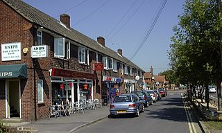
Tadley is a town and civil parish in the English county of Hampshire.

Little London is a village situated between the North Hampshire Downs and the gravel plains of the Kennet valley, 7 miles (11 km) north of Basingstoke and 15 miles (24 km) south of Reading. It is situated within Pamber civil parish and backs on to Pamber Forest, a 500-acre (2.0 km2) SSSI and remnant of the much larger ancient Royal Forest of Pamber. It is recorded as having been established for at least 400 years.

Elvetham Heath is a residential area and civil parish, containing around 2000 homes on a 311-acre (1.26 km2) site, just outside the north western boundary of the town of Fleet in the English county of Hampshire. Construction of Elvetham Heath began in the summer of 1999 and ended in June 2008. The population of the civil parish at the 2011 Census was 5,183.

Basingstoke and Deane is a local government district and borough in Hampshire, England. Its primary settlement is Basingstoke. Other settlements include Bramley, Tadley, Kingsclere, Overton, Oakley, Whitchurch and the village of Deane, some 7 miles (11 km) from Basingstoke.
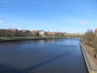
The Borough of Stockton-on-Tees is a unitary authority with borough status in the counties of County Durham and North Yorkshire, England. The borough had a population of 191,600 in 2011.

Silchester is a village and civil parish about 5 miles (8 km) north of Basingstoke in Hampshire. It is adjacent to the county boundary with Berkshire and about 9 miles (14 km) south-west of Reading.

Turgis Green is a small hamlet in the English county of Hampshire. It is split between the civil parishes of Hartley Wespall and Stratfield Turgis. It contains six Grade II listed buildings and a Grade II listed milestone.
Halstead is a village and civil parish in the Sevenoaks District of Kent, England. It is located 4.7 miles south east of Orpington & 6.1 miles north west of Sevenoaks, adjacent to the Kent border with Greater London. The population of the civil parish at the 2011 census was 1,607.

Basingstoke is a constituency in Hampshire represented in the House of Commons of the UK Parliament since 2005 by Maria Miller, a member of the Conservative Party who served as Culture Secretary and Minister for Women and Equalities from 2012 to 2014 under Prime Minister David Cameron.

North East Hampshire is a constituency represented in the House of Commons of the UK Parliament by Ranil Jayawardena, a Conservative who has served as Environment Secretary since 2022.

Stratfield Turgis is a small village and civil parish in the north-east of the English county of Hampshire.
St Helen Without is a civil parish in the Vale of White Horse district in the English county of Oxfordshire. In 1974 it was transferred from Berkshire. It is immediately west of Abingdon and includes the villages of Dry Sandford and Shippon. A large part of the parish is occupied by Dalton Barracks and its associated airfield. According to the 2001 census the parish had a population of 2,623. The parish was created by the Local Government Act 1894, by the division of the parish of Abingdon St. Helen. The part inside Abingdon Municipal Borough became part of Abingdon parish, whilst that part outside became St. Helen Without. It became part of the Abingdon Rural District of Berkshire in 1894, and then part of the Vale of White Horse in Oxfordshire under the Local Government Act 1972.
Sherborne St John is a village and civil parish near Basingstoke in the English county of Hampshire.

Wield is a civil parish in Hampshire, England, within the district of East Hampshire. It includes two neighbouring villages, Upper Wield and Lower Wield. At the 2011 Census the population was 254.
Herriard is a village and civil parish in the Basingstoke and Deane district of Hampshire, England. Its nearest town is Basingstoke, which lies 4+1⁄2 miles (7.2 km) north. The village is situated mainly on the A339 road between Alton, and Basingstoke. At the 2001 census, it had a population of 247, increasing marginally to 251 at the 2011 Census. It was formerly served by the now-disused Herriard railway station on the Basingstoke and Alton Light Railway.

Pamber End is a hamlet in north Hampshire, England. Located south of Tadley..
Pamber Green is a hamlet in north Hampshire, England.

Pamber Heath is a village in north Hampshire, England. Situated within the civil parish of Pamber, the village lies at the north end of Pamber Forest.
Nutley is a small village and civil parish in the Basingstoke and Deane district of Hampshire, England. It is located approximately 5.6 miles (9.0 km) south-west from Basingstoke, just off the B3046 road. The parish has an acreage of 1,524 acres (617 ha) with 74 acres (30 ha) made up of permanent grass and 386 acres (156 ha) of woodland.
Litchfield and Woodcott is a civil parish in the English county of Hampshire.
References
- ↑ "Civil Parish population 2011". Neighbourhood Statistics. Office for National Statistics. Retrieved 2 January 2017.
