Ashmansworth

Last updated

Ashmansworth
St James Church Ashmansworth.jpg
St James Church
Hampshire UK location map.svg
Red pog.svg
Ashmansworth
Location within Hampshire
Population216 (2011 Census) [1]
OS grid reference SU4157
Civil parish
  • Ashmansworth
District
Shire county
Region
Country England
Sovereign state United Kingdom
Post town NEWBURY
Postcode district RG20
Dialling code 01635
Police Hampshire and Isle of Wight
Fire Hampshire and Isle of Wight
Ambulance South Central
UK Parliament
List of places
UK
England
Hampshire
51°18′58″N1°24′11″W / 51.316°N 1.403°W / 51.316; -1.403
The Plough (former public house), photographed in 2005 The Plough, Ashmansworth.jpg
The Plough (former public house), photographed in 2005

Ashmansworth is a village and civil parish in the Basingstoke and Deane district of the English county of Hampshire. [2] [3]

Contents

Geography

The village is about 7.5 miles (12.1 km) south west of Newbury in Berkshire, and 9 miles (14 km) north east from Andover in Hampshire, just south west of the top of a ridge line running south. The ridge overlooks Highclere Castle and Newbury, with views over large areas of Berkshire and North Hampshire. With heights between 235 and 240 metres above sea-level, Ashmansworth is the highest village in Hampshire and a spot height of 242 metres (794 ft) is at the top of the ridge on the north east side of the village makes it one of the highest points in Hampshire. [4] It lies within the North Wessex Downs Area of Outstanding Natural Beauty (AONB), and the area is popular with walkers, cyclists and horse riders.

The village is at the junction of five minor roads about 1 km west of the A343 between Newbury and Andover. Access has not always been as good as today.

The hamlet of Crux Easton lies around 1 mile south east from Ashmansworth.

History

St James' Church

St James' Church, Ashmansworth, is believed to have been built around the middle of the 12th century, to which date the nave belongs. The chancel dates from the end of the same century. Windows have been inserted at various dates and the east wall was rebuilt in 1745. [5] Wall paintings, mainly discovered in the 1800s and early 1900s, depict the life of Jesus, and probably date from the 1200s to the 1600s. [6] The village church is dedicated to Saint James the Great. It is now a Grade I listed building. [7]

Origins of Ashmansworth

Excavations in Church Farm indicate part of the hamlet was occupied in the Iron Age. The hamlet is also located in close proximity to the Oxdrove prehistoric route. [8]

Some Roman pottery fragments have also been discovered in Ashmansworth. [8]

Ashmansworth was granted as part of Whitchurch to the church of Winchester, some time in the 10th Century. The first reference to Ashmansworth is in a charter dated 909, in which Edward the Elder returned the hamlet to the community. [9] In 934, King Æthelstan (referring to the hamlet as ‘Aescmaeres’) directed that some of the land was to be put under the management of the bishop. It remained in possession of the bishopric until 1649. [10]

Obadiah Sedgwick (and, from 1654, his son, Obadiah) was the lord of the manor from 1649 to the late 1600s, when it returned to the bishop. The manor was sold in 1802 to the Earl of Carnarvon. [10] [8]

19th Century

In 1811 a fire destroyed major parts of the village, along with parish records. [8]

The population of Ashmansworth remained low during the 19th century. This was not helped by the restricted access to the land. A Black's Guide, published in 1871, described the village as being “among the least trodden districts and most secluded angles of the country, noteworthy only for its early English church”. [8]

An independent Parish Council for Ashmansworth was founded in 1894. One of the first issues it addressed was the water supply. Throughout its history Ashmansworth experienced difficulties in maintaining an adequate supply of drinking water. Before the installation of piped water in the late 1930s, the only sources of drinking water for many villagers were Mere Pool and the 100 metres deep well at Church Farm. [8]

20th Century

In 1901 a spokesman for the Archaeological Society described Ashmansworth as “a long scattered village, neglected and deserted in its aspect, with a rapidly decreasing population”. At this time the church had fallen into disrepair, probably as a result of it being subordinate to the East Woodhay parish. [8]

Over the course of the 20th century the character of Ashmansworth changed rapidly, largely as a result of the intensive farming practices adopted after the Second World War.

The modern village has a central core, concentrated around the main thoroughfare where the Village Hall, built in 1952, [8] village green, war memorial, former Plough Inn, former chapel and old school house are all located.

There are many key buildings in the village including eight listed buildings, some dating from the 18th century such as Plough Cottage and Pheasant Cottage.

Demography

According to the 2001 census, it had a population of 215. [11] According to the 2011 census, it had a population of 216. [12]

Amenities

The village was served for many years by the local public house, The Plough, which ceased trading in 2008. [13]

Notable residents

Related Research Articles

<span class="mw-page-title-main">Basingstoke</span> Town in England

Basingstoke is a town in Hampshire, situated in south-central England across a valley at the source of the River Loddon on the western edge of the North Downs. It is the largest settlement in Hampshire without city status. It is located 30 miles (48 km) north-east of Southampton, 48 miles (77 km) south-west of London, 27 miles (43 km) west of Guildford, 22 miles (35 km) south of Reading and 20 miles (32 km) north-east of the county town and former capital Winchester. According to the 2016 population estimate, the town had a population of 113,776. It is part of the borough of Basingstoke and Deane and part of the parliamentary constituency of Basingstoke.

<span class="mw-page-title-main">Basingstoke and Deane</span> Borough and non-metropolitan district in England

Basingstoke and Deane is a local government district with borough status in Hampshire, England. The main town is Basingstoke, where the council is based. The district also includes the towns of Tadley and Whitchurch, along with numerous villages and surrounding rural areas. The modern district was created in 1974, initially being called Basingstoke. It changed its name to "Basingstoke and Deane" in 1978 at the same time that it was made a borough; Deane was added to the name to represent the rural parts of the borough, being the area's smallest village.

<span class="mw-page-title-main">St Mary Bourne</span> Human settlement in England

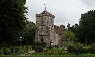
St Mary Bourne is a village and civil parish in the Basingstoke and Deane district of Hampshire, England. It lies on the valley of the Bourne Rivulet, a tributary of the River Test, 5 miles (8.0 km) northeast of Andover.

<span class="mw-page-title-main">Bramley, Hampshire</span> Village in Hampshire, England

Bramley is a village and parish in Hampshire, England. In the 2001 census it had a population of 3,348. It has a village shop, bakery, estate agency, pub – The Bramley Inn – and a railway station. Also, Bramley Camp houses an Army facility where military training and manoeuvres take place.

<span class="mw-page-title-main">Hannington, Hampshire</span> Human settlement in England

Hannington is a civil parish in the English county of Hampshire. It is situated between Basingstoke and Newbury, on the North Hampshire Downs in the North Wessex Downs Area of Outstanding Natural Beauty. In the 2001 census it had a population of 332 people, increasing to 493 at the 2011 Census.

<span class="mw-page-title-main">Steventon, Hampshire</span> Human settlement in England

Steventon is a village and a civil parish with a population of about 250 in north Hampshire, England. Situated 7 miles south-west of the town of Basingstoke, between the villages of Overton, Oakley and North Waltham, it is close to Junction 7 of the M3 motorway.

<span class="mw-page-title-main">North Waltham</span> Human settlement in England

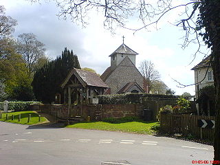
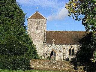
North Waltham is a village and civil parish in the borough of Basingstoke and Deane in Hampshire, England. It is located around 6 miles (9.7 km) southwest of Basingstoke and just north of the M3 motorway. In the 2011 Census it had a population of 870. The village is home to a pond, shop, Victorian primary school, a recreation ground and two pubs: The Fox, and The Wheatsheaf. The Church of England Parish Church is dedicated to St Michael.

<span class="mw-page-title-main">Dummer, Hampshire</span> Human settlement in England

Dummer is a parish and village in Hampshire, England. It is 6 miles south-west of Basingstoke and near Junction 7 on the M3 motorway.

<span class="mw-page-title-main">Litchfield, Hampshire</span> Human settlement in England

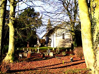
Litchfield is a village and former civil parish, now in the parish of Litchfield and Woodcott, in the Basingstoke and Deane district of Hampshire, England. It is closely bypassed by the A34 trunk road between Newbury and Whitchurch, which follows the course of the former Didcot, Newbury and Southampton Railway. Litchfield railway station, which closed in 1960, was on this line. The station is a private house, not owned by C.A.H Wills who owns Litchfield farms estate and lives in the village. The station was sold by Hampshire County Council in 1978 and has been restored. The approach road is now a private drive to the property. In 1976 the Litchfield - Whitchurch bypass was opened and made use of the DN&SR trackbed south of Litchfield towards Whitchurch for a distance of one mile. In 1931 the parish had a population of 88.

<span class="mw-page-title-main">Herriard</span> Human settlement in England

Herriard is a village and civil parish in the Basingstoke and Deane district of Hampshire, England. Its nearest town is Basingstoke, which lies 4+12 miles (7.2 km) north. The village is situated mainly on the A339 road between Alton, and Basingstoke. At the 2001 census, it had a population of 247, increasing marginally to 251 at the 2011 Census. It was formerly served by the now-disused Herriard railway station on the Basingstoke and Alton Light Railway.
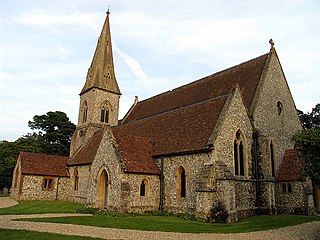
<span class="mw-page-title-main">Inhurst</span> Human settlement in England

Inhurst is a hamlet in Hampshire, England. It is in the civil parish of Baughurst.

Monk Sherborne is a village in north Hampshire, England.

Plastow Green is a hamlet in north Hampshire, England.

Aldern Bridge is a hamlet in Hampshire, United Kingdom. The settlement is within the civil parish of Burghclere, and is located approximately 2.3 miles (3.7 km) south-east of Newbury.

<span class="mw-page-title-main">Ashley Warren</span> Village in Hampshire, England

Ashley Warren is a hamlet in the Basingstoke and Deane district of Hampshire, England. The settlement is within the civil parish of Ecchinswell, Sydmonton and Bishops Green, and is located approximately 7.3 miles (11.7 km) south of Newbury.

<span class="mw-page-title-main">Woolton Hill</span> Village in Hampshire, England

Woolton Hill is a village in Hampshire, England, in the civil parish of East Woodhay. The village lies approximately 4 miles (6 km) south-west of the centre of Newbury and encompasses the hamlet of Broad Layings on its northern edge.

<span class="mw-page-title-main">Southrope</span> Human settlement in England

Southrope is a hamlet in the civil parish of Herriard, Hampshire. It has one pub, named the Fur and Feathers. The hamlet was once considered a part of the civil parish Bentworth, until the late 19th century. Its nearest town is Alton, which lies approximately 5.8 miles (9.3 km) south-east from the hamlet. The hamlet's toponym derives from Old English Sūþrop, meaning south village.

<span class="mw-page-title-main">Wootton St Lawrence</span> Human settlement in England

Wootton St Lawrence is a small village in the civil parish of Wootton St Lawrence with Ramsdell, in Hampshire, England, 2.5 miles (4.0 km) west of Basingstoke. The name is derived from the Old English wudu tun meaning woodland settlement or farm.

Lower Wyke is a hamlet in the Basingstoke and Deane district of Hampshire, England. It is in the civil parish of St. Mary Bourne. Its nearest town is Andover, which lies approximately 3.6 miles (5.8 km) south-east from the village.

Stoke is a small village in northwest Hampshire. At the 2011 Census the population of the village was included in the civil parish of St Mary Bourne. It lies in the valley of the Bourne Rivulet, a tributary of the River Test 5 miles (8.0 km) northeast of the town of Andover.

References

  1. "Civil Parish population 2011". Neighbourhood Statistics. Office for National Statistics. Retrieved 8 December 2016.
  2. Ordnance Survey: Landranger map sheet 174 Newbury & Wantage (Hungerford & Didcot) (Map). Ordnance Survey. 2014. ISBN   9780319228739.
  3. "Ordnance Survey: 1:50,000 Scale Gazetteer" (csv (download)). www.ordnancesurvey.co.uk. Ordnance Survey. 1 January 2016. Retrieved 30 January 2016.
  4. Basingstoke and Deane Borough Council. "Conservation Area Appraisal Ashmansworth" (PDF). Archived from the original (PDF) on 31 May 2012. Retrieved 13 December 2011.
  5. "St James - A Church near you" . Retrieved 22 December 2019.
  6. "St James Ashmansworth History" (PDF). Retrieved 22 December 2019.
  7. "Ashmansworth Parish Council" . Retrieved 22 December 2019.
  8. 1 2 3 4 5 6 7 8 "Ashmansworth information" (PDF). Retrieved 22 December 2019.
  9. Robertson, A. J. (17 December 2009). Anglosaxon Charters, page 305. Cambridge University Press. ISBN   9780521178327 . Retrieved 22 December 2019.
  10. 1 2 "British History- Ashmansworth" . Retrieved 22 December 2019.
  11. Basingstoke and Deane Borough Council. "New homes for your area? Community fact pack for the north west of the borough" (PDF). Archived from the original (PDF) on 31 May 2012. Retrieved 13 December 2011.
  12. "Civil Parish population 2011". Neighbourhood Statistics. Office for National Statistics. Retrieved 8 December 2016.
  13. Jane Meredith (9 October 2008). "Ashmansworth loses its only pub". Newbury Weekly News . Archived from the original on 21 April 2013. Retrieved 4 June 2012.