Tadley is a town and civil parish in the English county of Hampshire.

Little London is a village situated between the North Hampshire Downs and the gravel plains of the Kennet valley, 7 miles (11 km) north of Basingstoke and 15 miles (24 km) south of Reading. It is situated within Pamber civil parish and backs on to Pamber Forest, a 500-acre (2.0 km2) SSSI and remnant of the much larger ancient Royal Forest of Pamber. It is recorded as having been established for at least 400 years.

Basingstoke and Deane is a local government district with borough status in Hampshire, England. The main town is Basingstoke, where the council is based. The district also includes the towns of Tadley and Whitchurch, along with numerous villages and surrounding rural areas. The modern district was created in 1974, initially being called Basingstoke. It changed its name to "Basingstoke and Deane" in 1978 at the same time that it was made a borough; Deane was added to the name to represent the rural parts of the borough, being the area's smallest village.

Bramley is a village and parish in Hampshire, England. In the 2001 census it had a population of 3,348. It has a village shop, bakery, estate agency, pub – The Bramley Inn – and a railway station. Also, Bramley Camp houses an Army facility where military training and manoeuvres take place.

North Waltham is a village and civil parish in the borough of Basingstoke and Deane in Hampshire, England. It is located around 6 miles (9.7 km) southwest of Basingstoke and just north of the M3 motorway. In the 2011 Census it had a population of 870. The village is home to a pond, shop, Victorian primary school, a recreation ground and two pubs: The Fox, and The Wheatsheaf. The Church of England Parish Church is dedicated to St Michael.

Deane is a village and civil parish in the county of Hampshire, England. Its name appears in the name of the borough in which it is placed, Basingstoke and Deane.
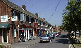
Heath End is a small village between Tadley and Baughurst in Hampshire, England.
Bramley Green is a small village in the civil parish of Bramley in the Basingstoke and Deane district of Hampshire, England. It lies approximately 4 miles (6.4 km) south-east from the village of Bramley.

Andwell is a village and former civil parish, now in the parish of Mapledurwell and Up Nately, in the Basingstoke and Deane district of Hampshire, England. Its former range was divided by the M3 motorway; it is also bounded to the north by the A30 road. Winchester College has owned land in the village since the 1390s. In 1931 the parish had a population of 20.
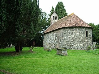
Ewhurst is a village in Hampshire, England, and 6.2 miles (10.0 km) northwest of Basingstoke. Its parish church dates from 1682. The village itself is much older, being referenced as "Ywyrstæ stigel" in 1023, appearing in the Domesday Book as "Werste", and later as "Ywhurst" in 1242.

Ashford Hill is a village in Basingstoke and Deane, Hampshire, England.
Adbury is a village in Hampshire, United Kingdom. The settlement is within the civil parish of Burghclere, and is located approximately 2.5 miles (4.0 km) south-east of Newbury.

Ashe Warren is a village in the Basingstoke and Deane district of Hampshire, England. The settlement is within the civil parish of Overton, and is located approximately 6.3 miles (10.1 km) west of Basingstoke.

Mapledurwell is a village and former civil parish, now in the parish of Mapledurwell and Up Nately, in the Basingstoke and Deane district, in the county of Hampshire, England. It is located south east of Basingstoke. In 1931 the parish had a population of 182.
Lower Woodcott is a small village in the Basingstoke and Deane district of Hampshire, Englannd. Its nearest town is Whitchurch, which lies approximately 4.3 miles (6.7 km) south-east from the village.
Nately Scures is a small village and former civil parish, now in the parish of Newnham, in the Basingstoke and Deane district of Hampshire, England. Its nearest large village is Hook, which lies approximately 1.7 miles (2.7 km) north-east from the village. In 1931 the parish had a population of 288.

North Oakley is a hamlet in the civil parish of Hannington in the Basingstoke and Deane district of Hampshire, England. Its nearest town is Tadley, which lies approximately 6.4 miles (10.3 km) north-east from the village.
North Sydmonton is a small village in the Basingstoke and Deane district of Hampshire, England. Its nearest town is Newbury, which lies approximately 4.3 miles (6.9 km) north-west from the village.
Nutley is a small village and civil parish in the Basingstoke and Deane district of Hampshire, England. It is located approximately 5.6 miles (9.0 km) south-west from Basingstoke, just off the B3046 road. The parish has an acreage of 1,524 acres (617 ha) with 74 acres (30 ha) made up of permanent grass and 386 acres (156 ha) of woodland.
Brock's Green is a small village in the Basingstoke and Deane district of Hampshire, England. Its nearest town is Newbury, which lies approximately 4.7 miles (7.6 km) north-west from the village.

