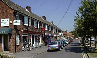
Tadley is a town and civil parish in the Basingstoke and Deane district of Hampshire, England, 5.5 miles (8.9 km) north of Basingstoke and 11 miles (17 km) south west of Reading.
The Kennet is a tributary of the River Thames in Southern England. Most of the river is straddled by the North Wessex Downs AONB. The lower reaches have been made navigable as the Kennet Navigation, which – together with the Avon Navigation, the Kennet and Avon Canal and the Thames – links the cities of Bristol and London.

Salisbury Plain is a chalk plateau in southern England covering 300 square miles (780 km2). It is part of a system of chalk downlands throughout eastern and southern England formed by the rocks of the Chalk Group and largely lies within the county of Wiltshire, but stretches into Hampshire.

Aldermaston is a village and civil parish in Berkshire, England. In the 2011 census, the parish had a population of 1,015. The village is in the Kennet Valley and bounds Hampshire to the south. It is approximately 8 miles (13 km) from Newbury, Basingstoke, and Reading and is 46 miles (74 km) from London.

Theale is a village and civil parish in West Berkshire, England. It is 5 miles (8 km) southwest of Reading and 10 miles (16 km) east of Thatcham. The compact parish is bounded to the south and south-east by the Kennet & Avon Canal, to the north by a golf course, to the east by the M4 motorway and to the west by the A340 road.

Silchester is a village and civil parish about 5 miles (8 km) north of Basingstoke in Hampshire. It is adjacent to the county boundary with Berkshire and about 9 miles (14 km) south-west of Reading.

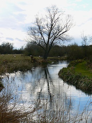
Foudry Brook is a small stream in southern England. It rises from a number of springs near the Hampshire village of Baughurst, and flows to the east and then the north, to join the River Kennet to the south of Reading. The upper section is called Silchester Brook, and beyond that, Bishop's Wood Stream. The underlying geology is chalk, covered by a layer of clay, and so it has the characteristics of a clay stream, experiencing rapid increases in level after heavy rain due to run-off from the surrounding land. It passes a number of listed buildings and scheduled monuments, including the site of the Roman town of Calleva Atrebatum or Silchester.

Beech Hill is a small village and civil parish in Berkshire, England. It is in the south east of the West Berkshire unitary authority area and bounds Hampshire and Wokingham district.

Boxford is a village and civil parish in the unitary authority of West Berkshire, England. The village is on the east bank of the River Lambourn, about 4 miles (6.4 km) northwest of Newbury but south of the M4 motorway. The hamlet of Westbrook is on the opposite bank of the Berkshire Downs tributary.

Padworth is a dispersed settlement and civil parish in the English county of Berkshire, with the nearest town being Tadley. Padworth is in the unitary authority of West Berkshire, and its main settlement is at Aldermaston Wharf or Lower Padworth, where there is Aldermaston railway station. It has its southern boundary with Mortimer West End, Hampshire. The south of the parish is wooded towards its edges and the north of the parish is agricultural with a hotel beside the Kennet and Avon Canal. In the centre of the parish is a school, Padworth College, which is Georgian and a later incarnation of its manor house.
Baughurst is a village and civil parish in Hampshire, England. It is located west of the town of Tadley, 6 miles (9.7 km) north of Basingstoke. In the 2001 census, it had a population of 2,473.

A.F.C. Aldermaston is a football club based in Aldermaston, Berkshire, England. Affiliated to the Berks & Bucks Football Association, the club are currently members of the Wessex League Division One and play at Waterside Park in Thatcham.
Brimpton Common is a hamlet in Berkshire, England. It is part of Brimpton Parish, and part of the Benefice of Aldermaston and Woolhampton in the Diocese of Oxford. It is in the Aldermaston Ward of West Berkshire Council.

Pilosella caespitosa is like several other Pilosella species and has a similar appearance to many of the hawkweeds.

Mortimer West End is a village and civil parish in north Hampshire in England. It lies in the northernmost point of the county.
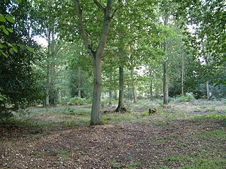
Pamber Forest and Silchester Common is a 341.7-hectare (844-acre) biological Site of Special Scientific Interest in Tadley in Hampshire. Pamber Forest and Upper Inhams Copse is managed by the Hampshire and Isle of Wight Wildlife Trust. Upper Inhams Copse was purchased by the Trust in 2001 and added to Pamber Forest.

West End Brook is a small stream in southern England. It rises near the Hampshire village of Tadley. Its name is probably related to the parish, and village, it passes through for some of its course: Mortimer West End.

Decoy Pit, Pools and Woods is a 17.7-hectare (44-acre) biological Site of Special Scientific Interest south of Aldermaston in Berkshire. An area of 8 hectares is a nature reserve called Decoy Heath, which is managed by the Berkshire, Buckinghamshire and Oxfordshire Wildlife Trust.

The Thames Basin Heaths are a natural region in southern England in Berkshire, Hampshire and Surrey, a slightly mottled east-west belt of ecologically recognised and protected land.

