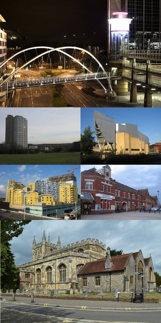
Winslade | |
---|---|
![]() Modern houses in Hackwood Lane | |
Location within Hampshire | |
Population | 224 (Tunworth, Weston Corbett, Weston Patrick and Winslade 2011 Census) |
OS grid reference | SU654481 |
Civil parish |
|
District | |
Shire county | |
Region | |
Country | England |
Sovereign state | United Kingdom |
Post town | Basingstoke |
Postcode district | RG25 |
Dialling code | 01256 |
Police | Hampshire |
Fire | Hampshire |
Ambulance | South Central |
UK Parliament | |
Winslade is a hamlet and civil parish in the Basingstoke and Deane district of Hampshire, England. It lies 3 miles (4.8 km) south of Basingstoke, just off the A339 road. The hamlet covers an area of 712 acres (288 ha) and has an average elevation of 550 feet (170 m). Its nearest railway station is Basingstoke, 4.2 miles (6.8 km) north of the hamlet. The parish of Winslade contains the vast Hackwood Park, an 89-acre (36 ha) Grade I listed Royal deer park. According to the 2011 census, Winslade, along with Tunworth, Weston Corbett and Weston Patrick, had a population of 224.
The manor of Winslade was held by Hugh de Port and his descendants from 1086 until 1555, after which it was bought by William, Marquis of Winchester. Hackwood Park was acquired by William Paulet, 1st Marquess of Winchester in the 16th century, and was used as a deer hunting park until the 20th century. Winslade contains 42 Grade II listed buildings, including Hackwood House, a Grade II* listed building. Its church, dedicated to St Mary, dates from 1816 and was Grade II listed on 26 April 1957.
The hamlet's name has been spelled in various ways, including Winesflot (11th century), Wineslode (13th century), Wynesflode (14th century), and Wyndslade (16th century). [1] The parish of Winslade formerly included the village of Kempshott, which covered an area of 555 acres (225 ha), but was merged with Winslade in 1393. It formed a part of Winslade until 1876, when it was ceded to Dummer's parish under the Divided Parishes Act. [1] Hackwood Park was acquired by William Paulet, 1st Marquess of Winchester in the 16th century and was used as a Royal deer park until the early 20th century. [2]
The earliest mention of the manor of Winslade was made in 1086, when it was held by landowner Hugh de Port. In 1275, Winslade was owned by John de St John for "half a knight's fee" by Alan de Hagheman, who purchased the manor a year later. [1] In 1316, the manor was passed to John de Knolle, who then granted it to John de Tichborne after his death in 1331. The manor had continued in his ownership by his descendants until 1555 when the manor was sold by William, Marquis of Winchester. William died in the same year he sold it, and consequently the land was passed onto his son Francis of Bolton, [3] who was fined four shillings (equivalent to £26,700 in 2017) as lord of both Winslade and Kempshott for not attending the court of Basingstoke Hundred in 1560. [4] It was sold to his overlord, John Marquess of Winchester, two years later, and his descendants continued to hold it until at least 1908. [1] According to the 1901 census, Winslade had a population of 59. [5]
Winslade is located in the northern central part of Hampshire, in South East England, 3 miles (4.8 km) south of Basingstoke, its nearest town. [6] The hamlet falls under the North East Hampshire parliament constituency, represented in the House of Commons by Conservative MP Ranil Jayawardena. [7] The nearest schools to Winslade are those situated in Basingstoke, including St John's Church of English Primary School, [8] Brighton Hill Community School, [9] and Basingstoke College of Technology. [10] The parish covers an area of 712 acres (288 ha), and has an average elevation of approximately 550 feet (170 m) above sea level. [1] The landscape is dominated by woodland and plantations, [6] with the soil being mostly clay, the subsoil of chalk, and the most prominent crops being wheat, barley, oats and turnips. [1] The parish contains Hackwood Park, an 89-acre (36 ha) Grade I listed Royal deer hunting park, which lies to the north. [1]
According to the 2011 census, the parishes of Winslade, Tunworth, Weston Corbett and Weston Patrick collectively had a population of 224 people, of which 34.6% were in full-time employment, lower than the national average of 37.70%. There are 95 households in the four parishes with an average size of 2.36 people. [11]
Due to its location in south central England and its proximity to the sea, the average maximum temperature in January is 7.2 °C (45 °F) with the average minimum being 1.6 °C (35 °F). The average maximum temperature in July is 21.9 °C (71 °F), with the average minimum being 12.5 °C (55 °F). The hamlet gets around 755 millimetres (29.7 in) of rain a year, with a minimum of 1 mm (0.04 in) of rain reported on 103 days a year. [12]
Climate data for Odiham weather station (nearest to Winslade), Odiham, elevation: 9 metres (30 feet) (1981–2010) | |||||||||||||
---|---|---|---|---|---|---|---|---|---|---|---|---|---|
Month | Jan | Feb | Mar | Apr | May | Jun | Jul | Aug | Sep | Oct | Nov | Dec | Year |
Average high °C (°F) | 7.2 (45.0) | 7.4 (45.3) | 10.3 (50.5) | 13.0 (55.4) | 16.6 (61.9) | 19.5 (67.1) | 21.9 (71.4) | 21.6 (70.9) | 18.5 (65.3) | 14.4 (57.9) | 10.3 (50.5) | 7.4 (45.3) | 14.1 (57.4) |
Average low °C (°F) | 1.6 (34.9) | 1.3 (34.3) | 3.0 (37.4) | 4.4 (39.9) | 7.5 (45.5) | 10.4 (50.7) | 12.5 (54.5) | 12.4 (54.3) | 10.2 (50.4) | 7.4 (45.3) | 4.2 (39.6) | 1.8 (35.2) | 6.4 (43.5) |
Average precipitation mm (inches) | 77.8 (3.06) | 56.0 (2.20) | 54.8 (2.16) | 52.6 (2.07) | 52.2 (2.06) | 48.5 (1.91) | 50.2 (1.98) | 52.1 (2.05) | 61.8 (2.43) | 87.2 (3.43) | 83.9 (3.30) | 78.5 (3.09) | 755.5 (29.74) |
Average precipitation days | 12.2 | 9.8 | 10.5 | 9.5 | 9.5 | 8.6 | 8.4 | 8.6 | 8.9 | 11.7 | 11.7 | 11.5 | 120.9 |
Source: Met Office [12] |
The parish of Winslade contains a total of 42 listed buildings—the majority of which are located in Hackwood Park—including three Grade II* listed. [13] Hackwood House is an imposing mansion of symmetrical design, with the original structure dating from 1680. The exterior has four Neo-classical columns, which are situated in front of pilasters raised from the main wall surface. The central doorway is housed in an oval recess and also contains two columns and pilasters at the side. The interior of Hackwood House contains panelling and a large fireplace of late 17th century style, with a carved ornamental festoon brought from Abbotstone House in Wiltshire. [14]
Other listed buildings in Hackwood Park are the fishing temple, a once-domed building with eight columns and an incomplete circular stone base, [15] a 19th-century teahouse pavilion, [16] a single story mid-18th century orangey, [17] a statue of George I which dates from 1722, [18] and a late 19th-century mill house. [19] Grade II* listed buildings include an early 19th-century stable block and riding school, [20] and a menagerie pond pavilion, which dates from 1727 and was given as a gift by James Gibbs to the third Duke of Bolton. [21]
The church of St Mary is a plain rectangular plan with a yellow brick tower and slate roofing. Although the site is old, the present church dates from 1816 and was Grade II listed on 26 April 1957. The church is described as a "rather unattractive building" with plastered walls, weathered stone bands and slender openings. [1] [22] Another place of worship was the Winslade Congregational Chapel, which is situated near a footpath leading to the villages of Herriard and Ellisfield. The chapel was opened in October 1888 by the fifth Earl of Portsmouth and Thomas Maton Kingdon, an ironmonger from Basingstoke. The deacons of London Street in Basingstoke decided to close it in 1930 and was eventually sold to the Portsmouth Estate five years later for £35 (equivalent to £2,448in 2019). [5]
Joseph Warton was an English academic and literary critic.
Hartley Wintney is a large village and civil parish in the Hart district of Hampshire, England. It lies about 3 miles (5 km) northwest of Fleet and 8 miles (13 km) east of Basingstoke. The parish includes the smaller contiguous village of Phoenix Green as well as the hamlets of Dipley, Elvetham, Hartfordbridge, and West Green.
Hursley is a village and civil parish in Hampshire, England with a population of around 900 in 2011. It is located roughly midway between Romsey and Winchester on the A3090. Besides the village the parish includes the hamlets of Standon and Pitt and the outlying settlement at Farley Chamberlayne.
Bransbury is a hamlet in Hampshire, England, part of the parish of Barton Stacey. The nearest village is Barton Stacey, halfway between Winchester and Andover; there is a junction for Bransbury on the A303 towards Exeter. Bransbury has twenty-two dwellings: a collection of agricultural workers’ cottages with gardens of generous proportions, Bransbury Manor, which dates from the 18th century, and Bransbury Mill, a Grade II listed building. The Crook and Shears Inn public house was converted into a dwelling in the late 20th century. The hamlet straddles the River Dever.
Kingsclere is a large village and civil parish in Hampshire, England.
Ashmansworth is a village and civil parish in the Basingstoke and Deane district of the English county of Hampshire.
Bentworth is an historic village and large civil parish in the East Hampshire district of Hampshire, England. The nearest town is Alton, which lies about 3 miles (5 km) east of the village. The parish covers an area of 3,763 acres (15.23 km2) and at its highest point is King's Hill, 716 feet (218 m) above sea level. According to the 2011 census, Bentworth had a population of 553. It lies on the edge of the East Hampshire Hangers.
Binsted is a village and large civil parish in East Hampshire, England. It's about 4.1 miles (6.6 km) east of Alton, its nearest town. The parish is one of the largest in northern Hampshire and covers almost 7,000 acres (2,800 ha). It contains two villages, Bucks Horn Oak and Holt Pound, as well as two hamlets, Wyck and Wheatley. The parish also covers the entirety of the Alice Holt Forest, a royal forest situated near the border with Surrey. The nearest railway station is 1.8 miles (2.9 km) northeast of the village, at Bentley. According to the 2011 census, the parish had a population of 1,817 people.
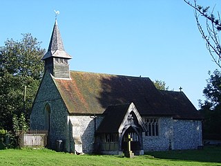
Greywell is a small village and civil parish in Hampshire, England – a past winner of the Best Kept Village in Hampshire competition and a recent winner of Best Small Village in Hampshire. It lies on the west bank of the River Whitewater, 6 miles east of Basingstoke and 1.5 miles west of Odiham. The area is popular with walkers and cyclists. Many photographers also take pictures of some of the local architecture. There are 29 Grade II listed buildings or entries in the area, and 2 Grade II* listed buildings. The nearby medieval Odiham Castle is of historical interest. At the centre of the village is the Fox and Goose public house.
Kempshott is a ward of Basingstoke on the western edge of the town, to the south of Pack Lane and north of Winchester Road. The population of the ward at the 2011 Census was 6,827.
Herriard is a village and civil parish in the Basingstoke and Deane district of Hampshire, England. Its nearest town is Basingstoke, which lies 4 1⁄2 miles (7.2 km) north. The village is situated mainly on the A339 road between Alton, and Basingstoke. At the 2001 census, it had a population of 247, increasing marginally to 251 at the 2011 Census. It was formerly served by the now-disused Herriard railway station on the Basingstoke and Alton Light Railway.
Oakhanger is a village in the East Hampshire district of Hampshire, England. Its nearest town is Bordon, which lies 1.7 miles (2.7 km) east, of the B3004 road. The village is part of the parish of Selborne, which covers an area of 7,915 acres (3,203 ha). The nearest railway station is Alton, which is 3.8 miles (6.1 km) northwest of the village, although Oakhanger formerly had its own military railway station, Oakhanger Halt railway station on the Longmoor Military Railway, until its closure.
Shalden is a village and civil parish in the East Hampshire district of Hampshire, England. It is 2.3 miles (3.7 km) northwest of Alton and 1.9 miles (3.1 km) northeast of Bentworth, just off the A339 road. The parish covers an area of 1,536 acres (622 ha) and has an average elevation of 600 feet (180 m) above sea level. The nearest railway station is Alton, 2.5 miles (4.0 km) southeast of the village. According to the 2011 census, it had a population of 435.
Medstead is a village and civil parish in the East Hampshire district of Hampshire, England. Its nearest town is Alton, which lies 4.3 miles (6.9 km) northeast of the village. According to the 2011 census, the village had a population of 2,036 people. The parish covers an area of 1,536 acres (622 ha) and has an average elevation of approximately 600 feet (180 m) above sea level. One of the county's high points at 716 feet (218 m), King's Hill, runs through Medstead and Bentworth.
Tunworth is a hamlet and civil parish in Hampshire.
Neatham is a Roman hamlet in the civil parish of Alton in the East Hampshire district of Hampshire, England. Its nearest town is Alton,(where the 2011 Census population was included) which lies 1.6 miles (2.6 km) south-west from the hamlet.
Bradley is a small village and civil parish in the Basingstoke and Deane district of Hampshire, England. Its nearest town is Alton, which lies 5.4 miles (8.7 km) southeast from the village, although Basingstoke lies 6.6 miles (10.6 km) to the north. According to the 2011 census, the village had a population of 202 people. The parish covers an area of 975 acres (395 ha), of which 149 acres (60 ha) is woodland and its highest point is 170 metres (560 ft) above sea level. It contains no hamlets.
Itchen Stoke and Ovington is an English civil parish consisting of two adjoining villages in Hampshire, England, 2 miles (3.2 km) west of Alresford town centre in the valley of the River Itchen, 5 miles (8.0 km) north-east of Winchester, and 2 miles (3.2 km) south-east of Itchen Abbas.
Hackwood Park is a large country estate that primarily consists of an early 18th-century ornamental woodland and formal lawn garden and a large detached house. It is within the boundaries of Winslade, an overwhelmingly rural parish immediately south of Basingstoke in Hampshire. In its 260-acre (110 ha) grounds contain 23 separately listed structures including a teahouse pavilion, an ornamental bridge, statue of George I of Great Britain, three dispersed stone tōrōs, five urns and two fountains, a coach house and stables. Sheep and deer are tended to on grounds behind a variously arc-shaped and straight ha-ha wall.
Little Wolford is a hamlet and civil parish in the Stratford-on-Avon district of Warwickshire, England. With the neighbouring parish of Great Wolford it is part of 'The Wolfords'. Little Wolford is significant for its Grade II* listed 15th- to 16th-century Little Wolford Manor House.
![]() | Wikimedia Commons has media related to Winslade . |