
The United Wa State Army, abbreviated as the UWSA or the UWS Army, is the military wing of the United Wa State Party (UWSP), the de facto ruling party of Wa State. It is an ethnic minority army of an estimated 20,000–25,000 Wa soldiers, led by Bao Youxiang. The UWSA was formed after the collapse of the armed wing of the Communist Party of Burma (CPB) in 1989.

Mong Hsu Township is a township of Loilen District in the Shan State of Myanmar. The principal town is Mong Hsu. Om-pu waterfall on Nam Parng River of Mong Hsu is the second largest waterfall of Shan State. The nearest commercial airport to Mong Hsu is Lashio Airport.

Mongyai Township is a township of Lashio District in the Shan State of eastern Burma. The principal town is Mongyai. Mount Loi Leng of Mongyai is the highest point in Shan State.
Tangyan Township is a township of Lashio District in the Shan State of eastern Burma. The principal town is Tangyan. Tangyan emerged as an important centre for Panthay people in the mid-20th century, especially after the destruction of Panglong during World War II.
Mu Se Township is a township of Mu Se District in the Shan State of eastern Burma. The principal town and administrative center is Muse. It is the terminus of Mandalay-Lashio-Muse road.
Hopang Township is a township of the Wa Self-Administered Division in the Shan State of Burma. The principal town is Hopang. It is one of the 6 townships of Wa Self-Administered Division. It became part of Hopang District instead of Kunlong District in 2011.

Mong Khet Township is a township of Kengtong District in the Shan State of Burma. The principal town and administrative center is Mong Khet. It has been calculated to be the center of the Valeriepieris circle.
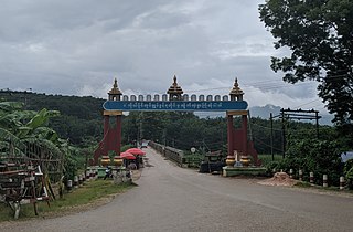
Mong Yang Township is a township of Kengtong District in the Shan State of Burma. The capital town is Mong Yang. Mong Pawk is part of it but is under UWSA control.
Kengtung District is a district of the Shan State in Myanmar. It consists of 3 towns and 1449 villages.
Kunhing (Kunhein) is located in Kunhing Township in the middle part of southern Shan state, Myanmar. The name Kunhein refers to "a thousand island" in the local Shan language.

Pangkham, known before 1999 as Pangsang, is a border town in Myanmar's far eastern Shan State. It is situated at a bend on the Hka River near the border with Yunnan Province, China, opposite of the town of Menglian. Pangkham is the main town of Pangsang Township of Matman District of Shan State.
The Wa Self-Administered Division is an autonomous self-administered division in Myanmar (Burma). Its official name was announced by decree on 20 August 2010.
Pangsang Township is a township of the Wa Self-Administered Division of Shan State, formerly and conterminously part of Matman District. Prior to 2011, it was part of Hopang District and Lashio District. Its capital town is Pangsang.
Namphan Township, also known as Na-hpan, is a township of the Wa Self-Administered Division of Shan State, formerly and conterminously part of Matman District. Prior to 2011, it was part of Hopang District and Lashio District. Its capital is Namphan.
Hopang District is a district of Shan State, Burma. It is part of the Wa Self-Administered Division. It was set up in 2011 and consists of three townships, Hopang, Mongmai and Pangwan, and two subtownships, Namtit and Panlong.
Matman Township, also known as Metman Township, is a township of the Wa Self-Administered Division of Shan State, formerly and conterminously part of Matman District. The capital of the township is Matman.
Matman District or Metman District is a district of Shan State, Burma. It is part of the Wa Self-Administered Division. It was formerly part of Hopang District. Matman District consists of three townships: Matman, Namphan and Pangsang.
Meung Yum is a Waic language spoken by about 8,000 people in Kunlong Township, Shan State, Burma.
Matman is the capital town of Matman Township, Shan State, Myanmar. It is part of the Wa Self-Administered Division.

Pang Hseng, also known as Pan Saing, Kyu Koke and Kyu-hkök, is a town in Mu Se Township, Mu Se District, northern Shan State, Myanmar.


