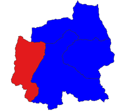
Magway Region is an administrative division in central Myanmar. It is the second largest of Myanmar's seven divisions, with an area of 44,820 km2. Pa Del Dam (ပဒဲဆည်) is one of the dams in Aunglan Township, Magway Division. The capital and second largest city of the Magway Division is Magway. The largest city is Pakokku. The major cities of Magway Division are Magway, Pakokku, Aunglan, Yenangyaung, Taungdwingyi, Chauk, Minbu, Thayet and Gangaw.

Shan State is a state of Myanmar. Shan State borders China (Yunnan) to the north, Laos to the east, and Thailand to the south, and five administrative divisions of Myanmar in the west. The largest of the 14 administrative divisions by land area, Shan State covers 155,800 km2, almost a quarter of the total area of Myanmar. The state gets its name from Burmese name for the Tai peoples: "Shan people". The Tai (Shan) constitute the majority among several ethnic groups that inhabit the area. Shanland is largely rural, with only three cities of significant size: Lashio, Kengtung, and the capital, Taunggyi. Taunggyi is 150.7 km northeast of the nation's capital Naypyitaw.

Theinni or Hsenwi is a town in northern Shan State of Burma, situated near the north bank of the Nam Tu River and now the centre of Hsenwi Township in Lashio District. It is 28 miles (45 km) north of Lashio and 2,100 feet (640 m) above sea level.
Mawkmai is a town and capital of Mawkmai Township in Loilem District, Shan State, Burma. Mawkmai is connected by road to Loimut in the west and Langkho in the north-east which connects with the National Road 45. It was the historical capital of former Mawkmai State.
Thaungdut is a village on the Chindwin River in Homalin Township in Hkamti District in the Sagaing Region of northwestern Burma. It is located next to Chaunggan.

The Karenni, also known as the Kayah or Kayah Li, are a Karen people native to the Kayah State of Myanmar (Burma).

Mong Nai Township is a township of Langkho District in the Shan State of Myanmar. The main town is Mong Nai. It is an ancient city. The primary agricultural products of the area are rice and sugar.

Nawnghkio Township is a township of Kyaukme District in the Shan State of eastern Myanmar. The principal town and administrative seat is Nawnghkio. The name 'Nawnghkio' was started to call after a camp near a green lake. The lake is located in the west of 'Haw Taw Monastery' of today's Nawnghkio.

Mong Pan Township is a township of Langkho District in the Shan State of Myanmar. The capital town is Mong Pan or Möngpan, formerly the residence of the Sawbwa.

Laukkaing Township or Laukkai Township is a township located within Laukkaing District, Shan State, Myanmar. It is the principal township of the Kokang Self-Administered Zone. The principal town is Laukkai. The township is divided into 137 villages organized into 8 village tracts and 2 towns, each with 3 urban wards. Besides Laukkai, the other town is Chinshwehaw in the southeast of the township.
Kengtung Township is a township of Kengtung District in the Shan State of Myanmar. The principal town is Kengtung. It lies almost entirely east of the Salween River and its area is over 12,000 square miles (31,000 km2). It is bounded on the north by the states of Mang Lon, Mong Lem and Keng Hung ; east by the Mekong River, south by the Siamese Shan States, and west in a general way by the Salween River, though it overlaps it in some places. The state is known to the Chinese as Mhng Khng, and was frequently called by the Burmese the 32 cities of the Gn (HkOn). The classical name of the state is Khemarata or Khemarata Tungkapuri.
Mabein is a town in northern Shan State of Myanmar, formerly Burma. It is situated on the Shweli River and connected to Momeik, and to Bhamo and Myitkyina in Kachin State by road. Mabein lies only 90 km (56 mi) from the border with Yunnan Province, China, but 200 km (124 mi) north of Mandalay.

Htigyaing Township or Tigyaing Township is a township of Katha District in eastern Sagaing Region, in northern Myanmar. It lies on the border with the Shan State of Myanmar. The administrative seat is at Htigyaing.

Langhko District, also Langkho District, is a district of the Shan State in Myanmar. It consists of 4 towns in 2010.
Hkengnang is a village in Mawkmai Township, Loilen District, in the Shan State of eastern Burma. It is a primarily agricultural village with fields surrounding it in an otherwise remote, heavily forested area. It lies north of Mak and northwest of Wān Long.
Wān Long is a village in Mawkmai Township, Loilen District, in the Shan State of eastern Burma. It is located southeast of Hkengnang, east of Mak and northwest of Daw Mawkla.
Matman Township, also known as Metman Township, is a township of the Wa Self-Administered Division of Shan State, formerly and conterminously part of Matman District. The capital of the township is Matman.

Konkyan Township or Kongyan Township is a township located within Laukkaing District, Shan State, Myanmar. It is one of two townships of the Kokang Self-Administered Zone. The principal town is Konkyan. The township is divided into 141 villages organized into 8 village tracts and 2 towns, each with 3 urban wards. Besides Konkyan, the other town is Mawhtike in the northeast of the township.

Mawkmai, also known as Maukme, was a Shan State in what is today Burma. It belonged to the Eastern Division of the Southern Shan States.

The Pa-O National Liberation Army is a Pa-O insurgent group in Myanmar (Burma). It is the armed wing of the Pa-O National Liberation Organisation.


