Papalote, Texas | |
|---|---|
 Papalote  Papalote | |
| Coordinates: 28°10′21″N97°36′07″W / 28.17250°N 97.60194°W | |
| Country | United States |
| State | Texas |
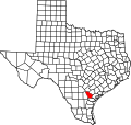
| County | Bee |
| Elevation | 89 ft (27 m) |
| Time zone | UTC-6 (Central (CST)) |
| • Summer (DST) | UTC-5 (CDT) |
| Area code | 361 |
| GNIS feature ID | 1378831 [1] |
Papalote is an unincorporated community in Bee County, in the U.S. state of Texas. [1] According to the Handbook of Texas, the community had a population of 70 in 2000. It is located within the Beeville micropolitan area.