Champigny-sur-Marne is a commune in the southeastern suburbs of Paris, France. It is located 12.5 km (7.8 mi) from the centre of Paris.

The arrondissement of Vitry-le-François is an arrondissement of France in the Marne department in the Grand Est region. It has 110 communes. Its population is 46,024 (2016), and its area is 1,402.0 km2 (541.3 sq mi).

The arrondissement of Château-Thierry is an arrondissement of France in the Aisne department in the Hauts-de-France region. It has 108 communes. Its population is 69,836 (2016), and its area is 1,115.2 km2 (430.6 sq mi).

Champs-sur-Marne is a commune in the eastern suburbs of Paris, France. It is located 18.2 km (11.3 mi) from the center of Paris, in the Seine-et-Marne Departments of France in the Île-de-France region.

Le Mée-sur-Seine is a commune in the Seine-et-Marne department in the Île-de-France region in north-central France, next to Melun. It is located in the south-eastern suburbs of Paris 41.1 km (25.5 mi) from the center.

The Saulx is a 115 km long river in France, right tributary of the Marne. Its source is near the village Germisay. It flows generally northwest, through the following départements and towns:

The Ornain is a 116 km long river in northeastern France, right tributary of the Saulx. It is formed near the village Gondrecourt-le-Château by the confluence of the small rivers Ognon and Maldite. It flows generally northwest. Its course crosses the following départements and towns:
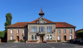
Pargny-la-Dhuys is a commune in the Aisne department in Hauts-de-France in northern France.

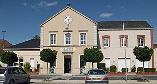
Paroy-sur-Saulx is a commune in the Haute-Marne department in north-eastern France. It is located about 35 km south east of Saint-Dizier.

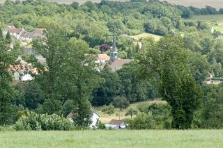
Bignicourt-sur-Saulx is a commune of the Marne department in northeastern France.

Pargny-lès-Reims is a commune in the Marne department in north-eastern France.
Sept-Saulx is a commune in the Marne department in north-eastern France.
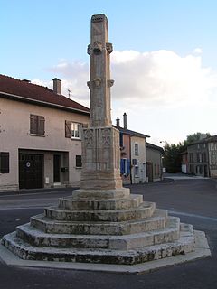
Vitry-en-Perthois is a commune in the Marne department in north-eastern France.

Beurey-sur-Saulx is a commune in the Meuse department in the Grand Est region in northeastern France.

Couvonges is a commune in the Meuse department in Grand Est in north-eastern France.

Mognéville is a commune in the Meuse department in Grand Est in north-eastern France.
The canton of Essômes-sur-Marne is an administrative division of the Aisne department, in northern France. It was created at the French canton reorganisation which came into effect in March 2015. Its seat is in Essômes-sur-Marne.
The canton of Sermaize-les-Bains is an administrative division of the Marne department, northeastern France. It was created at the French canton reorganisation which came into effect in March 2015. Its seat is in Sermaize-les-Bains.

The Communauté urbaine du Grand Reims is the communauté urbaine, an intercommunal structure, centred on the city of Reims. It is located in the Marne department, in the Grand Est region, northeastern France. It was created on 1 January 2017 by the merger of the previous communauté d'agglomération Reims Métropole with the communautés de communes Beine-Bourgogne, Champagne Vesle, Nord Champenois, Fismes Ardre et Vesle, Vallée de la Suippe, Rives de la Suippe, Vesle et Coteaux de la Montagne de Reims and 18 other communes. Its population was estimated to be 300,699 in 2019, of which 187,074 lived in Reims proper.
Pargny may refer to the following places in France: