Pomacle

Last updated • 3 min readFrom Wikipedia, The Free Encyclopedia
Pomacle
Mairie Pomacle 09113.JPG
The town hall in Pomacle
Location of Pomacle
Pomacle
France location map-Regions and departements-2016.svg
Red pog.svg
Pomacle
Grand Est region location map.svg
Red pog.svg
Pomacle
Coordinates: 49°20′09″N4°08′53″E / 49.3358°N 4.1481°E / 49.3358; 4.1481 Coordinates: 49°20′09″N4°08′53″E / 49.3358°N 4.1481°E / 49.3358; 4.1481
Country France
Region Grand Est
Department Marne
Arrondissement Reims
Canton Bourgogne-Fresne
Intercommunality CU Grand Reims
Government
  Mayor (20202026) Anne Desveronniers [1]
Area
1
11.19 km2 (4.32 sq mi)
Population
 (Jan. 2019) [2]
465
  Density42/km2 (110/sq mi)
Time zone UTC+01:00 (CET)
  Summer (DST) UTC+02:00 (CEST)
INSEE/Postal code
51439 /51110
1 French Land Register data, which excludes lakes, ponds, glaciers > 1 km2 (0.386 sq mi or 247 acres) and river estuaries.

Pomacle (French pronunciation:  [pɔmakl] ) is a commune in the department of Marne, in the Grand Est region, northeastern France. It has 454 inhabitants (2017).

Contents

History

The occupation of the territory of Pomacle has a strong history, as the archeological searches reveal. Based on the topographic dictionary of Marne, the term 'Pomacle' is certified for the first time in 1145 in the administrative archives from the village of Reims (Pomaclum). This took effect by the Papal bull of Pope Eugene III. It confirmed immunity for the abbey of Saint Remi of Reims and for its dependence.

The origin of the name Pomacle remains unknown. Perhaps the word "Pomum" should be understood with a Latin suffix, thus forming the equivalent of pometum or pomerutum and designate an orchard or fruit trees instead. The second hypothesis is that the name of Pommacle comes from the name of a brook, a tributary of the Suippe which waters the Bazancourt area. A (historical document?) previous to 1312 Tells us that Pomacle was a dependent of the Dean of Lavannes and thus he became the region's benefactor. This document(?) also tells us that the church of Pomacle was placed under the double patronage of St Medard and St Gildart.

Pomacle suffered greatly in 1650 during the troubles of the Insurrection and during the First World War. On the second of September 1914, as the retreat of the French army continued, the inhabitants of Pomacle were forced to flee their village. However, they are rapidly over outstripped by the German army and had to make a U-turn and return to their homes. The victorious counter offensive forces the German army to retreat. The front is stabilized and Pomacle, now occupied finds itself for four years at the very edge of the combat zones. During the year 1917, the pressure of the French army became more pronounced and so the villagers were evacuated by order of the Germans on 19 March 1917 and directed through the railway(?) station to Douzy then to Villers-Cemay where they are accommodated in the homes of the locals. the families are then directed to the other villages in the neighbourhood.

At the end of the war, when the inhabitants of Pomacle returned, the church had been destroyed and the four fifths of the houses were seriously damaged. At first it was in these ruined houses that the Pomacains lived. Then at the request of the disaster victims the Office of Liberated Regions provided some prefabricated huts for their use. For many, this temporary housing lasted at least 4 years.

The principal activity of Pomacle is farming. In 1933, it had 36 farms. In 1963, there were no more than 26, and Pomacle, at the end of the year 2000 counted 10 agricultural concerns to which should be added 6 businesses whose principal activity is not agricultural. The principal crops are wheat, alfalfa, barley and beets, to which can be added some other crops such as asparagus, orchard grass, tobacco and rapeseed. The yields have been largely increased during the last 50 years. From 30 quintals per hectare for wheat in 1949, the yields today are at about 90 to 110 quintals. The evolution is comparable for the beet crop. In 1949 the yields were slightly higher at 30 tons per hectare.

It is on this land that has taken place(?) on 21 August 1983 The Festival of Harvest the final local ploughing contest?? It is also at Pomacle that the world championship of ploughing with the association with Terre Attitude, that will take place from 16 to 19 September 1999.

See also

Related Research Articles

<span class="mw-page-title-main">Sugar beet</span> Plant grown commercially for sugar production

A sugar beet is a plant whose root contains a high concentration of sucrose and which is grown commercially for sugar production. In plant breeding, it is known as the Altissima cultivar group of the common beet. Together with other beet cultivars, such as beetroot and chard, it belongs to the subspecies Beta vulgaris subsp. vulgaris. Its closest wild relative is the sea beet.

<span class="mw-page-title-main">Aisne</span> Department of France

Aisne is a French department in the Hauts-de-France region of northern France. It is named after the river Aisne. In 2019, it had a population of 531,345.

<span class="mw-page-title-main">Ardennes (department)</span> Department of France

Ardennes is a department in the Grand Est region of northeastern France named after the broader Ardennes. Its prefecture is the town Charleville-Mézières. The department has 270,582 inhabitants. The inhabitants of the department are known as Ardennais or Ardennaises.

<span class="mw-page-title-main">Marne (department)</span> Department of France

Marne is a department in the Grand Est region of France. It is named after the river Marne which flows through it. The prefecture (capital) of Marne is Châlons-en-Champagne. The subprefectures are Épernay, Reims, and Vitry-le-François. It had a population of 566,855 in 2019.

<span class="mw-page-title-main">Champagne-Ardenne</span> Former region of France

Champagne-Ardenne is a former administrative region of France, located in the northeast of the country, bordering Belgium. Mostly corresponding to the historic province of Champagne, the region is known for its sparkling white wine of the same name.

<span class="mw-page-title-main">Châlons-en-Champagne</span> Prefecture and commune in Grand Est, France

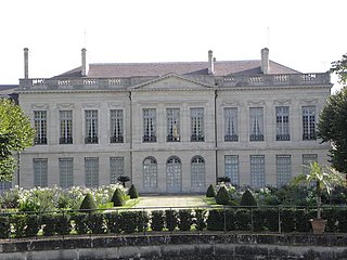
Châlons-en-Champagne is a city in the Grand Est region of France. It is the capital of the department of Marne, despite being only a quarter the size of the city of Reims.

<span class="mw-page-title-main">Abbécourt</span> Commune in Hauts-de-France, France

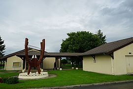
Abbécourt is a commune in the Aisne department in the Hauts-de-France region of northern France.

<span class="mw-page-title-main">Agriculture in the Russian Empire</span> Overview of agriculture in the Russian Empire

Agriculture in the Russian Empire throughout the 19th-20th centuries Russia represented a major world force, yet it lagged technologically behind other developed countries. Imperial Russia was amongst the largest exporters of agricultural produce, especially wheat. The Free Economic Society of 1765 to 1919 made continuing efforts to improve farming techniques.

<span class="mw-page-title-main">Clérey-la-Côte</span> Commune in Grand Est, France

Clérey-la-Côte is a commune in the Vosges department in Grand Est in northeastern France.

<span class="mw-page-title-main">Aussonce</span> Commune in Grand Est, France

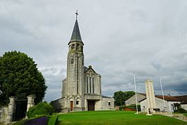
Aussonce is a commune in the Ardennes department in the Grand Est region of north-eastern France.

<span class="mw-page-title-main">Asfeld</span> Commune in Grand Est, France

Asfeld is a commune in the Ardennes department in the Grand Est region of north-eastern France, formerly named Ecry or Ecri.

<span class="mw-page-title-main">Bussy-le-Château</span> Commune in Grand Est, France

Bussy-le-Château is a commune in the Marne department in the Grand Est region of Northeastern France. In 2018, it had a population of 173. The inhabitants of the commune are known as Bussinais (masculine) and Bussinaises (feminine).

<span class="mw-page-title-main">Courcy, Marne</span> Commune in Grand Est, France

Courcy is a commune in the Marne department in north-eastern France. Courcy-Brimont station has rail connections to Reims and Laon.

<span class="mw-page-title-main">Dontrien</span> Commune in Grand Est, France

Dontrien is a commune in the Marne department in north-eastern France.

<span class="mw-page-title-main">Fismes</span> Commune in Grand Est, France

Fismes is a commune in the Marne department in the Grand Est region of north-eastern France.

<span class="mw-page-title-main">Mauvages</span> Commune in Grand Est, France

Mauvages is a commune in the Meuse department in Grand Est in north-eastern France.

<span class="mw-page-title-main">Șandra</span> Commune in Timiș, Romania

Șandra is a commune in Timiș County, Romania. It is composed of two villages, Șandra and Uihei. These were part of Biled commune until 2004, when they were split off.

<span class="mw-page-title-main">Agriculture in Armenia</span>

Armenia has 2.1 million hectares of agricultural land, 72% of the country's land area. Most of this, however, is mountain pastures, and cultivable land is 480,000 hectares, or 16% of the country's area. In 2006, 46% of the work force was employed in agriculture, and agriculture contributed 21% of the country's GDP. In 1991 Armenia imported about 65 percent of its food.

<span class="mw-page-title-main">Meuse (department)</span> Department of France

Meuse is a department in northeast France, named after the River Meuse. Meuse is part of the current region of Grand Est and is landlocked and borders by the French departments of Ardennes, Marne, Haute-Marne, Vosges, Meurthe-et-Moselle, and Belgium to the north. Parts of Meuse belong to Parc naturel régional de Lorraine. It had a population of 184,083 in 2019. Front lines in trench warfare during World War I ran varying courses through the department and it hosted an important battle/offensive in 1916 in and around Verdun.

<span class="mw-page-title-main">Fort de la Pompelle</span>

The Fort de la Pompelle, also known as Fort Herbillon, is one of a number of forts built around Reims after 1870 as part of a fortification belt in the Séré de Rivières system. The forts saw combat during the First World War in the defense of Reims. The fort is located about 2 kilometres (1.2 mi) north of the town of Sillery, next to the N44 road, between Reims and Châlons-en-Champagne. Constructed as a supporting position for larger forts and disarmed in 1913, it saw the heaviest fighting of the Reims forts. It was bombarded during the war and remains in a state of ruin.

References

  1. "Répertoire national des élus: les maires" (in French). data.gouv.fr, Plateforme ouverte des données publiques françaises. 13 September 2022.
  2. "Populations légales 2019". The National Institute of Statistics and Economic Studies. 29 December 2021.