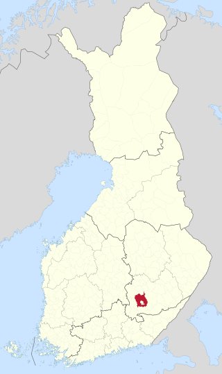
Jämsänkoski is a former town and municipality of Finland in the Central Finland region. It is located near Lake Päijänne and the Jämsänjoki river. The town had a population of 7,351 in 2008. It covered an area of 448.67 km² of which 48.02 km² is water. The population density was 16.9 inhabitants per km².
Äänekoski is a town in Finland. It is located in the Central Finland region, about 45 kilometres (28 mi) north of Jyväskylä. The town has a population of 18,021 and covers an area of 1,138.39 square kilometres (439.53 sq mi) of which 253.84 km2 (98.01 sq mi) is water. The population density is 20.37 inhabitants per square kilometre (52.8/sq mi).
Haapajärvi is a town and municipality of Finland.

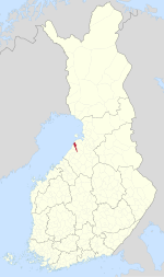
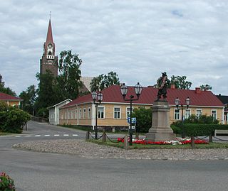
Kärsämäki is a municipality of Finland. It is located in the province of Oulu and is part of the Northern Ostrobothnia region. The municipality has a population of 2,456 and covers an area of 700.91 square kilometres (270.62 sq mi) of which 6.06 km2 (2.34 sq mi) is water. The population density is 3.53 inhabitants per square kilometre (9.1/sq mi). Kärsämäki is a significant road junction where Highway 4 (Helsinki–Oulu–Utsjoki) and Highway 28 (Kokkola–Kajaani) intersect and where Highway 58 leading to Kangasala begins. The distance to the regional capital Oulu is 123 kilometres (76 mi).

Loppi is a municipality in Finland. It is located in the province of Southern Finland and is part of the Kanta-Häme region, located about 50 kilometers south of the city of Hämeenlinna. Loppi was founded in 1632. The municipality has a population of 7,719 and covers an area of 655.97 square kilometres (253.27 sq mi) of which 58.36 km2 (22.53 sq mi) is water. The population density is 12.91 inhabitants per square kilometre (33.4/sq mi). The municipality is unilingually Finnish.

Oulainen is a town and a municipality of Finland. It is located in the Northern Ostrobothnia region, 101 kilometres (63 mi) south of the city of Oulu. The municipality has a population of 6,955 (30 September 2023) and covers an area of 597.53 square kilometres (230.71 sq mi) of which 10.01 km2 (3.86 sq mi) is water. The population density is 11.83 inhabitants per square kilometre (30.6/sq mi). Oulainen is founded in 1865, and it received township rights in 1977.

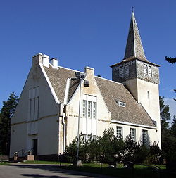
Piippola is a village and a former municipality of Finland.
Raahe is a town and municipality of Finland. Founded by Swedish statesman and Governor General of Finland Count Per Brahe the Younger in 1649, it is one of 10 historic wooden towns remaining in Finland. Examples of other Finnish historic wooden towns are Kaskinen (Kaskö), Old Rauma, Porvoo (Borgå), Jakobstad (Pietarsaari), and Vaasa (Vasa). After a devastating fire in 1810, Raahe was rebuilt adhering to new design principles which minimized the risk of fire and enlarged some civic spaces. Old Raahe is noted for its Renaissance-inspired rectilinear town plan featuring an unusual central-square with closed corners.

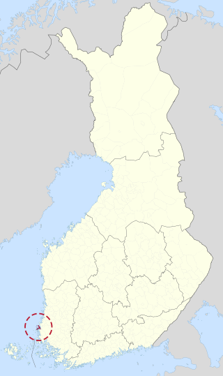
Salo is a town and municipality of Finland. It is located in the Southwest Finland region. The municipality has a population of 51,051 and covers an area of 2,168.30 square kilometres (837.19 sq mi) of which 181.78 km2 (70.19 sq mi) is water. The population density is 25.69/km2 (66.5/sq mi). The municipality is unilingually Finnish.
Suomusjärvi is a former municipality of Finland. It was consolidated with Salo on January 1, 2009.

Angelniemi is a former municipality of Finland. It became part of Halikko in 1967. It was located on partly on the continent by the Halikonlahti Bay and partly on Kimito Island and is still nowadays the only part of the island where Finnish is the primary language. Today the population of the area is 398, but it rises during the summer because of the summer cottages.

Uskela is a former municipality of Finland.

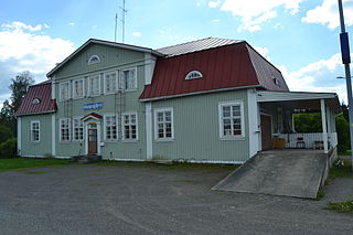
Paavola is a former municipality of Finland, now a village in the municipality of Siikajoki. The village is located beside the Siikajoki river. Though lacking rail transport connections, the settlement does lie beside the crossroads of routes 86 and 807.

The Province of Oulu was a province of Finland from 1775 to 2009. It bordered the provinces of Lapland, Western Finland and Eastern Finland and also the Gulf of Bothnia and Russia.

Ahlainen is a former municipality in the province of Satakunta, Finland. It was annexed with the city of Pori in 1972. The population of Ahlainen was 2,445 in 1971.

Pohjaslahti is a village and former municipality of Finland at the time of its existence in the Häme Province, now in the Pirkanmaa region. It was divided between Vilppula and Virrat in 1973. Pohjaslahti was the last rural municipality to be created in Finland, which happened in 1941.

Saloinen is a former municipality of Finland. It was a part of the Oulu Province, but now located in the region of Northern Ostrobothnia. It was consolidated with the town of Raahe in 1973.
Säyneinen is a village and a former municipality of Finland at the time of its existence in the Kuopio Province, now in Northern Savonia. Together with Muuruvesi, it was consolidated with Juankoski in 1971, since 2017 part of Kuopio.
Mikkelin maalaiskunta is a former municipality of Finland located in the modern region of Southern Savonia. Together with Anttola, it was consolidated with the town of Mikkeli in 2001.
Pyhämaa is a village and a former municipality of Finland in the former Turku and Pori Province, now in the Finland Proper region. It was consolidated with the town of Uusikaupunki in 1974.