
Count Per Brahe the Younger was a Swedish soldier, statesman, and author. He served as Privy Councillor from 1630, Lord High Steward from 1640, as well as Governor-General of Finland in 1637–1640 and 1648–1654.
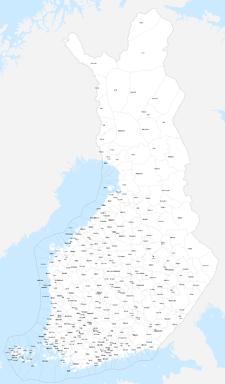
The municipalities represent the local level of administration in Finland and act as the fundamental, self-governing administrative units of the country. The entire country is incorporated into municipalities and legally, all municipalities are equal, although certain municipalities are called cities or towns. Municipalities have the right to levy a flat percentual income tax, which is between 16 and 22 percent, and they provide two thirds of public services. Municipalities control many community services, such as schools, health care and the water supply, and local streets. They do not maintain highways, set laws or keep police forces, which are responsibilities of the central government.
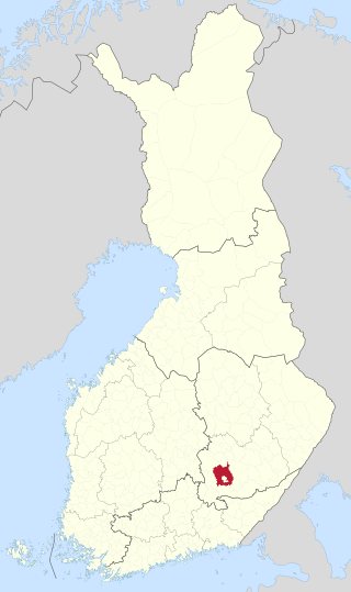
Äänekoski is a town in Finland. It is located in the Central Finland region, about 45 kilometres (28 mi) north of Jyväskylä. The town has a population of 17,977 and covers an area of 1,138.39 square kilometres (439.53 sq mi) of which 253.84 km2 (98.01 sq mi) is water. The population density is 20.32 inhabitants per square kilometre (52.6/sq mi).
Sub-regions are divisions used for statistical purposes in Finland. The country is divided into 69 sub-regions, which are formed by groups of municipalities within the 19 regions of Finland. These sub-regions represent a LAU 1 level of division used in conjunction with the Nomenclature of Territorial Units for Statistics.

Jyväskylän maalaiskunta, 'The Rural Municipality of Jyväskylä' is a former municipality of Finland. Together with Korpilahti, Jyväskylän maalaiskunta was consolidated with Jyväskylä on 1 January 2009. It was the last municipality to carry the name maalaiskunta.

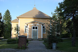
Piippola is a village and a former municipality of Finland.
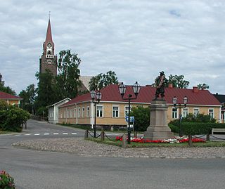
Raahe is a town and municipality of Finland. Founded by Swedish statesman and Governor General of Finland Count Per Brahe the Younger in 1649, it is one of 10 historic wooden towns remaining in Finland. Examples of other Finnish historic wooden towns are Kaskinen (Kaskö), Old Rauma, Porvoo (Borgå), Jakobstad (Pietarsaari), and Vaasa (Vasa). After a devastating fire in 1810, Raahe was rebuilt adhering to new design principles which minimized the risk of fire and enlarged some civic spaces. Old Raahe is noted for its Renaissance-inspired rectilinear town plan featuring an unusual central-square with closed corners.
Ristiina was a municipality of Finland. It was founded in 1649 and it was named after Kristina Stenbock, the wife of Governor General and Count Per Brahe. From the beginning of the year 2013 Ristiina is a part of Mikkeli city.

Salo is a town in Finland, located in the southwestern interior of the country. The population of Salo is approximately 51,000, while the sub-region has a population of approximately 60,000. It is the 20th most populous municipality in Finland, and the 24th most populous urban area in the country.
Suomusjärvi is a former municipality of Finland. It was consolidated with Salo on January 1, 2009.

Uskela is a former municipality of Finland.

The Province of Oulu was a province of Finland from 1775 to 2009. It bordered the provinces of Lapland, Western Finland and Eastern Finland and also the Gulf of Bothnia and Russia.
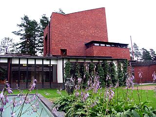
Säynätsalo is a former municipality in Finland and a part of Jyväskylä. As of November 2010 its population was 3,340. Säynätsalo municipality consisted of islands of Säynätsalo and Lehtisaari and also a part of Muuratsalo island. All of the islands are located on the Lake Päijänne. Also a small slice of land on the continent was part of the municipality.
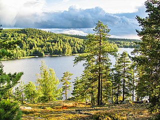
Muuratsalo is an island in lake Päijänne, Finland. The northern part of the island belongs to Jyväskylä and the southern part to Muurame. It is located 14 kilometres (8.7 mi) south from the Jyväskylä city centre and 5 kilometres (3.1 mi) east from Muurame. There are 800 inhabitants in Muuratsalo. The Muuratsalo Experimental House by Alvar Aalto is located on the island. Elissa and Alvar Aalto discovered the place for this jewel of architecture while Säynätsalo Town Hall was under construction on the neighbouring island.
Pattijoki is a settlement and former municipality in Finland. It was a part of the Oulu Province, but now located in the region of Northern Ostrobothnia. It was consolidated with the town of Raahe in 2003.

Simpele is a built-up area and a former municipality of Finland in the South Karelia region, originally in the Viipuri Province and after the Second World War, the Kymi Province. It was consolidated with Rautjärvi in 1973, becoming its new administrative center.
Mikkelin maalaiskunta is a former municipality of Finland located in the modern region of Southern Savonia. Together with Anttola, it was consolidated with the town of Mikkeli in 2001.
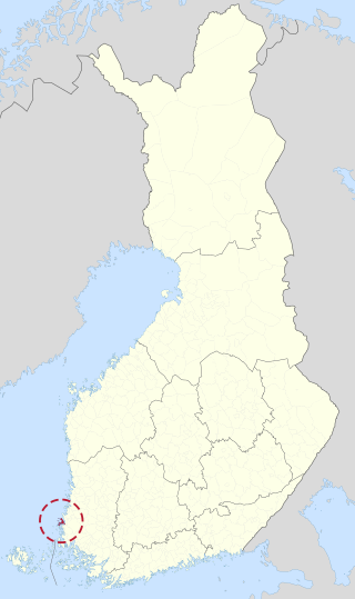
Pyhämaa is a village and a former municipality of Finland in the former Turku and Pori Province, now in the Finland Proper region. It was consolidated with the town of Uusikaupunki in 1974.


