
Töysä is a former municipality in Western Finland. It was consolidated to Alavus on 1 January 2013. It is part of the Southern Ostrobothnia region. The municipality had a population of 3,122 and covered an area of 309.66 square kilometres (119.56 sq mi) of which 11.91 km2 (4.60 sq mi) was water. The population density was 10.4853/km2 (27.157/sq mi). Most inhabitants spoke Finnish, with hardly any other languages being spoken.

Kempele is a municipality 11 kilometres (6.8 mi) south of the city of Oulu and 7 kilometres (4.3 mi) south of the Oulu Airport in Northern Finland. Historically it was in the province of Oulu, but today it is in the region of Northern Ostrobothnia. The population of Kempele is 18,927 and the municipality covers an area of 110.32 square kilometres (42.59 sq mi), of which 0.21 square kilometres (0.081 sq mi) is inland waters (2018-01-01). The population density is 172 inhabitants per square kilometre (450/sq mi). The municipality of Kempele was founded in 1867.

Oulunsalo is former municipality in the region of Northern Ostrobothnia, in Finland. Along with Haukipudas, Kiiminki and Yli-Ii it lost its municipal status and was merged with the city of Oulu on 1 January 2013. The municipality had a population of 9,746 and covered an area of 211.22 square kilometres (81.55 sq mi), of which 127.86 km2 (49.37 sq mi) is water. The population density is 116.915/km2 (302.81/sq mi). The municipality was founded in 1882.

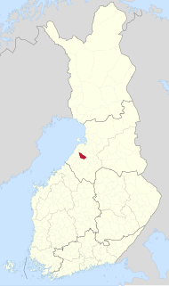
Liminka is a municipality in the Northern Ostrobothnia region in Finland. Liminka is located about 25 kilometres (16 mi) south of Oulu.

Haukipudas is a town and former municipality of Finland. It is located in the province of Oulu and part of the Northern Ostrobothnia region. Its shore runs along the Gulf of Bothnia, with the river Kiiminkijoki running through the province. Along with Kiiminki, Oulunsalo and Yli-Ii municipalities it was merged with the city of Oulu on 1 January 2013.
Karjalohja is a former municipality of Finland.
Kesälahti is a former municipality of Finland. It was consolidated with Kitee on 1 January 2013.
Kiikoinen is a former municipality of Finland.
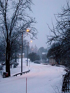
Lumijoki is a municipality of Finland.

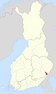
Paltamo is a municipality of Finland. It is part of the Kainuu region. The municipality has a population of 3,222 (31 March 2021) and covers an area of 1,139.12 square kilometres (439.82 sq mi) of which 220.23 km2 (85.03 sq mi) is water. The population density is 3.51 inhabitants per square kilometre (9.1/sq mi). There are two built-up areas in the municipality: Kontiomäki and Paltamo. Kontiomäki has about 600 inhabitants.
Pudasjärvi is a town and a municipality of Finland.
Punkaharju is a former municipality of Finland. It was consolidated with the town of Savonlinna on January 1, 2013.

Pyhäjoki is a municipality of Finland. It is located in the defunct province of Oulu, which was split in two regions; Pyhäjoki is part of the Northern Ostrobothnia region.
Ristiina was a municipality of Finland. It was founded in 1649 and it was named after Kristina Stenbock, the wife of Governor General and Count Per Brahe. From the beginning of the year 2013 is a part of Mikkeli city.

Suomenniemi is a former municipality of Finland. It was consolidated with Mikkeli on 1 January 2013.
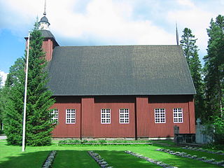
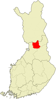
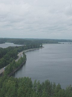
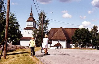
Utajärvi is a municipality of Finland. It is located in the Northern Ostrobothnia region next to the border of the Kainuu region, and is part of the former province of Oulu. It is 58 kilometres (36 mi) from Utajärvi to Oulu and 125 kilometres (78 mi) to Kajaani. The municipality has a population of 2,604 (31 March 2021) and covers an area of 1,736.73 square kilometres (670.56 sq mi) of which 65.55 km2 (25.31 sq mi) is water. The population density is 1.56 inhabitants per square kilometre (4.0/sq mi). The municipality is unilingually Finnish.
Vihanti was a municipality of Finland. It was merged with the city of Raahe on 1 January 2013.
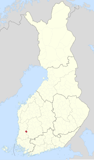
Vähäkyrö is a former municipality of Finland and an exclave of the city of Vaasa since January 1, 2013.

Yli-Ii was a municipality of Finland. It was located in the province of Oulu and was part of the Northern Ostrobothnia region. Alongside Haukipudas, Kiiminki and Oulunsalo municipalities it was merged with the city of Oulu on 1 January 2013. The municipality had a population of 2,179 and covered an area of 793.27 square kilometres (306.28 sq mi) of which 24.12 km2 (9.31 sq mi) is water. The population density was 2.8330/km2 (7.3374/sq mi).

Ylikiiminki is a former municipality of Finland. It was consolidated with the city of Oulu on 1 January 2009.


