
Towcester is an affluent market town and civil parish in the West Northamptonshire unitary authority area of Northamptonshire, England. From 1974 to 2021, it was the administrative centre of the South Northamptonshire district.

Calverton is a civil parish in the unitary authority area of the City of Milton Keynes, Buckinghamshire, England and just outside the Milton Keynes urban area, situated roughly 1 mile (1.6 km) south of Stony Stratford, and 4 miles (6.4 km) west of Central Milton Keynes. The parish consists of one village, Lower Weald, and two hamlets, Upper Weald and Middle Weald. Lower Weald is the largest of the three settlements, and Manor Farm, the parish church and the former parochial school are within its boundaries.

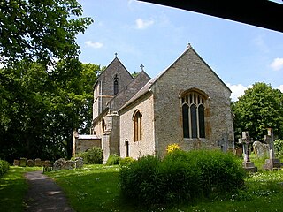
Lillingstone Dayrell is a village and former civil parish, now in the parish of Lillingstone Dayrell with Luffield Abbey, in Buckinghamshire, England. It is about three and a half miles north of Buckingham, eight miles west of Milton Keynes and five miles south of Towcester.

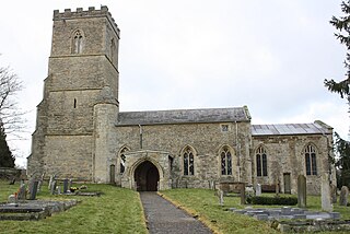
Lillingstone Lovell is a village and civil parish in north Buckinghamshire, England. It is located around 4 miles (6.4 km) north of Buckingham and 8 miles (13 km) west of Milton Keynes, and around 5 miles (8 km) south of Towcester in the neighbouring county of Northamptonshire. Silverstone Circuit is located just over 2 miles (3.2 km) north-west of Lillingstone Lovell.

Wolverton is a constituent town of Milton Keynes, England. It is located in the north-west of the city, beside the West Coast Main Line, the Grand Union Canal and the river Great Ouse. It is the administrative seat of Wolverton and Greenleys civil parish.

South Northamptonshire was a local government district in Northamptonshire, England, from 1974 to 2021. Its council was based in the town of Towcester, first established as a settlement in Roman Britain. The population of the Local Authority District Council in 2011 was 85,189.
Ashton is a village in West Northamptonshire about 1 mile (1.6 km) southeast of Roade village close to the Northampton to Milton Keynes A508, ca.3 miles (5 km) south of junction 15 of the M1 motorway, 6 miles (10 km) south of Northampton and 11 miles (18 km) north of Milton Keynes. The population of the civil parish at the 2011 census was 395. The village is about 67 miles (107.8 km) north of London via the M1 junction 15. The West Coast Main Line intersects the village on its eastern side.
Grafton Regis is a village and civil parish in West Northamptonshire, England, on the border with Buckinghamshire. The village is east of the A508 road, on which it has a short frontage and two bus stops, and is around 8 miles (13 km) south of Northampton and 9 miles (14 km) north of Milton Keynes. The population of the civil parish at the 2001 census was 152. This increased to 253 at the 2011 census.

Potterspury is a populous village and civil parish in West Northamptonshire, England. The nearest main town is Milton Keynes, the centre of which is about 7 miles south-east. At the time of the 2011 census, the parish's population was 1,453 people.
The Honour of Grafton is a contiguous set of manors in the south of Northamptonshire, England up to the county's eastern border with Buckinghamshire. Its dominant legacies are semi-scattered Whittlewood Forest and a William Kent wing of Wakefield Lodge in the body of that woodland.

Aspley Guise is a village and civil parish in the west of Central Bedfordshire, England. In addition to the village of Aspley Guise itself, the civil parish also includes part of the town of Woburn Sands, the rest of which is in the City of Milton Keynes in Buckinghamshire. Together with Woburn Sands and Aspley Heath, it forms part of the Milton Keynes urban area. It is centred 6 miles (9.7 km) east southeast of Central Milton Keynes and 1 mile (1.6 km) south of the M1 junction 13. It has its own railway station on the Marston Vale Line, and an historic centre with 29 listed buildings.

Milton Malsor is a village and civil parish in West Northamptonshire, England. The population of the civil parish at the 2011 census was 761. It is 4 miles (6.4 km) south of Northampton town centre, 45 miles (72 km) south-east of Birmingham, and 66 miles (106 km) north of central London; junction 15 of the M1 motorway is 2 miles (3.2 km) east by road. The area of the Milton Malsor civil parish is about 1,650 acres (670 ha), stretching from north of the M1 motorway between junctions 15 and 15A, south to the West Coast Main Line, east to the A508 and A45 roads, and west to the A43 road.

Hartwell is a village and civil parish in West Northamptonshire, England, bordering Buckinghamshire. The village is next to Salcey Forest and the M1 motorway. It is 7 miles (11 km) south of Northampton and 13 miles (21 km) north of Milton Keynes.
Old Stratford is a village and wider civil parish in the south of the English county of Northamptonshire. The population of the civil parish at the 2011 Census was 1,935. The 'Stratford' part of the village name is Anglo-Saxon in origin and means 'ford on a Roman road'. The Roman road in this sense is the Watling Street that runs through the middle of the village.

Adstone is a village and civil parish in West Northamptonshire, England. The population at the 2001 census was 65. It remained than 100 at the 2011 census and was included in the civil parish of Tiffield. Adstone is situated approximately 6.5 miles (10 km) south-southeast of Daventry and 6.5 miles (10 km) west-northwest of Towcester. It was known as Atenestone in the Domesday Book.

Alderton is a small English village and civil parish about 9 miles (14 km) south of Northampton, and 10 miles (16 km) north of Milton Keynes, along a road between the A5 and A508 main roads in the southwest and northeast respectively. The nearest large town is Towcester, about 3 miles (5 km) north. The village is famous for the remains of an English Heritage Scheduled Ancient Monument, a Norman Castle, known locally as "The Mount", which was the subject of an investigation by the Channel 4 programme Time Team.
Pury End is a hamlet of approximately 100 houses in the civil parish of Paulerspury, near Towcester in West Northamptonshire, England. The Grafton Way footpath crosses through the village and runs down Carey's Road. The population of the parish, including Pury End, Plumpton and Paulerspury, was 1,018 in the 2011 census.

Gayton is a rural village and civil parish in West Northamptonshire, England, 5 miles (8 km) south-west of Northampton town centre. The village is situated on a hill close to the larger villages of Bugbrooke, Milton Malsor and Blisworth, with a linked public footpath network. At the 2011 Census, the population of the parish was 544.

Courteenhall is a village 5 miles (8 km) south of the county town of Northampton, in the shire county of Northamptonshire, England, and about 66 miles (106 km) north of London. The population of the civil parish was 122 at the 2011 census. The village is located in a cul-de-sac.

The Grafton Way is a 13-mile (21 km) footpath in Northamptonshire, England. It runs south east from Greens Norton to Cosgrove, where it meets the Knightley Way. It is named after the Dukes of Grafton, major land-owners in the area in the 18th and 19th centuries.

