
Penobscot County is a county in the U.S. state of Maine, named for the Penobscot people in Wabanakik. As of the 2020 census, the population was 152,199, making it the third-most-populous county in Maine. Its county seat is Bangor. The county was established on February 15, 1816, from part of Hancock County when the area was still part of Massachusetts. Penobscot County is home to the University of Maine.

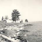
Brooksville is a town on Penobscot Bay in Hancock County, Maine, United States. As of the 2020 census, the town population was 935. It contains the villages of North Brooksville, South Brooksville, West Brooksville, Brooksville Corner, and Harborside.

Millinocket is a town in Penobscot County, Maine, United States. The population was 4,114 at the 2020 census.

The Penobscot River is a 109-mile-long (175 km) river in the U.S. state of Maine. Including the river's West Branch and South Branch increases the Penobscot's length to 264 miles (425 km), making it the second-longest river system in Maine and the longest entirely in the state. Its drainage basin contains 8,610 square miles (22,300 km2).
Baker Mountain is a wild, trail-less mountain located in Beaver Cove, Piscataquis County, Maine. It is flanked to the northwest by Lily Bay Mountain. Elephant Mountain is about 2 miles (3 km) to the southwest, and White Cap Mountain is about 5 miles (8 km) to the east.

South Twin Lake having about 3,200 acres (13 km2) is wholly within Penobscot County, Maine. It is about 6 miles (10 km) west of Millinocket, Maine and is part of the Pemadumcook Chain of Lakes. The lake is centered at 45°37.25′N68°51′W and has spillway elevation 492 feet (150 m) above sea level. It is part of the watershed of the West Branch of the Penobscot River.

The Baker Branch Saint John River is a 48.0-mile-long (77.2 km) river. This river is a tributary of the Saint John River, flowing in the Maine North Woods, in Maine, in the Northeastern United States.

The West Branch Penobscot River is a 117-mile-long (188 km) tributary of the Penobscot River through the North Maine Woods in Maine. The river is also known as Abocadneticook, Kahgognamock, and Kettegwewick.
Castine is a census-designated place (CDP) in the town of Castine in Hancock County, Maine, United States. The CDP population was 1,029 at the 2010 census, out of 1,366 people in the town as a whole.

Ripogenus Gorge is a rock-walled canyon formed in Maine where the West Branch Penobscot River crosses the Caribou Lake anticline. Ripogenus Falls controlled discharge from Ripogenus Lake until Ripogenus Dam was completed at the upstream end of the gorge in 1916. The dam forms a hydroelectric reservoir raising the level of Ripogenus Lake to include the upstream Chesuncook Lake, Caribou Lake, and Moose Pond. The resulting reservoir is often identified by the name of the largest included lake: Chesuncook. The gorge provides an unusual exposure of Maine North Woods bedrock typically covered by saturated glacial till. The Silurian Ripogenus Formation of weakly metamorphosed shallow marine siliciclastics and fossiliferous limestone has been described from investigation of the gorge.
Gero Island is a large island on Chesuncook Lake in Piscataquis County, Maine, United States. The island is 3,175 acres (1,285 ha) in area, with all but 133 acres (54 ha) regulated. It is known for exemplary natural communities of slender rush as well as white pine forest and lower elevation spruce-fir forest. Chesuncook Lake was created by damming the West Branch Penobscot River in the 19th and early 20th centuries.

The Ambajejus Boom House is an historic logging facility in remote central Maine. Built in 1907 on a small island in Ambajejus Lake, it is the only surviving structure associated with the great logging drives that drove the economy of inland Maine for decades. It was listed on the National Register of Historic Places in 1973. The building has been rehabilitated and can be visited by boat from various launch points on the lake.
Chesuncook is a small unincorporated settlement on the northwestern shore of Chesuncook Lake in rural central Piscataquis County, Maine. A small village, originally supporting logging operations in the area, has existed here since at least the time of Henry David Thoreau, who wrote about it in The Maine Woods. The village is now a primarily seasonal settlement that caters principally to outdoors enthusiasts. Seven historic properties on or near the "Main Street" fronting the lake were listed on the National Register of Historic Places in 1973.

Millinocket Lake is 9 miles (14 km) northwest of Millinocket, Maine, United States, and is drained by Millinocket Stream, which flows through the town of Millinocket into the West Branch Penobscot River 2 miles (3.2 km) south of town. The lake is fed by Sandy Stream, which drains the southeastern slopes of Mount Katahdin by tributaries including Roaring Brook, Avalanche Brook, Spring Brook, Beaver Brook, and Rum Brook. Sandy Stream is a good spawning habitat for rainbow smelt, which are a primary prey for lake trout and land-locked Atlantic salmon living in the lake.
Rainbow Lake is the source of Rainbow Stream in Rainbow township in the North Maine Woods. Rainbow Stream discharges over a dam at the west end of the lake and flows 4 miles (6.4 km) south to Nahmakanta Lake. Nahmakanta Lake overflows through Nahmakanta Stream and Pemadumcook Chain of Lakes to the Penobscot River. The Appalachian Trail follows Rainbow Stream and the south shore of the lake; but the old logging road to the dam has deteriorated with boggy areas no longer passable by four-wheel drive vehicles. The lake has a small catchment basin and is surrounded by large granite boulders. The low nutrient input in this setting produces unusually clear water. The lake has a native population of brook trout.
A chain of three Jo-Mary Lakes along the border of Penobscot County and Piscataquis County drain into the Pemadumcook Chain of Lakes in the North Maine Woods. The flow sequence is from Upper Jo-Mary Lake into Middle Jo-Mary Lake and then through Lower Jo-Mary Lake into Pemadumcook Lake.
The Saint John Ponds are a chain of shallow lakes at the headwaters of the Baker Branch Saint John River in the North Maine Woods. The flow sequence is from the Upper First Saint John Pond, through the Lower First Saint John Pond, Second Saint John Pond, Third Saint John Pond, and Fourth Saint John Pond to the Fifth Saint John Pond. Flow from one pond to the next is sometimes called Baker Stream rather than the Baker Branch Saint John River. Great Northern Paper Company dug a canal from Fifth Saint John Pond 2 miles (3.2 km) westward to the North Branch Penobscot River in 1939, and built a dam at the north end of Fifth Saint John Pond so pulpwood logs harvested in the upper Saint John River watershed could be floated down the Penobscot River to Millinocket, Maine. The canal and dam have fallen into disrepair so most drainage from the ponds again flows down the Saint John River. All upstream ponds with the exception of the first had dams to regulate discharge flow for log driving, but those dams have similarly fallen into disrepair. Moose use the ponds as summer refuge from heat and biting insects.
Mattawamkeag is a census-designated place (CDP) and the primary village in the town of Mattawamkeag, Penobscot County, Maine, United States. It is in the southwestern corner of the town, where the Mattawamkeag River joins the Penobscot. The community is bordered to the south by the town of Winn and to the west, across the Penobscot, by the town of Woodville.
William Hilton II was an American business executive and engineer who worked as the Vice President of the Maine-based Great Northern Paper Company from 1929 to 1957, and then as the company's Director from 1957 until his retirement on January 1, 1960. He is also known as one of the first forest fire lookouts in the United States.


