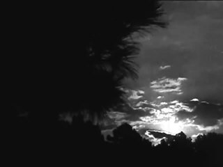
In meteorology, a cloud is an aerosol consisting of a visible mass of minute liquid droplets, frozen crystals, or other particles suspended in the atmosphere of a planetary body or similar space. Water or various other chemicals may compose the droplets and crystals. On Earth, clouds are formed as a result of saturation of the air when it is cooled to its dew point, or when it gains sufficient moisture from an adjacent source to raise the dew point to the ambient temperature. They are seen in the Earth's homosphere, which includes the troposphere, stratosphere, and mesosphere. Nephology is the science of clouds, which is undertaken in the cloud physics branch of meteorology. There are two methods of naming clouds in their respective layers of the homosphere, Latin and common.

Cumulus clouds are clouds which have flat bases and are often described as "puffy", "cotton-like" or "fluffy" in appearance. Their name derives from the Latin cumulo-, meaning heap or pile. Cumulus clouds are low-level clouds, generally less than 2,000 m (6,600 ft) in altitude unless they are the more vertical cumulus congestus form. Cumulus clouds may appear by themselves, in lines, or in clusters.

Altocumulus is a middle-altitude cloud genus that belongs mainly to the stratocumuliform physical category characterized by globular masses or rolls in layers or patches, the individual elements being larger and darker than those of cirrocumulus and smaller than those of stratocumulus. However, if the layers become tufted in appearance due to increased airmass instability, then the altocumulus clouds become more purely cumuliform in structure. Like other cumuliform and stratocumuliform clouds, altocumulus signifies convection. A sheet of partially conjoined altocumulus perlucidus is sometimes found preceding a weakening warm front, where the altostratus is starting to fragment, resulting in patches of altocumulus perlucidus between the areas of altostratus. Altocumulus is also commonly found between the warm and cold fronts in a depression, although this is often hidden by lower clouds.

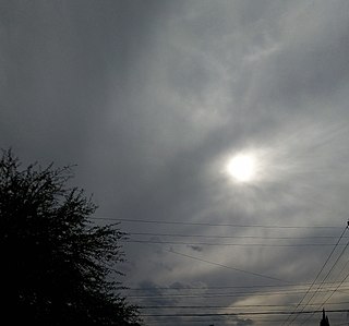
Altostratus is a middle-altitude cloud genus belonging to the stratiform physical category characterized by a generally uniform gray to bluish-green sheet or layer. It is lighter in color than nimbostratus and darker than high cirrostratus. The sun can be seen through thin altostratus, but thicker layers can be quite translucent.

A stratocumulus cloud, occasionally called a cumulostratus, belongs to a genus-type of clouds characterized by large dark, rounded masses, usually in groups, lines, or waves, the individual elements being larger than those in altocumulus, and the whole being at a lower height, usually below 2,000 metres (6,600 ft). Weak convective currents create shallow cloud layers because of drier, stable air above preventing continued vertical development. Historically, in English, this type of cloud has been referred to as a twain cloud for being a combination of two types of clouds.

A nimbostratus cloud is a multi-level, amorphous, nearly uniform and often dark grey cloud that usually produces continuous rain, snow or sleet but no lightning or thunder.

Cirrocumulus is one of the three main genus-types of high-altitude tropospheric clouds, the other two being cirrus and cirrostratus. They usually occur at an altitude of 5 to 12 km. Like lower-altitude cumuliform and stratocumuliform clouds, cirrocumulus signifies convection. Unlike other high-altitude tropospheric clouds like cirrus and cirrostratus, cirrocumulus includes a small amount of liquid water droplets, although these are in a supercooled state. Ice crystals are the predominant component, and typically, the ice crystals cause the supercooled water drops in the cloud to rapidly freeze, transforming the cirrocumulus into cirrostratus. This process can also produce precipitation in the form of a virga consisting of ice or snow. Thus, cirrocumulus clouds are usually short-lived. They usually only form as part of a short-lived transitional phase within an area of cirrus clouds and can also form briefly as a result of the breaking up of part of a cumulonimbus anvil.

Cirrostratus is a high-level, very thin, generally uniform stratiform genus-type of cloud. It is made out of ice-crystals, which are pieces of frozen water. It is difficult to detect and it can make halos. These are made when the cloud takes the form of thin cirrostratus nebulosus. The cloud has a fibrous texture with no halos if it is thicker cirrostratus fibratus. On the approach of a frontal system, the cirrostratus often begins as nebulous and turns to fibratus. If the cirrostratus begins as fragmented of clouds in the sky it often means the front is weak. Cirrostratus is usually located above 5.5 km (18,000 ft). Its presence indicates a large amount of moisture in the upper troposphere. Clouds resembling cirrostratus occasionally form in polar regions of the lower stratosphere. Polar stratospheric clouds can take on this appearance when composed of tiny supercooled droplets of water or nitric acid.
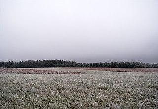
Stratus clouds are low-level clouds characterized by horizontal layering with a uniform base, as opposed to convective or cumuliform clouds that are formed by rising thermals. More specifically, the term stratus is used to describe flat, hazy, featureless clouds at low altitudes varying in color from dark gray to nearly white. The word stratus comes from the Latin prefix strato-, meaning "layer". Stratus clouds may produce a light drizzle or a small amount of snow. These clouds are essentially above-ground fog formed either through the lifting of morning fog or through cold air moving at low altitudes over a region. Some call these clouds "high fog" for their fog-like form. While light rain may fall, this cloud does not indicate much meteorological precipitation.

Lenticular clouds are stationary clouds that form mostly in the troposphere, typically in parallel alignment to the wind direction. They are often comparable in appearance to a lens or saucer. Nacreous clouds that form in the lower stratosphere sometimes have lenticular shapes.

A warm front is a density discontinuity located at the leading edge of a homogeneous warm air mass, and is typically located on the equator-facing edge of an isotherm gradient. Warm fronts lie within broader troughs of low pressure than cold fronts, and move more slowly than the cold fronts which usually follow because cold air is denser and less easy to remove from the Earth's surface. This also forces temperature differences across warm fronts to be broader in scale. Clouds ahead of the warm front are mostly stratiform, and rainfall defiantly increases as the front approaches. Fog can also occur preceding a warm frontal passage. Clearing and warming is usually rapid after frontal passage. If the warm air mass is unstable, thunderstorms may be embedded among the stratiform clouds ahead of the front, and after frontal passage thundershowers may continue. On weather maps, the surface location of a warm front is marked with a red line of semicircles pointing in the direction of travel.

Cumulus mediocris is a low to middle level cloud with some vertical extent of the genus cumulus, larger in vertical development than Cumulus humilis. It also may exhibit small protuberances from the top and may show the cauliflower form characteristic of cumulus clouds. Cumulus mediocris clouds do not generally produce precipitation of more than very light intensity, but can further advance into clouds such as Cumulus congestus or Cumulonimbus, which do produce precipitation and severe storms.

Cumulus congestus clouds, also known as towering cumulus, are a form of cumulus that can be based in the low or middle height ranges. They achieve considerable vertical development in areas of deep, moist convection. They are an intermediate stage between cumulus mediocris and cumulonimbus, producing showers of snow, rain or ice pellets.

The altocumulus undulatus is a mid-level cloud, usually white or grey with layers or patches containing undulations that resemble "waves" or "ripples" in water. Elements within the cloud are generally darker than those in cirrocumulus and smaller than those in stratocumulus. These clouds may appear both as patches or as covering the sky. The width of these clouds is generally less than 300 feet thick. The presence of altocumulus undulatus may indicate precipitation within the next 20 hours or simply an overcast day.

A castellanus is a cloud that displays at least in its upper part cumuliform protuberances having the shape of turrets that give a crenellated aspect. Some of these turrets are higher than they are wide; they have a common base and seem to be arranged in a line. The castellanus characteristic is particularly obvious when the clouds are observed from the side.

This glossary of meteorology is a list of terms and concepts relevant to meteorology and atmospheric science, their sub-disciplines, and related fields.

Altocumulus lacunosus is a type of altocumulus cloud. The term lacunosus is from Latin, meaning "full of gaps". This type of cloud appears as holes present in an altocumulus cloud cover that resemble a honeycomb, it is considered to be rare since it is typically short-lived. Lacunosus cloud types forms when a layer of cold air and a layer of warmer air come in contact with each other, this then causes the cold air to sink in the form of localized downdrafts, these downdrafts then strike through the cloud and create the holes.

Altocumulus volutus is a type of altocumulus cloud. This cloud type has the appearance of a single, small, horizontal, rolling line, it is relatively rare compared with its counterpart stratocumulus volutus, This cloud does not attach to any other cloud. It may or may not appear with altocumulus clouds of different species. When found in a thunderstorm, it forms when cold air from a thunderstorm's downdraft makes the already present warm and moist air rise, expanding and cooling as it rises. It then condenses, although the most likely scenario is that it condenses into a shelf cloud or roll cloud, rather than an altocumulus volutus cloud. When found in environments where it is not associated with a thunderstorm, it forms because of wind shear.
Translucidus is a cloud variety, it appears in altocumulus, altostratus, stratus, and stratocumulus clouds, this cloud variety is very recognizable, with its only feature being that it is translucent, and gives away the location of the Sun and Moon, and sometimes, it lets stars in the night sky be visible, it is the opposite of the cloud variety opacus, which isnt translucent, but opaque.
