
Cirrus is a genus of high cloud made of ice crystals. Cirrus clouds typically appear delicate and wispy with white strands. In the Earth's atmosphere, cirrus are usually formed when warm, dry air rises, causing water vapor deposition onto mineral dust and metallic particles at high altitudes. Globally, they form anywhere between 4,000 and 20,000 meters above sea level, with the higher elevations usually in the tropics and the lower elevations in more polar regions.

In meteorology, a cloud is an aerosol consisting of a visible mass of miniature liquid droplets, frozen crystals, or other particles suspended in the atmosphere of a planetary body or similar space. Water or various other chemicals may compose the droplets and crystals. On Earth, clouds are formed as a result of saturation of the air when it is cooled to its dew point, or when it gains sufficient moisture from an adjacent source to raise the dew point to the ambient temperature.

Cumulonimbus is a dense, towering, vertical cloud, typically forming from water vapor condensing in the lower troposphere that builds upward carried by powerful buoyant air currents. Above the lower portions of the cumulonimbus the water vapor becomes ice crystals, such as snow and graupel, the interaction of which can lead to hail and to lightning formation, respectively.

Altocumulus is a middle-altitude cloud genus that belongs mainly to the stratocumuliform physical category, characterized by globular masses or rolls in layers or patches – the individual elements being larger and darker than those of cirrocumulus and smaller than those of stratocumulus. However, if the layers become tufted in appearance due to increased airmass instability, then the altocumulus clouds become more purely cumuliform in structure. Like other cumuliform and stratocumuliform clouds, altocumulus signifies convection. A sheet of partially conjoined altocumulus perlucidus is sometimes found preceding a weakening warm front, where the altostratus is starting to fragment, resulting in patches of altocumulus perlucidus between the areas of altostratus. Altocumulus is also commonly found between the warm and cold fronts in a depression, although this is often hidden by lower clouds.

Altostratus is a middle-altitude cloud genus made up of water droplets, ice crystals, or a mixture of the two. Altostratus clouds are formed when large masses of warm, moist air rise, causing water vapor to condense. Altostratus clouds are usually gray or blueish featureless sheets, although some variants have wavy or banded bases. The sun can be seen through thinner altostratus clouds, but thicker layers can be quite opaque.

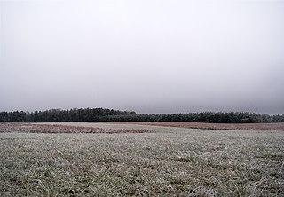
A nimbostratus cloud is a multilevel, amorphous, nearly uniform, and often dark-grey cloud that usually produces continuous rain, snow, or sleet, but no lightning or thunder.

Cirrocumulus is one of the three main genus types of high-altitude tropospheric clouds, the other two being cirrus and cirrostratus. They usually occur at an altitude of 5 to 12 km, however they can occur as low as 10,000 ft (3.0 km) in the arctic and weather reporting standards such as the Canadian MANOBS suggests heights of 29,000 ft (8.8 km) in summer and 26,000 ft (7.9 km) in winter. Like lower-altitude cumuliform and stratocumuliform clouds, cirrocumulus signifies convection. Unlike other high-altitude tropospheric clouds like cirrus and cirrostratus, cirrocumulus includes a small amount of liquid water droplets, although these are in a supercooled state. Ice crystals are the predominant component, and typically, the ice crystals cause the supercooled water drops in the cloud to rapidly freeze, transforming the cirrocumulus into cirrostratus. This process can also produce precipitation in the form of a virga consisting of ice or snow. Thus, cirrocumulus clouds are usually short-lived. They usually only form as part of a short-lived transitional phase within an area of cirrus clouds and can also form briefly as a result of the breaking up of part of a cumulonimbus anvil.

Cirrostratus is a high-altitude, very thin, generally uniform stratiform genus-type of cloud. It is made out of ice-crystals, which are pieces of frozen water. It is difficult to detect and it can make halos. These are made when the cloud takes the form of thin cirrostratus nebulosus. The cloud has a fibrous texture with no halos if it is thicker cirrostratus fibratus. On the approach of a frontal system, the cirrostratus often begins as nebulous and turns to fibratus. If the cirrostratus begins as fragmented of clouds in the sky it often means the front is weak. Cirrostratus is usually located above 5.5 km (18,000 ft). Its presence indicates a large amount of moisture in the upper troposphere. Clouds resembling cirrostratus occasionally form in polar regions of the lower stratosphere. Polar stratospheric clouds can take on this appearance when composed of tiny supercooled droplets of water or nitric acid.
Stratus clouds are low-level clouds characterized by horizontal layering with a uniform base, as opposed to convective or cumuliform clouds formed by rising thermals. The term stratus describes flat, hazy, featureless clouds at low altitudes varying in color from dark gray to nearly white. The word stratus comes from the Latin prefix Strato-, meaning "layer". Stratus clouds may produce a light drizzle or a small amount of snow. These clouds are essentially above-ground fog formed either through the lifting of morning fog or through cold air moving at low altitudes. Some call these clouds "high fog" for their fog-like form.
Cirrus castellanus or Cirrus castellatus is a species of cirrus cloud. Its name comes from the word castellanus, which means of a fort, of a castle in Latin. Like all cirrus, this species occurs at high altitudes. It appears as separate turrets rising from a lower-level cloud base. Often these cloud turrets form in lines, and they can be taller than they are wide. This cloud species is usually dense in formation.

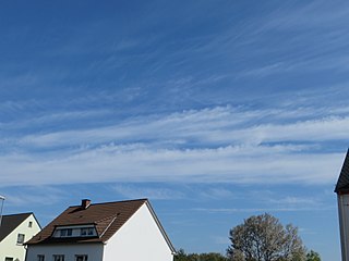
Cirrus fibratus or also called Cirrus filosus is a species of cirrus cloud. The name cirrus fibratus is derived from Latin, meaning "fibrous". These clouds are similar to cirrus uncinus, commonly known as "mares' tails"; however, fibratus clouds do not have tufts or hooks at the end. The filaments are usually separate from one another.
Cirrus duplicatus is a variety of cirrus cloud. The name cirrus duplicatus is derived from Latin, meaning "double". The duplicatus variety of cirrus clouds occurs when there are at least two layers of cirrus clouds. Most of the time, occurrences of cirrus fibratus and cirrus uncinus are in the duplicatus form. Like stratus clouds, cirrus clouds are often seen in the duplicatus form.

Cirrus radiatus is a variety of cirrus cloud. The name cirrus radiatus is derived from Latin, meaning "rayed, striped". This variety of cirrus clouds occurs in parallel bands that often cover the entire sky and appear to converge at a single point or two opposite points on the horizon. Cirrus radiatus is often partly made up of cirrocumulus or cirrostratus.

Cirrus vertebratus is a type of cirrus cloud. The name cirrus vertebratus is derived from Latin, meaning "jointed, articulated, vertebrated". Like cirrus intortus, the vertebratus species is exclusive to the cirrus genus. Cirrus vertebratus gives the impression of vertebrae in a spinal column, ribs, or a fish skeleton.

Cirrocumulus floccus is a type of cirrocumulus cloud. The name cirrocumulus floccus is derived from Latin, meaning "a lock of wool". Cirrocumulus floccus appears as small tufts of cloud with rounded heads, but ragged bottoms. The cloud can produce virga, precipitation that evaporates before reaching the ground. Like cirrocumulus castellanus, cirrocumulus floccus is an indicator of atmospheric instability at the level of the cloud. In fact, cirrocumulus floccus can form from cirrocumulus castellanus, being the evolutionary state after the base of the original cloud has dissipated.

Cirrocumulus lenticularis is a type of cirrocumulus cloud. The name cirrocumulus lenticularis is derived from Latin, meaning "like a lentil". Cirrocumulus lenticularis are smooth clouds that have the appearance of a lens or an almond. They usually form at the crests of atmospheric waves, which would otherwise be invisible. This species of cirrocumulus can often be quite elongated and normally has very distinguished boundaries. Cirrocumulus lenticularis forms when stable air is forced upward; this is usually due to orographic features, but can occur away from mountains as well. Irisation can occasionally occur with these clouds.

Cirrostratus fibratus or also called Cirrostratus filosus is a type of cirrostratus cloud. The name cirrostratus fibratus is derived from Latin, meaning "fibrous". Cirrostratus fibratus is one of the two most common forms that cirrostratus often takes, with the other being cirrostratus nebulosus. They are formed from strong, continuous winds blowing at high altitudes, and they often cover a large portion of the sky. Cirrostratus fibratus may often develop from either cirrus fibratus or cirrus spissatus cloud. Precipitation is often imminent behind these clouds; however, they are not a precipitation-producing cloud.

A homogenitus, anthropogenic or artificial cloud is a cloud induced by human activity. Although most clouds covering the sky have a purely natural origin, since the beginning of the Industrial Revolution, the use of fossil fuels and water vapor and other gases emitted by nuclear, thermal and geothermal power plants yield significant alterations of the local weather conditions. These new atmospheric conditions can thus enhance cloud formation.
Stratus nebulosus is a species of low-level stratus cloud. It is one of only two species that is associated with stratus clouds, other being fractus. Translated from Latin meaning nebulous, their cloud abbreviations can be respectively written as ‘St neb’. For a cloud to be classified as nebulosus, there has to be zero sign of detail in the cloud.
