
In meteorology, a cyclone is a large air mass that rotates around a strong center of low atmospheric pressure, counterclockwise in the Northern Hemisphere and clockwise in the Southern Hemisphere as viewed from above. Cyclones are characterized by inward-spiraling winds that rotate about a zone of low pressure. The largest low-pressure systems are polar vortices and extratropical cyclones of the largest scale. Warm-core cyclones such as tropical cyclones and subtropical cyclones also lie within the synoptic scale. Mesocyclones, tornadoes, and dust devils lie within the smaller mesoscale.

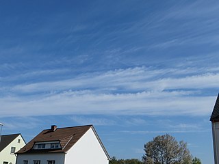
Cirrus is a genus of high cloud made of ice crystals. Cirrus clouds typically appear delicate and wispy with white strands. In the Earth's atmosphere, cirrus are usually formed when warm, dry air rises, causing water vapor deposition onto mineral dust and metallic particles at high altitudes. Globally, they form anywhere between 4,000 and 20,000 meters above sea level, with the higher elevations usually in the tropics and the lower elevations in more polar regions.

In meteorology, a cloud is an aerosol consisting of a visible mass of miniature liquid droplets, frozen crystals, or other particles suspended in the atmosphere of a planetary body or similar space. Water or various other chemicals may compose the droplets and crystals. On Earth, clouds are formed as a result of saturation of the air when it is cooled to its dew point, or when it gains sufficient moisture from an adjacent source to raise the dew point to the ambient temperature.

Cumulus clouds are clouds that have flat bases and are often described as puffy, cotton-like, or fluffy in appearance. Their name derives from the Latin cumulus, meaning "heap" or "pile". Cumulus clouds are low-level clouds, generally less than 2,000 m (6,600 ft) in altitude unless they are the more vertical cumulus congestus form. Cumulus clouds may appear by themselves, in lines, or in clusters.

Altocumulus is a middle-altitude cloud genus that belongs mainly to the stratocumuliform physical category, characterized by globular masses or rolls in layers or patches – the individual elements being larger and darker than those of cirrocumulus and smaller than those of stratocumulus. However, if the layers become tufted in appearance due to increased airmass instability, then the altocumulus clouds become more purely cumuliform in structure. Like other cumuliform and stratocumuliform clouds, altocumulus signifies convection. A sheet of partially conjoined altocumulus perlucidus is sometimes found preceding a weakening warm front, where the altostratus is starting to fragment, resulting in patches of altocumulus perlucidus between the areas of altostratus. Altocumulus is also commonly found between the warm and cold fronts in a depression, although this is often hidden by lower clouds.

Altostratus is a middle-altitude cloud genus made up of water droplets, ice crystals, or a mixture of the two. Altostratus clouds are formed when large masses of warm, moist air rise, causing water vapor to condense. Altostratus clouds are usually gray or blueish featureless sheets, although some variants have wavy or banded bases. The sun can be seen through thinner altostratus clouds, but thicker layers can be quite opaque.

A stratocumulus cloud, occasionally called a cumulostratus, belongs to a genus-type of clouds characterized by large dark, rounded masses, usually in groups, lines, or waves, the individual elements being larger than those in altocumulus, and the whole being at a lower height, usually below 2,000 metres (6,600 ft). Weak convective currents create shallow cloud layers because of drier, stable air above preventing continued vertical development. Historically, in English, this type of cloud has been referred to as a twain cloud for being a combination of two types of clouds.

A nimbostratus cloud is a multilevel, amorphous, nearly uniform, and often dark-grey cloud that usually produces continuous rain, snow, or sleet, but no lightning or thunder.

Cirrocumulus is one of the three main genus types of high-altitude tropospheric clouds, the other two being cirrus and cirrostratus. They usually occur at an altitude of 5 to 12 km, however they can occur as low as 10,000 ft (3.0 km) in the arctic and weather reporting standards such as the Canadian MANOBS suggests heights of 29,000 ft (8.8 km) in summer and 26,000 ft (7.9 km) in winter. Like lower-altitude cumuliform and stratocumuliform clouds, cirrocumulus signifies convection. Unlike other high-altitude tropospheric clouds like cirrus and cirrostratus, cirrocumulus includes a small amount of liquid water droplets, although these are in a supercooled state. Ice crystals are the predominant component, and typically, the ice crystals cause the supercooled water drops in the cloud to rapidly freeze, transforming the cirrocumulus into cirrostratus. This process can also produce precipitation in the form of a virga consisting of ice or snow. Thus, cirrocumulus clouds are usually short-lived. They usually only form as part of a short-lived transitional phase within an area of cirrus clouds and can also form briefly as a result of the breaking up of part of a cumulonimbus anvil.

Lenticular clouds are stationary clouds that form mostly in the troposphere, typically in parallel alignment to the wind direction. They are often comparable in appearance to a lens or saucer. Nacreous clouds that form in the lower stratosphere sometimes have lenticular shapes.

A warm front is a density discontinuity located at the leading edge of a homogeneous warm air mass, and is typically located on the equator-facing edge of an isotherm gradient. Warm fronts lie within broader troughs of low pressure than cold fronts, and move more slowly than the cold fronts which usually follow because cold air is denser and less easy to remove from the Earth's surface. This also forces temperature differences across warm fronts to be broader in scale. Clouds ahead of the warm front are mostly stratiform, and rainfall generally increases as the front approaches. Fog can also occur preceding a warm frontal passage. Clearing and warming is usually rapid after frontal passage. If the warm air mass is unstable, thunderstorms may be embedded among the stratiform clouds ahead of the front, and after frontal passage thundershowers may continue. On weather maps, the surface location of a warm front is marked with a red line of semicircles pointing in the direction of travel.

Cumulus congestus or towering cumulus clouds are a species of cumulus that can be based in the low- to middle-height ranges. They achieve considerable vertical development in areas of deep, moist convection. They are an intermediate stage between cumulus mediocris and cumulonimbus, sometimes producing rainshowers, snow, or ice pellets. Precipitation that evaporates before reaching the surface is virga.

The altocumulus undulatus is a mid-level cloud, usually white or grey with layers or patches containing undulations that resemble "waves" or "ripples" in water. Elements within the cloud are generally darker than those in cirrocumulus and smaller than those in stratocumulus. These clouds may appear both as patches or as covering the sky. The width of these clouds is generally less than 300 feet thick. The presence of altocumulus undulatus may indicate precipitation within the next 20 hours or simply an overcast day.
Cirrus castellanus or Cirrus castellatus is a species of cirrus cloud. Its name comes from the word castellanus, which means of a fort, of a castle in Latin. Like all cirrus, this species occurs at high altitudes. It appears as separate turrets rising from a lower-level cloud base. Often these cloud turrets form in lines, and they can be taller than they are wide. This cloud species is usually dense in formation.

Cirrocumulus castellanus or Cirrocumulus castellatus is a type of cirrocumulus cloud. Castellanus is from the Latin meaning "of a castle". These clouds appear as round turrets that are rising from either a lowered line or sheet of clouds. Cirrocumulus castellanus is an indicator of atmospheric instability at the level of the cloud. The clouds form when condensation occurs in the base cloud, causing latent heating to occur. This causes air to rise from the base cloud, and if the air ascends into conditionally unstable air, cirrocumulus castellanus will form.

Cirrocumulus floccus is a type of cirrocumulus cloud. The name cirrocumulus floccus is derived from Latin, meaning "a lock of wool". Cirrocumulus floccus appears as small tufts of cloud with rounded heads, but ragged bottoms. The cloud can produce virga, precipitation that evaporates before reaching the ground. Like cirrocumulus castellanus, cirrocumulus floccus is an indicator of atmospheric instability at the level of the cloud. In fact, cirrocumulus floccus can form from cirrocumulus castellanus, being the evolutionary state after the base of the original cloud has dissipated.

A castellanus, or castellatus, is a cloud that displays at least in its upper part cumuliform protuberances having the shape of turrets that give a crenellated aspect. Some of these turrets are higher than they are wide; they have a common base and seem to be arranged in a line. The castellanus characteristic is particularly obvious when the clouds are observed from the side.

Altocumulus floccus is a cloud type named for its tuft-like, wooly appearance. The base of the cloud can form as low as 2,000 metres (6,600 ft), or as high as 6,000 metres (20,000 ft). They often form in clusters, or patches, and bases can vary in height with differing atmospheric conditions within the PBL. They are similar to Altocumulus castellanus, but often have a shallower vertical extent in comparison.
