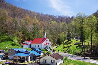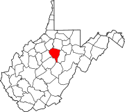
Kermit is a town in Mingo County, West Virginia, United States. The population was 406 at the 2010 census. Kermit is located along the Tug Fork, opposite Warfield, Kentucky. The Norfolk Southern Railway's Kenova District runs through town.

Accoville is an unincorporated community and census-designated place (CDP) in Logan County, West Virginia, United States. The community lies along Buffalo Creek. As of the 2010 United States Census, its population was 574.

Rosedale is an unincorporated community in Braxton and Gilmer counties in the U.S. state of West Virginia. It lies along the Right Fork Steer Creek, at an elevation of 778 feet (237 m).

Lashmeet is a census-designated place (CDP) in western Mercer County, West Virginia, United States. It lies along West Virginia Route 10 northwest of the city of Princeton, the county seat of Mercer County. Its elevation is 2,539 feet (774 m). Although Lashmeet is unincorporated, it has a post office, with the ZIP code of 24733. As of the 2010 census, its population was 479.

Alpoca is an unincorporated community in Wyoming County, West Virginia, United States, along Barkers Creek and West Virginia Route 10. The Alpoca Post Office has been closed.

Sarah Ann is a census-designated place (CDP) in Logan County, West Virginia, United States. The CDP includes the unincorporated community of Sarah Ann, plus the neighboring communities of Crystal Block and part of Stirrat. As of the 2010 census, the population of the CDP was 345.

Kistler is an unincorporated community and census-designated place (CDP) in Logan County, West Virginia, United States. As of the 2010 census, its population was 528.

Robinette is an unincorporated community and census-designated place (CDP) in Logan County, West Virginia, United States, along Buffalo Creek. Its population was 663 as of the 2010 census. Prior to 2010, Robinette was part of the Amherstdale-Robinette CDP.

Lundale is an unincorporated community in Logan County, West Virginia, United States. Lundale is 8.5 miles (13.7 km) northeast of Man, along Buffalo Creek.

Lorado is an unincorporated community in Logan County, West Virginia, United States. Lorado is 10 miles (16 km) east-northeast of Man, along Buffalo Creek. Lorado has a post office with ZIP code 25630.

Barnabus is an unincorporated community in Logan County, West Virginia, United States, along West Virginia Route 44 and Island Creek. Barnabus is 7.5 miles (12.1 km) south of Logan. Barnabus was named for one of its founding citizens, Barnabus Curry.

Omar is an unincorporated community and census-designated place (CDP) in Logan County, West Virginia, United States. Omar is located along West Virginia Route 44 and Island Creek, 6.5 miles (10.5 km) south of Logan. Omar has a post office with ZIP code 25638. As of the 2010 census, its population was 552.

Wilkinson is an unincorporated community in Logan County, West Virginia, United States. Wilkinson is located along West Virginia Route 44 and Island Creek, 1.5 miles (2.4 km) south of Logan. Wilkinson has a post office with ZIP code 25653.

Superior Bottom is an unincorporated community in Logan County, West Virginia, United States. Superior Bottom is located along West Virginia Route 44 and Island Creek, 7 miles (11 km) south of Logan.

Rossmore is an unincorporated community and census-designated place (CDP) in Logan County, West Virginia, United States, along West Virginia Route 44 and Island Creek. Its population was 301 as of the 2010 census.

Leading Creek is a tributary of the Little Kanawha River, 28.6 miles (46.0 km) long, in central West Virginia in the United States. Via the Little Kanawha and Ohio rivers, it is part of the watershed of the Mississippi River, draining an area of 147 square miles (380 km2) in a rural region on the unglaciated portion of the Allegheny Plateau.

Jerrys Run is an unincorporated community in Wood County, West Virginia, United States, located along Pond Creek.

Lowdell is an unincorporated community located in Wood County, West Virginia, United States, situated along Pond Creek.

Flinn is an unincorporated community in Wood County, West Virginia, United States, situated along Pond Creek.

Lillyhaven is an unincorporated community in Wyoming County, West Virginia, United States, along the Clear Fork.


