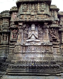
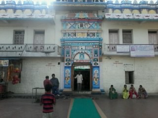
Pingali, Parbhani

Last updated

Pingali
Village/Railway station
India Maharashtra location map.svg
Red pog.svg
Pingali
Location in Maharashtra
India location map.svg
Red pog.svg
Pingali
Pingali (India)
Coordinates: 19°12′44″N76°51′15″E / 19.2121365°N 76.8541648°E / 19.2121365; 76.8541648 Coordinates: 19°12′44″N76°51′15″E / 19.2121365°N 76.8541648°E / 19.2121365; 76.8541648
CountryFlag of India.svg  India
State Maharashtra
District Parbhani
Government
  Type Gram panchayat
Elevation
414 m (1,358 ft)
Population
 (2011)
  Total6,403
Demonym(s) Pingalikar
Languages
  Official Marathi
Time zone UTC+5:30 (IST)
PIN
431402
Telephone code02452
Vehicle registration MH-22

Pingali also known as Pingali Kothala is a village and railway station in Parbhani taluka of Parbhani district in the Indian state of Maharashtra. [1]

Parbhani City in Maharashtra, India

Parbhani is a city in Maharashtra state of India. It is the administrative headquarters of Parbhani District. Parbhani is the fourth largest city in Marathwada region of Maharashtra after Aurangabad, Nanded and Latur. Parbhani is around 200 kilometres (120 mi) away from regional headquarters of Aurangabad while it is 491 km (305 mi) away from the state capital Mumbai.

Parbhani district District of Maharashtra in India

Parbhani district, is one of the eight districts in the Marathawada region of Maharashtra state of India. Parbhani city is the headquarters of this district. Parbhani district is well known for religious tourism of Jainism, Hinduism

Maharashtra State in western India

Maharashtra is a state in the western peninsular region of India occupying a substantial portion of the Deccan Plateau. It is the second-most populous state and third-largest state by area in India. Spread over 307,713 km2 (118,809 sq mi), it is bordered by the Arabian Sea to the west, the Indian states of Karnataka and Goa to the south, Telangana to the southeast and Chhattisgarh to the east, Gujarat and Madhya Pradesh to the north, and the Indian union territory of Dadra and Nagar Haveli to the north west. It is also the world's second-most populous subnational entity.

Contents

Demography

According to the 2011 census of India, Pingali had 1,345 households and a population of 6,403, of which 3,222 were male and 3,181 were female. The average sex ratio of the village was 987, which was higher than the Maharashtra state average of 929. The literacy rate was 71% compared to 82.3% for the state. Male literacy rate was 81% while female literacy rate was 61%.

The 2001 Census of India was the 14th in a series of censuses held in India every decade since 1871.

Schedule Caste constituted 19% of total population.

Pingali Railway Station

Pingali Railway Station is away from village Pingali Kothala.

ParameterDetail
Station codePIZ
Zone SCR (South Central)
Division Hazur Sahib Nanded
District Parbhani
Platforms4
Halting Trains21
TrackDiesel

Geography and Transport

Following table shows distance of Pingali from some of major cities.

CityDistance (km)
Nanded 64
Purna 31
Manwath 33
Parbhani 10
Aurangabad 212
Mumbai 483

Related Research Articles

Sailu City in Maharashtra, India

Sailu also known as Selu is a city and a municipal council in Parbhani district in the Indian state of Maharashtra.

Aundha Nagnath town in Maharashtra, India

Aundha Naganath is a town and a tehsil in Basmat Subdivision of Hingoli district in Marathwada region of the Indian state of Maharashtra.

Pokharni village in Maharashtra, India

Pokharni is a village ,located in the Parbhani District of the Marathawada region of Maharashtra State of India. It is known for a temple dedicated to Narasimha.

Ashti, Jalna Village in Maharashtra, India

Ashti is a major village in Partur taluka of Jalna district in Maharashtra state of India.

Zari, Parbhani Village in Maharashtra, India

Zari is a major village in Parbhani taluka of Parbhani district of Maharashtra state in India.

Palam, Parbhani Town in Maharashtra, India

Palam is a town and a headquarter of Palam taluka. It's located in Parbhani district which is part of State of Maharashtra in India.

Manwath Road Village/Railway station in Maharashtra, India

Manwath Road is a village in Manwath taluka of Parbhani district of Indian state of Maharashtra. Village is mainly known for being a major railway station on Nanded-Aurangabad rail route. Station code of Manwath road is MVO. It is 8 km away from taluka headquarter Manwath.

Ranisawargaon Village in Maharashtra, India

Ranisawargaon also Rani Sawargaon, is a major village in Gangakhed taluka of Parbhani district in Indian state of Maharashtra.

Chudawa Village/Railway station in Maharashtra, India

Chudawa or Chudava is a village and railway station on Purna taluka of Parbhani district in Indian state of Maharashtra. It is 12 km away from Purna.

Mirkhel Village/Railway station in Maharashtra, India

Mirkhel is a village and railway station in Parbhani taluka of Parbhani district in the Indian state of Maharashtra.

Pedgaon, Parbhani Village/Railway station in Maharashtra, India

Pedgaon is a major village and railway station in Parbhani district in Indian state of Maharashtra.

Sendra Village in Maharashtra, India

Sendra also known as Shendra is a village in Parbhani taluka of Parbhani district of Maharashtra state in India.

Dharmapuri, Parbhani Village in Maharashtra, India

Dharmapuri is a village in Parbhani taluka of Parbhani district of Maharashtra state in India.

Takli Kumbhakarna Village in Maharashtra, India

Takli Kumbhakarna also known as Takli is a village in Parbhani taluka of Parbhani district of Maharashtra state in India.

Nandkheda, Parbhani Village in Maharashtra, India

Nandkheda is a village in Parbhani taluka of Parbhani district of Maharashtra state in India.

Takli Bobade Village in Maharashtra, India

Takli Bobade is a village in Parbhani taluka of Parbhani district of Maharashtra state in India.

Shahapur, Parbhani Village in Maharashtra, India

Shahapur is a village in Parbhani taluka of Parbhani district of Maharashtra state in India.

Jamb, Parbhani Village in Maharashtra, India

Jamb also known as Jam is a village in Parbhani taluka of Parbhani district of Maharashtra state in India.

Bramhangaon, Parbhani Village in Maharashtra, India

Bramhangaon also known as Bramangaon is a village in Parbhani taluka of Parbhani district of Maharashtra state in India.

Wangi, Parbhani Village in Maharashtra, India

Wangi is a village in Parbhani taluka of Parbhani district of Maharashtra state in India.

References

  1. "PIZ/Pingli (1 PFs) - Train Departure Timings". India Rail Info. 26 April 2010. Retrieved 13 September 2015.