
Gangakhed is a city on banks of Godavari River and a municipal council in Parbhani district in the state of Maharashtra, India. It is also known as Dakshin Kashi. It is also the second largest city In Parbhani District.

Partur is a town with municipal council in Jalna district in the Indian state of Maharashtra.
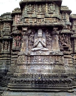
Aundha Naganath is a town in the Aundha Nagnath subdivision of Hingoli district. It lies in the Marathwada region of the Indian state of Maharashtra. The town is known for the Aundha Nagnath Temple, which is dedicated to Shiva. The famous tourist spot along with the Temple includes the beautiful Garden and the Reserved Forest Region on the outskirts of the town.
Navipet is a Mandal in Nizamabad district in the state of Telangana in India Navipet is top mandal in Nizamabad district Which has good market value for crops and small revenue business. Navipet lies on Nizamabad Bhainsa main road. Navipet is famous for weekly goats market.
Pokharni is a village located in the Parbhani District of the Marathawada region of Maharashtra State of India. It is known for a temple dedicated to Narasimha.
Anjani Khurd is a village in Lonar taluka, Buldhana district, Maharashtra, India.Khurd and Kalan Persian language word which means small and Big respectively when two villages have same name then it is distinguished as Kalan means Big and Khurd means Small with Village Name.
Amboli is a village in Rajgurunagar (Khed) Taluka of Pune district in Maharashtra state of India.
Sonkhed is a village in Loha taluka of Nanded district in Maharashtra state of India.
Ashti is a major village in Partur taluka of Jalna district in Maharashtra state of India.
Zari is a major village in Parbhani taluka of Parbhani district of Maharashtra state in India.
Palam is a town and a headquarter of Palam taluka. It's located in Parbhani district which is part of State of Maharashtra in India.
Manwath Road is a village in Manwath taluka of Parbhani district of Indian state of Maharashtra. Village is mainly known for being a major railway station on Nanded-Aurangabad rail route. Station code of Manwath road is MVO. It is 8 km away from taluka headquarter Manwath.
Wanegaon is a village in Nanded taluka of Nanded district of the Indian state of Maharashtra. It is also a railway station on the Nanded-Aurangabad route. The village is 3 kilometres (1.9 mi) away from Nanded Airport.
Limbgaon is a village and railway station in Nanded taluka of Nanded district of Indian state of Maharashtra. It is located 14 km away from Nanded.
Chudawa or Chudava is a village and railway station on Purna taluka of Parbhani district in Indian state of Maharashtra. It is 12 km away from Purna.
Vishnupuri is a village in Nanded taluka of Nanded district in the Indian state of Maharashtra. It is 10 kilometres (6.2 mi) from Nanded city on the Nanded-Latur highway. Though it is a village, it is now a suburb of the city due its close proximity and rapid urbanisation. Swami Ramanand Teerth Marathwada University, Shri Guru Gobind Singhji Institute of Engineering and Technology and Shankarrao Chavan Government Medical College, Nanded are located there

Chak Sahbu is a small village in Jalandhar District of Punjab State, India. The village is administrated by Sarpanch who is elected representative of village. It is located 49 km towards East from Jalandhar, 14 km from Phillaur and 119 km from Chandigarh. The nearest census town and marketplace is located 1 km in Apra, Punjab. The nearest train station is situated 13.9 km away in Phillaur, nearest domestic airport is at Ludhiana and the nearest international airport is 143 km away in Amritsar.
Tadpangari is a village in Parbhani taluka of Parbhani district in Indian state of Maharashtra. Village has a health Sub-centre which works under Primary Health Centre of Daithana. Village is located on Parbhani-Gangakhed state highway.
Allowal is a medium size village in Phillaur tehsil of Jalandhar District of Punjab State, India. It is located 5 km away from postal head office Phillaur, 14.8 km from Goraya, 48 km from Jalandhar and 111 km from state capital Chandigarh. The village is administrated by a sarpanch who is an elected representative of village as per Panchayati raj (India).
Bakapur is a village in Phillaur tehsil of Jalandhar district of Punjab State, India. It is located 7 km away from postal head office in Phillaur, 10 km from Goraya, 41.5 km from district headquarter Jalandhar and 115 km from state capital Chandigarh. The village is administrated by a sarpanch who is an elected representative of village as per Panchayati raj (India).

