Mason County is a county in the U.S. state of West Virginia. As of the 2020 census, the population was 25,453. Its county seat and largest city is Point Pleasant. The county was founded in 1804 and named for George Mason, delegate to the U.S. Constitutional Convention. Before the Civil War, the county was in the State of Virginia.

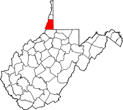
Marshall County is a county in the U.S. state of West Virginia. At the 2020 census, the population was 30,591. Its county seat is Moundsville. With its southern border at what would be a continuation of the Mason-Dixon line to the Ohio River, it forms the base of the Northern Panhandle of West Virginia.

Hampshire County is a county in the U.S. state of West Virginia. As of the 2020 census, the population was 23,093. Its county seat is Romney, West Virginia's oldest town (1762). The county was created by the Virginia General Assembly in 1754, from parts of Frederick and Augusta Counties (Virginia) and is the state's oldest county. The county lies in both West Virginia's Eastern Panhandle and Potomac Highlands regions.

Point Pleasant is a city in and the county seat of Mason County, West Virginia, United States, at the confluence of the Ohio and Kanawha Rivers. The population was 4,101 at the 2020 census. It is the principal city of the Point Pleasant micropolitan area extending into Ohio. The town is best known for the Mothman, a purported humanoid creature reportedly sighted in the area that has become a part of West Virginia folklore.

Wheeling is a city in Ohio and Marshall counties in the U.S. state of West Virginia. The county seat of Ohio County, it lies along the Ohio River in the foothills of the Appalachian Mountains within the state's Northern Panhandle. As of the 2020 census, the city had a population of 27,062, making it the fifth-most populous city in West Virginia and the most populous in the Northern Panhandle. The Wheeling metropolitan area had a population of 139,513 in 2020. Wheeling is located about 60 miles (97 km) west of Pittsburgh and 120 miles (190 km) east of Columbus via Interstate 70.

The Kanawha River is a tributary of the Ohio River, approximately 97 mi (156 km) long, in the U.S. state of West Virginia. The largest inland waterway in West Virginia, its watershed has been a significant industrial region of the state since early in the 19th century.
Pleasant Valley may refer to:

Marshall is a census-designated place (CDP) in northwestern Fauquier County, Virginia, in the United States. The population as of the 2010 census was 1,480.

Willard was an unincorporated community located in what is now a part of Washington Dulles International Airport in the U.S. state of Virginia.

The Weirton–Steubenville, WV–OH Metropolitan Statistical Area, also known as the Upper Ohio Valley, is a metropolitan statistical area consisting of two counties in the Northern Panhandle of West Virginia and one in Ohio, anchored by the cities of Weirton and Steubenville. As of the 2020 census, the MSA had a population of 116,903. This puts it at 334th largest in the United States. It is also included in the larger Pittsburgh–New Castle–Weirton, PA–OH–WV Combined Statistical Area.

U.S. Route 119 (US 119) travels through Connellsville, Greensburg, and Punxsutawney, and bypasses Uniontown and Indiana. There are numerous other boroughs and villages along its 133-mile (214 km) route in the Keystone State. The southern entrance of US 119 is at the West Virginia state line one-half-mile south of Point Marion. The northern terminus is at US 219 two miles (3 km) south of DuBois, Pennsylvania. US 119 is in the National Highway System from the West Virginia state line to Exit 0 of PA Turnpike 66, and from US 22 to US 219. From US 22 to US 219, the highway carries the name of the Buffalo-Pittsburgh Highway; from US 22 to PA 56, it is also known as the Patrick J. Stapleton Highway; near Uniontown, it bears the name George C. Marshall Parkway.

Four Mile, historically called Moss City, is an unincorporated community in Custer County, South Dakota, United States, located 4 miles (6.4 km) west of Custer at the junction of U.S. Route 16 and Pleasant Valley Road.

The 1996 United States presidential election in West Virginia took place on November 5, 1996, as part of the 1996 United States presidential election. Voters chose five representatives, or electors to the Electoral College, who voted for president and vice president.
Sugar Valley is an unincorporated community in Pleasants County, West Virginia, United States. The community is located at the confluence of Sugar Creek and Middle Island Creek.
Ruraldale is an unincorporated community in Upshur County, West Virginia, United States. It lies along Hacker's Creek Road. Ruraldale is home to one place of worship, Pleasant Valley Methodist Church.

Virgil Anson Lewis was a lawyer, teacher and historian of the U.S. state of West Virginia, as well as mayor of Mason City, West Virginia. His state history was used in West Virginia schools for five decades; Lewis was the first State Historian and Archivist of West Virginia (1905–1912).

The 1976 United States presidential election in West Virginia took place on November 2, 1976, in West Virginia as part of the 1976 United States presidential election. The two major party candidates, Republican Gerald Ford and Democrat Jimmy Carter were the only candidates to appear on the state's ballot.
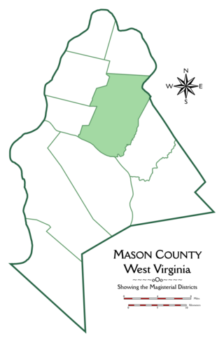
Cooper Magisterial District is one of ten magisterial districts in Mason County, West Virginia, United States. The district was originally established as a civil township in 1863, and converted into a magisterial district in 1872. In 2020, Cooper District was home to 1,700 people.