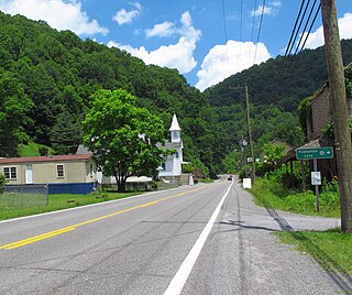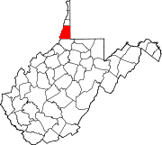
Ennis is an unincorporated community in McDowell County, West Virginia, United States. Ennis lies on U.S. Route 52 west of Switchback.

Gilliam is an unincorporated community on the North Fork River in McDowell County, West Virginia, United States. It lies between Algoma and Rolfe along County Route 17.

McConnell is an unincorporated community and census-designated place (CDP) in Logan County, West Virginia, United States, on the Guyandotte River. As of the 2010 census, its population was 514. It was established in 1933.

Isaban is an unincorporated community located on Fourpole Creek, in McDowell and Mingo counties in the U.S. state of West Virginia.

Smoot is an unincorporated community in western Greenbrier County, West Virginia, United States. It lies south of the interchange of Interstate 64 and U.S. Route 60 northwest of the city of Lewisburg, the county seat of Greenbrier County. Its elevation is 2,480 feet (756 m). Although it is unincorporated, it has a post office, with the ZIP code of 24977.

Mohegan is an unincorporated community on the Tug Fork River in McDowell County, West Virginia, United States. It sits at an altitude of 1,230 feet.

Powhatan is an unincorporated community in McDowell County, West Virginia located approximately one mile from Northfork, West Virginia.

Six is an unincorporated community in McDowell County, West Virginia, United States. Six is located on West Virginia Route 16 5 miles (8.0 km) southwest of Welch.

Superior is an unincorporated community in McDowell County, West Virginia, United States. Superior is located on U.S. Route 52 2.5 miles (4.0 km) east-southeast of Welch.

Leckie is an unincorporated community in McDowell County, West Virginia, United States. Leckie is 1 mile (1.6 km) northeast of Anawalt.

Twin Branch is an unincorporated community in McDowell County, West Virginia, United States. Twin Branch is 1 mile (1.6 km) west-southwest of Davy. It was founded by Henry Ford as a mining community.

Vallscreek is an unincorporated community in McDowell County, West Virginia, United States. Vallscreek is 5.5 miles (8.9 km) south-southeast of War. It was also known as Hartwell.

McDowell is an unincorporated community in McDowell County, West Virginia, United States. McDowell is 3.5 miles (5.6 km) east-southeast of Northfork.

Worth is an unincorporated community in McDowell County, West Virginia, United States. Worth is 3 miles (4.8 km) east of Northfork.

Lex is an unincorporated community in McDowell County, West Virginia, United States. Lex is located on West Virginia Route 80 1.3 miles (2.1 km) north of Bradshaw.

Litwar is an unincorporated community in McDowell County, West Virginia, United States. Litwar is located on the Tug Fork 2 miles (3.2 km) west-northwest of Iaeger.

McAlpin is an unincorporated community in Raleigh County, West Virginia, United States. McAlpin is located on County Route 30 and Winding Gulf 1.9 miles (3.1 km) west-southwest of Sophia.

McCreery is an unincorporated community in Raleigh County, West Virginia.

Prudence is an unincorporated community and coal town in Fayette County, West Virginia.

MacDonald is an unincorporated community and coal town in Fayette County, West Virginia, United States.


