Powhattan Township | |
|---|---|
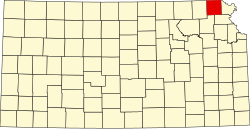
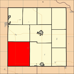 Location in Brown County | |
| Coordinates: 39°42′48″N095°41′11″W / 39.71333°N 95.68639°W | |
| Country | United States |
| State | Kansas |
| County | Brown |
| Area | |
• Total | 89.82 sq mi (232.63 km2) |
| • Land | 89.76 sq mi (232.49 km2) |
| • Water | 0.054 sq mi (0.14 km2) 0.06% |
| Elevation | 1,096 ft (334 m) |
| Population (2000) | |
• Total | 874 |
| • Density | 9.8/sq mi (3.8/km2) |
| GNIS feature ID | 0472964 |
Powhattan Township is a township in Brown County, Kansas, United States. As of the 2000 census, its population was 874.