Sabetha, Kansas

Last updated

Sabetha, Kansas
Sabetha, Kansas post office from NW 2 long.JPG
US Post Office in Sabetha (2015)
SabethaKansasSeal.png
Nemaha County Kansas Incorporated and Unincorporated areas Sabetha Highlighted.svg
Location within Nemaha County and Kansas
Map of Nemaha Co, Ks, USA.png
Coordinates: 39°54′46″N95°47′29″W / 39.91278°N 95.79139°W / 39.91278; -95.79139 [1]
Country United States
State Kansas
Counties Brown, Nemaha
Founded1854
Incorporated 1874
Named for Sabbath
Area
[2]
  Total3.20 sq mi (8.30 km2)
  Land3.19 sq mi (8.26 km2)
  Water0.01 sq mi (0.03 km2)
Elevation
[1]
1,273 ft (388 m)
Population
 (2020) [3]
  Total2,545
  Density800/sq mi (310/km2)
Time zone UTC−6 (CST)
  Summer (DST) UTC−5 (CDT)
ZIP Code
66534
Area code 785
FIPS code 20-62025
GNIS ID 485648 [1]
Website cityofsabetha.com

Sabetha is a city in Brown and Nemaha counties in the U.S. state of Kansas. [1] As of the 2020 census, the population of the city was 2,545. [3]

Contents

History

Sabetha as seen in 1913 Sabetha, KS (1913).jpg
Sabetha as seen in 1913

The town's settlement began circa 1854, with a name reportedly derived from the word "Sabbath", the day the first settler arrived. [4] Sabetha was incorporated as a city in 1874. [5]

On the evening of June 13, 1998, an F2 tornado damaged much of the downtown, but no casualties were reported. The downtown area received little warning as the tornado struck less than 1 minute after the tornado siren began to sound. [6] The tornado, which touched down half a mile west of the Sabetha City Hall, caused serious damage to two blocks of the town, with 18 buildings in the downtown area being damaged, five (including the city hall building) to near "the point of loss". The tornado lifted about half a mile east of City Hall. Damage to the city hall building amounted to $2 million, and additional damage to homes and vehicles away from downtown occurred due to tornado-toppled trees and branches away from the tornado's center along with strong straight-line winds. [7]

Geography

According to the United States Census Bureau, the city has a total area of 3.47 square miles (8.99 km2), of which, 3.46 square miles (8.96 km2) is land and 0.01 square miles (0.03 km2) is water. [8]

Demographics

Historical population
CensusPop.Note
1880 849
1890 1,36861.1%
1900 1,64620.3%
1910 1,7687.4%
1920 2,00313.3%
1930 2,33216.4%
1940 2,241−3.9%
1950 2,173−3.0%
1960 2,3186.7%
1970 2,3762.5%
1980 2,297−3.3%
1990 2,3411.9%
2000 2,58910.6%
2010 2,571−0.7%
2020 2,545−1.0%
U.S. Decennial Census

2010 census

As of the census [9] of 2010, there were 2,571 people, 1,090 households, and 645 families living in the city. The population density was 743.1 inhabitants per square mile (286.9/km2). There were 1,230 housing units at an average density of 355.5 per square mile (137.3/km2). The racial makeup of the city was 96.6% White, 0.9% African American, 0.5% Native American, 0.1% Asian, 0.1% Pacific Islander, 0.5% from other races, and 1.3% from two or more races. Hispanic or Latino of any race were 1.0% of the population.

There were 1,090 households, of which 27.4% had children under the age of 18 living with them, 49.4% were married couples living together, 6.6% had a female householder with no husband present, 3.1% had a male householder with no wife present, and 40.8% were non-families. Of all households, 37.2% were made up of individuals, and 20.5% had someone living alone who was 65 years of age or older. The average household size was 2.24 and the average family size was 2.97.

The median age in the city was 42.8 years. 25% of residents were under the age of 18; 5.4% were between the ages of 18 and 24; 22.3% were from 25 to 44; 23.1% were from 45 to 64; and 24.2% were 65 years of age or older. The gender makeup of the city was 47.5% male and 52.5% female.

2000 census

As of the census [10] of 2000, there were 2,589 people, 958 households, and 611 families living in the city. The population density was 798.8 inhabitants per square mile (308.4/km2). There were 1,049 housing units at an average density of 323.6 per square mile (124.9/km2). The racial makeup of the city was 97.76% White, 0.93% African American, 0.15% Native American, 0.19% Asian, 0.04% Pacific Islander, 0.19% from other races, and 0.73% from two or more races. Hispanic or Latino of any race were 0.31% of the population.

There were 958 households, out of which 30.1% had children under the age of 18 living with them, 55.7% were married couples living together, 5.7% had a female householder with no husband present, and 36.2% were non-families. Of all households, 34.0% were made up of individuals, and 19.1% had someone living alone who was 65 years of age or older. The average household size was 2.33 and the average family size was 3.01.

In the city, the population was spread out, with 23.4% under the age of 18, 6.4% from 18 to 24, 22.8% from 25 to 44, 17.3% from 45 to 64, and 30.2% who were 65 years of age or older. The median age was 43 years. For every 100 females, there were 85.3 males. For every 100 females age 18 and over, there were 82.4 males.

The median income for a household in the city was $36,450, and the median income for a family was $45,000. Males had a median income of $31,958 versus $21,458 for females. The per capita income for the city was $22,126. About 3.7% of families and 7.0% of the population were below the poverty line, including 8.8% of those under age 18 and 7.3% of those age 65 or over.

Economy

Sabetha has more jobs than residents, due in part to the large Wenger Manufacturing plant that produces extruders and related equipment. Schenck Process (formerly MAC Equipment) is also a large employer in the area, manufacturing bulk material handling and air filtration equipment. KSi Conveyors and USC are other notable employers in the area. The city managers estimate that the city has a poll factor of 2 to 1, meaning that the city has nearly 5000 jobs, while only having 2500 residents. Many of the small neighboring cities are bedroom communities for the many people who commute to work in Sabetha.

Education

The community is served by Prairie Hills USD 113 public school district, [11] a public school district formed in 2010 by the merger of Sabetha USD 441 and Axtel USD 488. [12]

Notable people

Related Research Articles

<span class="mw-page-title-main">Nemaha County, Kansas</span> County in Kansas, United States

Nemaha County is a county located in the northeastern part of the U.S. state of Kansas. Its county seat is Seneca. As of the 2020 census, the county population was 10,273. The county was named for the Nemaha River.

<span class="mw-page-title-main">Marshall County, Kansas</span> County in Kansas, United States

Marshall County is a county located in the U.S. state of Kansas. Its county seat and largest city is Marysville. As of the 2020 census, the county population was 10,038. The county was named after Frank J. Marshall, a state representative who operated the first ferry over the Big Blue River.

<span class="mw-page-title-main">Hardtner, Kansas</span> City in Kiowa County, Kansas

Hardtner is a city in Barber County, Kansas, United States. As of the 2020 census, the population of the city was 167. It is located 1 mile north of the Kansas / Oklahoma state border.

<span class="mw-page-title-main">Fairview, Kansas</span> City in Brown County, Kansas

Fairview is a city in Brown County, Kansas, United States. As of the 2020 census, the population of the city was 240.

<span class="mw-page-title-main">Morrill, Kansas</span> City in Brown County, Kansas

Morrill is a city in Brown County, Kansas, United States. As of the 2020 census, the population of the city was 218.

<span class="mw-page-title-main">Udall, Kansas</span> City in Cowley County, Kansas

Udall is a city in Cowley County, Kansas, United States. As of the 2020 census, the population of the city was 661.
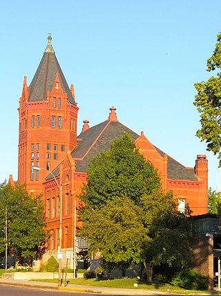
<span class="mw-page-title-main">Hill City, Kansas</span> City in Graham County, Kansas

Hill City is a city and county seat of Graham County, Kansas, United States. As of the 2020 census, the population of the city was 1,403.

<span class="mw-page-title-main">Eureka, Kansas</span> City in Greenwood County, Kansas

Eureka is a city in and the county seat of Greenwood County, Kansas, United States. As of the 2020 census, the population of the city was 2,332.

<span class="mw-page-title-main">Attica, Kansas</span> City in Harper County, Kansas

Attica is a city in Harper County, Kansas, United States. As of the 2020 census, the population of the city was 516. The town was named after the historical region of Attica, in Greece.

<span class="mw-page-title-main">Soldier, Kansas</span> City in Jackson County, Kansas

Soldier is a city in Jackson County, Kansas, United States. As of the 2020 census, the population of the city was 102.

<span class="mw-page-title-main">Pleasanton, Kansas</span> City in Kansas, United States

Pleasanton is a city in Linn County, Kansas, United States. As of the 2020 census, the population of the city was 1,208.

<span class="mw-page-title-main">Reading, Kansas</span> City in Lyon County, Kansas

Reading is a city in Lyon County, Kansas, United States. As of the 2020 census, the population of the city was 181.

<span class="mw-page-title-main">Axtell, Kansas</span> City in Marshall County, Kansas

Axtell is a city in Marshall County, Kansas, United States. As of the 2020 census, the population of the city was 399.

<span class="mw-page-title-main">Bern, Kansas</span> City in Nemaha County, Kansas

Bern is a city in Nemaha County, Kansas, United States. As of the 2020 census, the population of the city was 161.

<span class="mw-page-title-main">Wetmore, Kansas</span> City in Nemaha County, Kansas

Wetmore is a city in Nemaha County, Kansas, United States. As of the 2020 census, the population of the city was 348.

<span class="mw-page-title-main">Rozel, Kansas</span> City in Pawnee County, Kansas, United States

Rozel is a city in Pawnee County, Kansas, United States. As of the 2020 census, the population of the city was 102.

<span class="mw-page-title-main">Haysville, Kansas</span> City in Sedgwick County, Kansas

Haysville is a city in Sedgwick County, Kansas, United States, and a suburb of Wichita. As of the 2020 census, the population of the city was 11,262. Haysville is known as the "Peach Capital of Kansas".

<span class="mw-page-title-main">Selden, Kansas</span> City in Sheridan County, Kansas

Selden is a city in Sheridan County, Kansas, United States. As of the 2020 census, the population of the city was 184.

<span class="mw-page-title-main">Harveyville, Kansas</span> City in Wabaunsee County, Kansas

Harveyville is a city in Wabaunsee County, Kansas, United States. As of the 2020 census, the population of the city was 178. It is located 8.5 miles (13.7 km) northwest of the city of Burlingame.

<span class="mw-page-title-main">Greenleaf, Kansas</span> City in Washington County, Kansas

Greenleaf is a city in Washington County, Kansas, United States. As of the 2020 census, the population of the city was 350.

References

  1. 1 2 3 4 U.S. Geological Survey Geographic Names Information System: Sabetha, Kansas
  2. "2019 U.S. Gazetteer Files". United States Census Bureau. Retrieved July 24, 2020.
  3. 1 2 "Profile of Sabetha, Kansas in 2020". United States Census Bureau. Archived from the original on June 10, 2022. Retrieved June 9, 2022.
  4. Hrnicek, Alice (15 September 1982). Business, farming strengthen town, St. Joseph Gazette, pg. C1.
  5. Blackmar, Frank Wilson (1912). Kansas: A Cyclopedia of State History, Volume 2. Standard Publishing Company. pp.  617.
  6. (15 June 1998). Twister rips up downtown Sabetha, Lawrence Journal-World, Page 1B
  7. Kansas Event Report: F2 Tornado (Report). National Centers for Environmental Information. 1998. Retrieved February 25, 2017.
  8. "US Gazetteer files 2010". United States Census Bureau. Archived from the original on January 25, 2012. Retrieved July 6, 2012.
  9. "U.S. Census website". United States Census Bureau . Retrieved July 6, 2012.
  10. "U.S. Census website". United States Census Bureau . Retrieved January 31, 2008.
  11. "USD 273 Map" (PDF). Kansas Department of Transportation . Retrieved April 29, 2020.
  12. "School consolidations in Kansas for past decade". The Topeka Capital-Journal . July 24, 2011. Retrieved April 26, 2020.