Walnut Township, Brown County, Kansas

Last updated

Walnut Township
Map highlighting Walnut Township, Brown County, Kansas.svg
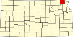
Location in Brown County
Coordinates: 39°50′38″N095°41′16″W / 39.84389°N 95.68778°W / 39.84389; -95.68778
Country United States
State Kansas
County Brown
Area
  Total
62.49 sq mi (161.86 km2)
  Land62.21 sq mi (161.12 km2)
  Water0.29 sq mi (0.74 km2)  0.46%
Elevation
1,109 ft (338 m)
Population
 (2000)
  Total
665
  Density11/sq mi (4.1/km2)
GNIS feature ID 0472753

Walnut Township is a township in Brown County, Kansas, United States. As of the 2000 census, its population was 665.

Contents

History

Walnut Township was formed in 1872. [1]

Geography

Walnut Township covers an area of 62.49 square miles (161.8 km2) and contains one incorporated settlement, Fairview. According to the USGS, it contains six cemeteries: Congregational, Fairview, Isley, Lambertson, Saint Paul and Shelton.

The streams of Mulberry Creek, Noharts Creek and Spring Creek run through this township.

References

  1. History of the State of Kansas: Containing a Full Account of Its Growth from an Uninhabited Territory to a Wealthy and Important State. A. T. Andreas. 1883. p. 710.