Oneida, Kansas

Last updated

Oneida, Kansas
Nemaha County Kansas Incorporated and Unincorporated areas Oneida Highlighted.svg
Location within Nemaha County and Kansas
Map of Nemaha Co, Ks, USA.png
Coordinates: 39°52′00″N95°56′23″W / 39.86667°N 95.93972°W / 39.86667; -95.93972 [1]
Country United States
State Kansas
County Nemaha
Platted 1873
Incorporated 1884
Named for Oneida people
Area
[2]
  Total0.23 sq mi (0.60 km2)
  Land0.23 sq mi (0.60 km2)
  Water0.00 sq mi (0.00 km2)
Elevation
[1]
1,273 ft (388 m)
Population
 (2020) [3]
  Total61
  Density270/sq mi (100/km2)
Time zone UTC-6 (CST)
  Summer (DST) UTC-5 (CDT)
ZIP code
66522
Area code 785
FIPS code 20-52900
GNIS ID 2396068 [1]

Oneida is a city in Nemaha County, Kansas, United States. [1] As of the 2020 census, the population of the city was 61. [3]

Contents

History

Oneida was laid out about 1873. [4] It was named after the Oneida people. [5] The town's streets were named after the main thoroughfares of Chicago. [4]

Geography

According to the United States Census Bureau, the city has a total area of 0.24 square miles (0.62 km2), all of it land. [6]

Demographics

Historical population
CensusPop.Note
1880 163
1890 31190.8%
1900 279−10.3%
1910 211−24.4%
1920 27630.8%
1930 224−18.8%
1940 187−16.5%
1950 138−26.2%
1960 119−13.8%
1970 112−5.9%
1980 1207.1%
1990 79−34.2%
2000 70−11.4%
2010 757.1%
2020 61−18.7%
U.S. Decennial Census

2020 census

The 2020 United States census counted 61 people, 9 households, and 5 families in Oneida. [7] [8] The population density was 265.2 per square mile (102.4/km2). There were 26 housing units at an average density of 113.0 per square mile (43.6/km2). [8] [9] The racial makeup was 91.8% (56) white or European American (91.8% non-Hispanic white), 0.0% (0) black or African-American, 1.64% (1) Native American or Alaska Native, 0.0% (0) Asian, 0.0% (0) Pacific Islander or Native Hawaiian, 0.0% (0) from other races, and 6.56% (4) from two or more races. [10] Hispanic or Latino of any race was 4.92% (3) of the population. [11]

Of the 9 households, 11.1% had children under the age of 18; 55.6% were married couples living together; 0.0% had a female householder with no spouse or partner present. 33.3% of households consisted of individuals and 22.2% had someone living alone who was 65 years of age or older. [8] The average household size was 2.6 and the average family size was 4.7. [12] The percent of those with a bachelor’s degree or higher was estimated to be 3.3% of the population. [13]

37.7% of the population was under the age of 18, 13.1% from 18 to 24, 16.4% from 25 to 44, 24.6% from 45 to 64, and 8.2% who were 65 years of age or older. The median age was 23.9 years. For every 100 females, there were 110.3 males. [8] For every 100 females ages 18 and older, there were 100.0 males. [8]

The 2016-2020 5-year American Community Survey estimates show that the median household income was $21,435 (with a margin of error of +/- $762). [14] Males had a median income of $18,981 (+/- $3,010). The median income for those above 16 years old was $17,870 (+/- $3,910). [15] Approximately, 50.0% of families and 47.7% of the population were below the poverty line, including 51.4% of those under the age of 18 and 25.0% of those ages 65 or over. [16] [17]

2010 census

As of the census [18] of 2010, there were 75 people, 26 households, and 17 families living in the city. The population density was 312.5 inhabitants per square mile (120.7/km2). There were 34 housing units at an average density of 141.7 per square mile (54.7/km2). The racial makeup of the city was 98.7% White and 1.3% African American.

There were 26 households, of which 38.5% had children under the age of 18 living with them, 65.4% were married couples living together, and 34.6% were non-families. 23.1% of all households were made up of individuals, and 3.8% had someone living alone who was 65 years of age or older. The average household size was 2.88 and the average family size was 3.59.

The median age in the city was 34.5 years. 36% of residents were under the age of 18; 4% were between the ages of 18 and 24; 28% were from 25 to 44; 20.1% were from 45 to 64; and 12% were 65 years of age or older. The gender makeup of the city was 46.7% male and 53.3% female.

2000 census

As of the census [19] of 2000, there were 70 people, 25 households, and 18 families living in the city. The population density was 302.1 inhabitants per square mile (116.6/km2). There were 36 housing units at an average density of 155.3 per square mile (60.0/km2). The racial makeup of the city was 97.14% White and 2.86% African American.

There were 25 households, out of which 40.0% had children under the age of 18 living with them, 60.0% were married couples living together, 8.0% had a female householder with no husband present, and 28.0% were non-families. 28.0% of all households were made up of individuals, and 20.0% had someone living alone who was 65 years of age or older. The average household size was 2.80 and the average family size was 3.50.

In the city, the population was spread out, with 30.0% under the age of 18, 8.6% from 18 to 24, 28.6% from 25 to 44, 18.6% from 45 to 64, and 14.3% who were 65 years of age or older. The median age was 33 years. For every 100 females, there were 133.3 males. For every 100 females age 18 and over, there were 122.7 males.

The median income for a household in the city was $45,417, and the median income for a family was $48,750. Males had a median income of $33,125 versus $23,750 for females. The per capita income for the city was $16,138. There were no families and 6.7% of the population living below the poverty line, including no under eighteens and none of those over 64.

Education

The community is served by Nemaha Central USD 115 public school district.

Related Research Articles

<span class="mw-page-title-main">Olmitz, Kansas</span> City in Barton County, Kansas

Olmitz is a city in Barton County, Kansas, United States. As of the 2020 census, the population of the city was 90.

<span class="mw-page-title-main">Waverly, Kansas</span> City in Coffey County, Kansas

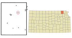
Waverly is a city in Coffey County, Kansas, United States. As of the 2020 census, the population of the city was 574.

<span class="mw-page-title-main">Hepler, Kansas</span> City in Crawford County, Kansas

Hepler is a city in Crawford County, Kansas, United States. As of the 2020 census, the population of the city was 90.

<span class="mw-page-title-main">McCune, Kansas</span> City in Crawford County, Kansas

McCune is a city in Crawford County, Kansas, United States. As of the 2020 census, the population of the city was 370.

<span class="mw-page-title-main">Mulberry, Kansas</span> City in Crawford County, Kansas

Mulberry is a city in Crawford County, Kansas, United States. As of the 2020 census, the population of the city was 409.

<span class="mw-page-title-main">Norcatur, Kansas</span> City in Decatur County, Kansas

Norcatur is a city in Decatur County, Kansas, United States. As of the 2020 census, the population of the city was 159.

<span class="mw-page-title-main">Denton, Kansas</span> City in Doniphan County, Kansas

Denton is a city in Doniphan County, Kansas, United States. As of the 2020 census, the population of the city was 130.

<span class="mw-page-title-main">Gove City, Kansas</span> City in Gove County, Kansas

Gove City, more commonly known as Gove, is a city in and the county seat of Gove County, Kansas, United States. As of the 2020 census, the population of the city was 80.

<span class="mw-page-title-main">Mission Woods, Kansas</span> City in Kansas, United States

Mission Woods is a city in Johnson County, Kansas, United States, and part of the Kansas City Metropolitan Area. As of the 2020 census, the population of the city was 203.

<span class="mw-page-title-main">Meade, Kansas</span> City in Meade County, Kansas

Meade is a city in and the county seat of Meade County, Kansas, United States. As of the 2020 census, the population of the city was 1,505.

<span class="mw-page-title-main">Ness City, Kansas</span> City in Ness County, Kansas

Ness City is a city in and the county seat of Ness County, Kansas, United States. As of the 2020 census, the population of the city was 1,329. Ness City is famous for its four-story Old Ness County Bank Building located downtown, and nicknamed Skyscraper of the Plains.

<span class="mw-page-title-main">Lyndon, Kansas</span> City in Osage County, Kansas

Lyndon is a city in, and the county seat of Osage County, Kansas, United States. As of the 2020 census, the population of the city was 1,037.

<span class="mw-page-title-main">Belleville, Kansas</span> City in Republic County, Kansas

Belleville is a city in and the county seat of Republic County, Kansas, United States. As of the 2020 census, the population of the city was 2,007.

<span class="mw-page-title-main">Munden, Kansas</span> City in Republic County, Kansas

Munden is a city in Republic County, Kansas, United States. As of the 2020 census, the population of the city was 96.

<span class="mw-page-title-main">Clearwater, Kansas</span> City in Sedgwick County, Kansas

Clearwater is a city in Sedgwick County, Kansas, United States. As of the 2020 census, the population of the city was 2,653.

<span class="mw-page-title-main">Colwich, Kansas</span> City in Sedgwick County, Kansas

Colwich is a city in Sedgwick County, Kansas, United States, located northwest of Wichita. As of the 2020 census, the population of the city was 1,455.

<span class="mw-page-title-main">Mount Hope, Kansas</span> City in Sedgwick County, Kansas

Mount Hope is a city in Sedgwick County, Kansas, United States. As of the 2020 census, the population of the city was 806.

<span class="mw-page-title-main">Mayfield, Kansas</span> City in Sumner County, Kansas

Mayfield is a city in Sumner County, Kansas, United States. As of the 2020 census, the population of the city was 75.

<span class="mw-page-title-main">Milan, Kansas</span> City in Sumner County, Kansas

Milan is a city in Sumner County, Kansas, United States. As of the 2020 census, the population of the city was 56.

<span class="mw-page-title-main">Lake Quivira, Kansas</span> City in Kansas, United States

Lake Quivira is a city in Johnson and Wyandotte counties in the State of Kansas, and part of the Kansas City Metropolitan Area. As of the 2020 census, the population of the city was 1,014.

References

  1. 1 2 3 4 U.S. Geological Survey Geographic Names Information System: Oneida, Kansas
  2. "2019 U.S. Gazetteer Files". United States Census Bureau. Retrieved July 24, 2020.
  3. 1 2 "Profile of Oneida, Kansas in 2020". United States Census Bureau. Archived from the original on June 10, 2022. Retrieved June 9, 2022.
  4. 1 2 Blackmar, Frank Wilson (1912). Kansas: A Cyclopedia of State History, Volume 2. Standard Publishing Company. p. 392.
  5. Capace, Nancy (June 1, 2000). Encyclopedia of Kansas. North American Book Dist LLC. p. 246. ISBN   978-0-403-09312-0.
  6. "US Gazetteer files 2010". United States Census Bureau. Archived from the original on July 2, 2012. Retrieved July 6, 2012.
  7. "US Census Bureau, Table P16: HOUSEHOLD TYPE". data.census.gov. Retrieved January 3, 2024.
  8. 1 2 3 4 5 "US Census Bureau, Table DP1: PROFILE OF GENERAL POPULATION AND HOUSING CHARACTERISTICS". data.census.gov. Retrieved January 3, 2024.
  9. Bureau, US Census. "Gazetteer Files". Census.gov. Retrieved December 30, 2023.
  10. "US Census Bureau, Table P1: RACE". data.census.gov. Retrieved January 3, 2024.
  11. "US Census Bureau, Table P2: HISPANIC OR LATINO, AND NOT HISPANIC OR LATINO BY RACE". data.census.gov. Retrieved January 3, 2024.
  12. "US Census Bureau, Table S1101: HOUSEHOLDS AND FAMILIES". data.census.gov. Retrieved January 3, 2024.
  13. "US Census Bureau, Table S1501: EDUCATIONAL ATTAINMENT". data.census.gov. Retrieved January 3, 2024.
  14. "US Census Bureau, Table S1903: MEDIAN INCOME IN THE PAST 12 MONTHS (IN 2020 INFLATION-ADJUSTED DOLLARS)". data.census.gov. Retrieved January 3, 2024.
  15. "US Census Bureau, Table S2001: EARNINGS IN THE PAST 12 MONTHS (IN 2020 INFLATION-ADJUSTED DOLLARS)". data.census.gov. Retrieved January 3, 2024.
  16. "US Census Bureau, Table S1701: POVERTY STATUS IN THE PAST 12 MONTHS". data.census.gov. Retrieved January 3, 2024.
  17. "US Census Bureau, Table S1702: POVERTY STATUS IN THE PAST 12 MONTHS OF FAMILIES". data.census.gov. Retrieved January 3, 2024.
  18. "U.S. Census website". United States Census Bureau . Retrieved July 6, 2012.
  19. "U.S. Census website". United States Census Bureau . Retrieved January 31, 2008.