
Africa is a continent comprising 63 political territories, representing the largest of the great southward projections from the main mass of Earth's surface. Within its regular outline, it comprises an area of 30,368,609 km2 (11,725,385 sq mi), excluding adjacent islands. Its highest mountain is Mount Kilimanjaro, its largest lake is Lake Victoria.
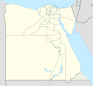
The geography of Egypt relates to two regions: North Africa and Southwest Asia.

California is a U.S. state on the western coast of North America. Covering an area of 163,696 sq mi (423,970 km2), California is among the most geographically diverse states. The Sierra Nevada, the fertile farmlands of the Central Valley, and the arid Mojave Desert of the south are some of the major geographic features of this U.S. state. It is home to some of the world's most exceptional trees: the tallest, most massive, and oldest. It is also home to both the highest and lowest points in the 48 contiguous states. The state is generally divided into Northern and Southern California, although the boundary between the two is not well defined. San Francisco is decidedly a Northern California city and Los Angeles likewise a Southern California one, but areas in between do not often share their confidence in geographic identity. The US Geological Survey defines the geographic center of the state at a point near North Fork, California.

Ethiopia is located in the Horn of Africa. It is bordered by Eritrea to the north, Djibouti and Somalia to the east, Sudan and South Sudan to the west, and Kenya to the south. Ethiopia has a high central plateau that varies from 1,290 to 3,000 m above sea level, with the highest mountain reaching 4,533 m (14,872 ft).

The Palearctic or Palaearctic is the largest of the eight biogeographic realms of the Earth. It stretches across all of Eurasia north of the foothills of the Himalayas, and North Africa.

The Great Basin is the largest area of contiguous endorheic watersheds in North America. It spans nearly all of Nevada, much of Oregon and Utah, and portions of California, Idaho, Wyoming, and Baja California, Mexico. It is noted for both its arid climate and the basin and range topography that varies from the North American low point at Badwater Basin in Death Valley to the highest point of the contiguous United States, less than 100 miles (160 km) away at the summit of Mount Whitney. The region spans several physiographic divisions, biomes, ecoregions, and deserts.

The Mojave Desert is an arid rain-shadow desert and the driest desert in North America. It is in the Southwestern United States, primarily within southeastern California and southern Nevada, and it occupies 47,877 sq mi (124,000 km2). Small areas also extend into Utah and Arizona. Its boundaries are generally noted by the presence of Joshua trees, which are native only to the Mojave Desert and are considered an indicator species, and it is believed to support an additional 1,750 to 2,000 species of plants. The central part of the desert is sparsely populated, while its peripheries support large communities such as Las Vegas in Nevada, Barstow, Lancaster, Palmdale, and Victorville in California, and St. George in Utah.

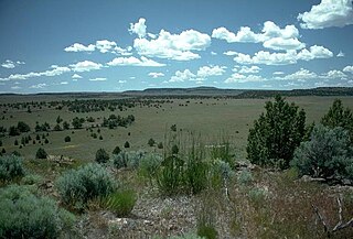
The Great Basin Desert is part of the Great Basin between the Sierra Nevada and the Wasatch Range. The desert is a geographical region that largely overlaps the Great Basin shrub steppe defined by the World Wildlife Fund, and the Central Basin and Range ecoregion defined by the U.S. Environmental Protection Agency and United States Geological Survey. It is a temperate desert with hot, dry summers and snowy winters. The desert spans a large part of the state of Nevada, and extends into western Utah, eastern California, and Idaho. The desert is one of the four biologically defined deserts in North America, in addition to the Mojave, Sonoran, and Chihuahuan Deserts.

Anza-Borrego Desert State Park (ABDSP) is a California State Park located within the Colorado Desert of southern California, United States. The park takes its name from 18th century Spanish explorer Juan Bautista de Anza and borrego, a Spanish word for sheep. With 585,930 acres (237,120 ha) that includes one-fifth of San Diego County, it is the largest state park in California.

The Virgin River is a tributary of the Colorado River in the U.S. states of Utah, Nevada, and Arizona. The river is about 162 miles (261 km) long. It was designated Utah's first wild and scenic river in 2009, during the centennial celebration of Zion National Park.

The Luni is the largest river in the Thar Desert of northwest India. It originates in the Pushkar valley of the Aravalli Range, near Ajmer, passes through the southeastern portion of the Thar Desert, and ends in the marshy lands of Rann of Kutch in Gujarat, after travelling a distance of 495 kilometres (308 mi). It is first known as Sagarmati, then after passing Govindgarh, it meets its tributary Saraswati, which originates from Pushkar Lake, and from then on it is called Luni.

Aleppo Governorate is one of the fourteen governorates of Syria. It is the most populous governorate in Syria with a population of more than 4,867,000, almost 23% of the total population of Syria. The governorate is the fifth in area with an area of 18,482 km2 (7,136 sq mi), or 18,498 sq. km, about 10% of the total area of Syria. The capital is the city of Aleppo.

The wildlife of Egypt is composed of the flora and fauna of this country in northeastern Africa and southwestern Asia, and is substantial and varied. Apart from the fertile Nile Valley, which bisects the country from south to north, the majority of Egypt's landscape is desert, with a few scattered oases. It has long coastlines on the Mediterranean Sea, the Gulf of Suez, the Gulf of Aqaba and the Red Sea. Each geographic region has a diversity of plants and animals each adapted to its own particular habitat.
The Oregon high desert is a region of the U.S. state of Oregon located east of the Cascade Range and south of the Blue Mountains, in the central and eastern parts of the state. Divided into a southern region and a northern region, the desert covers most of five Oregon counties and averages 4,000 feet (1,200 m) above sea level. The southwest region is part of the Great Basin and the southeast is the lower Owyhee River watershed. The northern region is part of the Columbia Plateau, where higher levels of rainfall allow the largest industry on private land to be the cultivation of alfalfa and hay. Public land within the region is owned primarily by the Bureau of Land Management, which manages more than 30,000 square miles (78,000 km2) including five rivers designated as Wild and Scenic.

The Lower Colorado River Valley (LCRV) is the river region of the lower Colorado River of the southwestern United States in North America that rises in the Rocky Mountains and has its outlet at the Colorado River Delta in the northern Gulf of California in northwestern Mexico, between the states of Baja California and Sonora. This north–south stretch of the Colorado River forms the border between the U.S. states of California/Arizona and Nevada/Arizona, and between the Mexican states of Baja California/Sonora.

The Gobi Desert is a large desert or brushland region in East Asia. It covers parts of Northern and Northeastern China and of Southern Mongolia. The desert basins of the Gobi are bounded by the Altai Mountains and the grasslands and steppes of Mongolia on the north, by the Taklamakan Desert to the west, by the Hexi Corridor and Tibetan Plateau to the southwest and by the North China Plain to the southeast. The Gobi is notable in history as the location of several important cities along the Silk Road.

The Sacramento Wash is a major drainage of northwest Arizona in Mohave County. The wash is east of the Black Canyon of the Colorado and drains into the south-flowing Colorado River 45 mi south of Lake Mohave, and 90 mi south of Hoover Dam at Lake Mead. The wash outfall is in the center-south of the Havasu-Mohave Lakes Watershed. An equivalent wash drains to the west of the Colorado River and the Black Canyon, draining southeast Nevada and a small part of California, the Piute Wash of the Piute Valley. The Piute Wash outfall is upstream of the Sacramento's outfall by about 15 miles.

The Buckskin Mountains is a mountain range in La Paz County, Arizona, United States. The range lies just east of the north-south Colorado River, and borders south of the east-west, west-flowing Bill Williams River.
The fauna of the State of California may be the most diverse in the United States of America. Of the Lower 48 conterminous states, California has the greatest diversity in climate, terrain and geology in general. The state's six life zones are the lower Sonoran (desert); upper Sonoran ; transition ; and the Canadian, Hudsonian, and Arctic zones, comprising California's highest elevations. California’s diverse geography gives rise to dozens of different ecosystems, each of which has its own unique native plants and animals. California is a huge state, the 3rd largest in the U.S., and can range broadly in habitat type.
