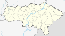
Atkarsky District is an administrative and municipal district (raion), one of the thirty-eight in Saratov Oblast, Russia. It is located in the northwest of the oblast. The area of the district is 2,700 square kilometers (1,000 sq mi). Its administrative center is the town of Atkarsk. Population: 16,550 ; 17,915 (2002 Census); 16,994 (1989 Soviet census).
Balakovsky District is an administrative and municipal district (raion), one of the thirty-eight in Saratov Oblast, Russia. It is located in the north of the oblast. The area of the district is 3,100 square kilometers (1,200 sq mi). Its administrative center is the city of Balakovo. Population: 19,617 ; 20,192 (2002 Census); 18,946 (1989 Soviet census).

Bazarno-Karabulaksky District is an administrative and municipal district (raion), one of the thirty-eight in Saratov Oblast, Russia. It is located in the north of the oblast. The area of the district is 2,300 square kilometers (890 sq mi). Its administrative center is the urban locality of Bazarny Karabulak. Population: 31,841 ; 36,571 (2002 Census); 36,391 (1989 Soviet census). The population of Bazarny Karabulak accounts for 30.9% of the district's total population.

Engelssky District is an administrative and municipal district (raion), one of the thirty-eight in Saratov Oblast, Russia. It is located in the center of the oblast. The area of the district is 3,100 square kilometers (1,200 sq mi). Its administrative center is the city of Engels. Population: 44,832 ; 44,528 (2002 Census); 42,312 (1989 Soviet census).

Ivanteyevsky District is an administrative and municipal district (raion), one of the thirty-eight in Saratov Oblast, Russia. It is located in the northeast of the oblast. The area of the district is 2,000 square kilometers (770 sq mi). Its administrative center is the rural locality of Ivanteyevka. Population: 15,186 ; 16,151 (2002 Census); 15,972 (1989 Soviet census). The population of Ivanteyevka accounts for 40.2% of the district's total population.

Kalininsky District is an administrative and municipal district (raion), one of the thirty-eight in Saratov Oblast, Russia. It is located in the west of the oblast. The area of the district is 2,000 square kilometers (770 sq mi). Its administrative center is the town of Kalininsk. Population: 33,302 ; 39,732 (2002 Census); 39,739 (1989 Soviet census). The population of Kalininsk accounts for 49.4% of the district's total population.

Krasnopartizansky District is an administrative and municipal district (raion), one of the thirty-eight in Saratov Oblast, Russia. It is located in the east of the oblast. The area of the district is 2,400 square kilometers (930 sq mi). Its administrative center is the urban locality of Gorny. Population: 13,008 ; 17,709 (2002 Census); 20,174 (1989 Soviet census). The population of Gorny accounts for 39.1% of the district's total population.

Lysogorsky District is an administrative and municipal district (raion), one of the thirty-eight in Saratov Oblast, Russia. It is located in the southwest of the oblast. The area of the district is 2,300 square kilometers (890 sq mi). Its administrative center is the urban locality of Lysye Gory. Population: 19,948 ; 21,260 (2002 Census); 20,797 (1989 Soviet census). The population of Lysye Gory accounts for 36.0% of the district's total population.

Marksovsky District is an administrative and municipal district (raion), one of the thirty-eight in Saratov Oblast, Russia. It is located in the center of the oblast. The area of the district is 2,900 square kilometers (1,100 sq mi). Its administrative center is the town of Marks. Population: 33,719 ; 34,216 (2002 Census); 30,940 (1989 Soviet census).

Novoburassky District is an administrative and municipal district (raion), one of the thirty-eight in Saratov Oblast, Russia. It is located in the north of the oblast. The area of the district is 1,700 square kilometers (660 sq mi). Its administrative center is the urban locality of Novye Burasy. Population: 16,359 ; 18,188 (2002 Census); 16,703 (1989 Soviet census). The population of Novye Burasy accounts for 35.9% of the district's total population.

Novouzensky District is an administrative and municipal district (raion), one of the thirty-eight in Saratov Oblast, Russia. It is located in the southeast of the oblast. The area of the district is 4,100 square kilometers (1,600 sq mi). Its administrative center is the town of Novouzensk. As of the 2010 Census, the total population of the district was 32,248, with the population of Novouzensk accounting for 52.8% of that number.

Petrovsky District is an administrative and municipal district (raion), one of the thirty-eight in Saratov Oblast, Russia. It is located in the north of the oblast. The area of the district is 2,300 square kilometers (890 sq mi). Its administrative center is the town of Petrovsk. Population: 14,538 ; 16,474 (2002 Census); 15,104 (1989 Soviet census).
Pitersky District is an administrative and municipal district (raion), one of the thirty-eight in Saratov Oblast, Russia. It is located in the south of the oblast. The area of the district is 2,600 square kilometers (1,000 sq mi). Its administrative center is the rural locality of Piterka. Population: 18,054 ; 19,581 (2002 Census); 18,801 (1989 Soviet census). The population of the administrative center accounts for 30.1% of the district's total population.
Pugachyovsky District is an administrative and municipal district (raion), one of the thirty-eight in Saratov Oblast, Russia. It is located in the northeast of the oblast. The area of the district is 3,900.6 square kilometers (1,506.0 sq mi). Its administrative center is the town of Pugachyov. As of the 2010 Census, the total population of the district was 20,031.

Rtishchevsky District is an administrative and municipal district (raion), one of the thirty-eight in Saratov Oblast, Russia. It is located in the northwest of the oblast. The area of the district is 2,300 square kilometers (890 sq mi). Its administrative center is the town of Rtishchevo. Population: 17,383 ; 19,546 (2002 Census); 21,857 (1989 Soviet census).

Samoylovsky District is an administrative and municipal district (raion), one of the thirty-eight in Saratov Oblast, Russia. It is located in the west of the oblast. The area of the district is 2,500 square kilometers (970 sq mi). Its administrative center is the urban locality of Samoylovka. Population: 21,451 ; 25,979 (2002 Census); 26,125 (1989 Soviet census). The population of Samoylovka accounts for 35.3% of the district's total population.

Saratovsky District is an administrative and municipal district (raion), one of the thirty-eight in Saratov Oblast, Russia. It is located in the center of the oblast. The area of the district is 1,900 square kilometers (730 sq mi). Its administrative center is the city of Saratov. Population: 48,105 ; 46,233 (2002 Census); 45,252 (1989 Soviet census).

Sovetsky District is an administrative and municipal district (raion), one of the thirty-eight in Saratov Oblast, Russia. It is located in the center of the oblast. The area of the district is 1,400 square kilometers (540 sq mi). Its administrative center is the urban locality of Stepnoye. Population: 28,012 ; 30,195 (2002 Census); 28,936 (1989 Soviet census). The population of Stepnoye accounts for 46.9% of the district's total population.

Volsky District is an administrative and municipal district (raion), one of the thirty-eight in Saratov Oblast, Russia. It is located in the north of the oblast. The area of the district is 3,700 square kilometers (1,400 sq mi). Its administrative center is the town of Volsk. Population: 27,457 ; 29,977 (2002 Census); 34,174 (1989 Soviet census).

Yekaterinovsky District is an administrative and municipal district (raion), one of the thirty-eight in Saratov Oblast, Russia. It is located in the northwest of the oblast. The area of the district is 3,000 square kilometers (1,200 sq mi). Its administrative center is the urban locality of Yekaterinovka. Population: 19,798 ; 21,576 (2002 Census); 23,649 (1989 Soviet census). The population of Yekaterinovka in 2010 accounted for 32.1% of the district's total population.