Gary is a city in Lake County, Indiana, United States, 25 miles (40 km) from downtown Chicago, Illinois. Gary is adjacent to the Indiana Dunes National Park and borders southern Lake Michigan. Gary was named after lawyer Elbert Henry Gary, who was the founding chairman of the United States Steel Corporation. The city is known for its large steel mills and as the birthplace of the Jackson 5 music group.

A ghetto, often the ghetto, is a part of a city in which members of a minority group live, especially as a result of social, legal, or economic pressure. Ghettos are often known for being more impoverished than other areas of the city. Versions of the ghetto appear across the world, each with their own names, classifications, and groupings of people.

Whittier is a neighborhood within the Powderhorn community in the U.S. city of Minneapolis, Minnesota, bounded by Franklin Avenue on the north, Interstate 35W on the east, Lake Street on the south, and Lyndale Avenue on the west. It is known for its many diverse restaurants, coffee shops and Asian markets, especially along Nicollet Avenue. The neighborhood is home to the Minneapolis Institute of Art, the Minneapolis College of Art and Design, and the Children's Theatre Company.

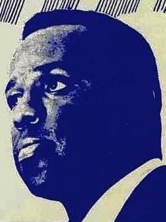
Richard Gordon Hatcher was an American attorney and politician who served as the first African-American mayor of Gary, Indiana for 20 years, from 1968 to 1988. At the time of his first election on November 7, 1967, he and Carl Stokes were the first African-Americans to be elected mayors of a U.S. city with more than 100,000 people. Hatcher also served as Vice-Chairman of the Democratic National Committee in the early 1980s.

Northern Indiana is a region of the U.S. State of Indiana, including 26 counties which border the states of Illinois, Michigan, and Ohio. Northern Indiana is also considered part of the Great Lakes Megalopolis. The area is generally classified into other sub-regions; Northwest Indiana is closely tied with Chicago economically, culturally, and politically and is part of the Chicago metropolitan area. The north central region centers on South Bend metropolitan area, with economic connections to southwest Michigan. Northeast Indiana is centered on the Fort Wayne metropolitan area.

Miller Beach is a neighborhood of Gary, Indiana on the southernmost shore of Lake Michigan. First settled in 1851, Miller Beach was originally an independent town. However, the "Town of Miller" was eventually annexed by the then flourishing city of Gary in 1918. Located in the northeastern corner of Lake County, Indiana, the former town is now known as "The Miller Beach Community." Miller Beach borders Lake Michigan to the north, Porter County to the east, and is largely surrounded by protected lands, including Indiana Dunes National Park. Miller Beach is also the closest beach/resort community to Chicago, and has been a popular vacation spot since the early 20th century. As of the 2000 US census, it had a population of 9,900.
The Fernwood Park race riot was a violent racial conflict instigated by white residents against African American residents who inhabited the Chicago Housing Authority (CHA) veterans' housing project in the Fernwood Park neighborhood in Chicago. Area residents viewed this as one of several attempts by the CHA to initiate racial integration into white communities. The riot took place between 98th and 111th streets and lasted for three days, from the day veterans and their families moved into the project, August 13th, 1947 to August 16th, 1947. The Chicago Police Department did little to stop the rioting, as was the case a year before at the Airport Homes race riots. It was one of the worst race riots in Chicago history.
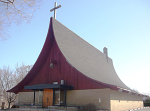
Tolleston is a neighborhood and former town in west-central Gary, Indiana. It is situated south of Ambridge, west of Midtown, east of Westside and north of Black Oak. Tolleston is the site of two large city parks, a historic cemetery, and the oldest church north of the Little Calumet River. The neighborhood's borders are defined by the Norfolk Southern tracks on the north, Grant Street on the east, 25th Avenue on the south, and Clark Road on the west. As of 2000, Tolleston had a population of 14,289, and was 97.5% African-American.

Aetna is a neighborhood in northeastern Gary, Indiana, south of Miller Beach and east of Interstate 65. As of 2000, the neighborhood had a population of 4,942, which was 83% black and 11% white.

Ambridge Mann, sometimes called Ambridge-Horace Mann or Horace Mann-Ambridge, is a neighborhood in northwestern Gary, Indiana. It is bounded by the Grand Calumet River on the north, by Grant Street on the east, by Chase Street on the west, and by the Norfolk Southern railroad on the south. Adjacent areas include an industrial district to the north, Downtown West to the east, Tolleston to the south, and Brunswick to the west. As of 2000, Ambridge Mann had a population of 6,236, which was 96.3% African-American. Located just south of Interstate 90, the neighborhood can be seen while passing Buchanan Street.

Glen Park, also sometimes called University Park, is the most populous neighborhood in Gary, Indiana. It is situated on the city's far south side, south of the Little Calumet River and Borman Expressway. The neighborhood is often divided into Glen Park East and Glen Park West, on the respective sides of Broadway. Within Gary, Glen Park borders on Black Oak to the west and Midtown and Pulaski to the north; beyond Gary, it adjoins Hobart, Merrillville, and unincorporated Calumet Township. As of 2000, the neighborhood had a population of 25,454, approximately a third of Gary's total population. In terms of race, as of 2000 Glen Park was 86% African-American, 9% white, and 5.5% Hispanic.

Midtown, also called Central, is a neighborhood in central Gary, Indiana. For many decades it was the only African-American neighborhood in the city. It is located south of Downtown West and north of Glen Park along Broadway, Gary's principal thoroughfare. It adjoins the neighborhoods of Tolleston to the west and Pulaski to the east. As of 2000, Midtown had a population of 12,056.

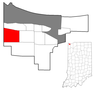
Black Oak is a neighborhood located on the far southwest side of Gary, Indiana. As of 2000, Black Oak had a population of 4,216, which was 84.7% white. It is Gary's only majority-white neighborhood, and the most recent neighborhood added to the city. Black Oak was annexed in 1976, under the administration of mayor Richard Hatcher. Prior to that, Black Oak had been an unincorporated area informally associated with nearby Hammond, and the area has Hammond telephone numbers.

Brunswick is a neighborhood in northwestern Gary, Indiana, just south of Gary Chicago Airport. It borders Hammond and East Chicago to the west, and the Gary neighborhoods of Ambridge Mann to the east and Westside to the south. The borders are defined by the Indiana Toll Road on the north, Chase Street on the east, the Norfolk Southern railway on the south and Cline Avenue on the west. As of 2000, Brunswick had a population of 4,442 people, which was 84.6% African-American and 7.7% white. Like many Gary neighborhoods, Brunswick was a segregated white community until the early 1970s, when massive white flight occurred.
Westside is a neighborhood in west-central Gary, Indiana, USA, bounded by the Cline Avenue expressway on the west, the Norfolk Southern railroad on the north, Clark Road on the east and 25th Avenue on the south. It lies directly east of the Hessville neighborhood of Hammond. Within Gary, it adjoins the neighborhoods of Brunswick, Tolleston and Black Oak. In 2000, Westside had a population of 6,153, which was 63.3% African-American and 31.9% white, with 10.1% Hispanic ethnicity.

Emerson, also called Downtown East, is a neighborhood in north-central Gary, Indiana. Emerson and Downtown West combine to form what is known as Downtown Gary. It was part of the original plat built by the United States Steel Corporation. Emerson is located east of Broadway, south of the Grand Calumet River, north of Ninth Avenue and west of Interstate 65. As of 2000, it had a population of 3,358. Emerson borders directly on Downtown West to the west but is separated from the Aetna and Pulaski neighborhoods to the east and south by an industrial corridor.
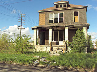
The city of Detroit, in the U.S. state of Michigan, has gone through a major economic and demographic decline in recent decades. The population of the city has fallen from a high of 1,850,000 in 1950 to 680,000 in 2015, removing it off the top 20 of US cities by population for the first time since 1850. However, the city's combined statistical area has a population of 5,318,744 people, which currently ranks 12th in the United States. Local crime rates are among the highest in the United States, and vast areas of the city are in a state of severe urban decay. In 2013, Detroit filed the largest municipal bankruptcy case in U.S. history, which it successfully exited on December 10, 2014. Poverty, crime, shootings, drugs and urban blight in Detroit are ongoing problems.

Downtown West, is a neighborhood in north-central Gary, Indiana. Emerson and Downtown West combine to form what is known as Downtown Gary. It was part of the original plat built by the United States Steel Corporation. It is located East of Grant Street, south of the Grand Calumet River, north of 9th Avenue and west of Broadway. As of 2000, Downtown West had a population of 4,684. Downtown West borders Emerson to the east, Ambridge Mann to the west, and Midtown to the south.

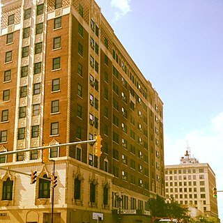
Downtown Gary is split by Broadway into two separate neighborhoods in north-central Gary, Indiana. Emerson and Downtown West combine to form what is known as Downtown Gary. It was part of the original plat built by the United States Steel Corporation. It is located east of Grant Street, south of the Grand Calumet River, north of 9th Avenue and west of Interstate 65. Downtown West borders Ambridge Mann to the west and Midtown to the south, but it is separated from the Aetna and Pulaski neighborhoods to the east and south by an industrial corridor.
The Gary, Indiana mayoral election of 1967 saw the election of Richard G. Hatcher.
