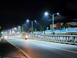
Varkala is a major coastal municipality situated in Southern part of Kollam district in the Indian state of Kerala. It is located 43.5 kilometers (27.0 mi) north-west of Thiruvananthapuram and 27.4 kilometers (17.0 mi) south-west of Kollam.

Nedumangad is a municipal town in the Thiruvananthapuram district in the Indian state of Kerala. It is the headquarters of Nedumangad Tehsil and Nedumangad Revenue Division. It is a suburb of the extended metropolitan region of Thiruvananthapuram. It is located around 16 km (9.9 mi) to the north-east of Thiruvananthapuram on the State Highway 2. It is an important commercial center in the district. It is a growing commercial and educational hub and all important government institutions are situated in the town. The Nedumangadu market has significance in southern Kerala.
Tirurangadi is a municipal town in Malappuram district of the Indian state Kerala. It is a historic town famed for its active participation in the freedom struggle, especially those dating back to the 1920s. It serves as a local taluk and is located, 30 km south of Calicut and 140 km north of Ernakulam.
Mundakayam, is a town in Kanjirappally Taluk in the Kottayam District of Kerala. It is the doorway to the high ranges of southern Kerala, and is at the border of Kottayam and Idukki districts. The next nearest town, Kanjirappally, is 14 km (8.7 mi) & Erumely is 12 km from Mundakayam. Mundakayam has rubber plantations, and greenery. The Manimala River runs through Mundakayam. It is located 48 km east of the district headquarters at Kottayam and 148 km from the state capital, Thiruvananthapuram. The name Mundakayam is said to be derived from the Mundi cranes that used to be seen along the Manimala River banks.

Perumbavoor is a place located at the bank of Periyar in Ernakulam District in the Indian state of Kerala. It is a part of the Kochi metropolitan area. It lies in the northeastern tip of the Greater Cochin area and is also the headquarters of Kunnathunad Taluk. Perumbavoor is famed in the state for wood industries and small-scale industries. Ernakulam lies 30 km southwest of Perumbavoor. The town lies between Angamaly and Muvattupuzha on the Main Central Road (MC), which connects Thiruvananthapuram to Angamaly through the old Travancore part of Kerala.
Nemom is an area in the city of Thiruvananthapuram. It is surrounded by Thirumala in the north, Malayinkeezhu in the north-east, Balaramapuram in the south-east, Kovalam in the south and Thiruvallam in the west. Nemom falls within the municipal corporation of Thiruvananthapuram, though partly exclusive. It is connected with Thiruvananthapuram, Neyyattinkara, Vizhinjam, Poovar, Kattakkada, Nagarcoil, and Kanyakumari through the main arterial highway National Highway 66.
Vattamkulam is a village in Malappuram district of the Indian state of Kerala. Vattamkulam means "Round Pond".
Adoor is a municipality in the Pathanamthitta district of Kerala, India. It is the headquarters of the Adoor Taluk and Adoor Revenue Division. Adoor is located 13.2 km (8.2 mi) southwest of the district headquarters Pathanamthitta and 78.1 km (48.5 mi) north of the state capital Thiruvananthapuram.

Thalayolaparambu is a town situated in Kottayam district in Kerala, India. Spanning over an area of 19.3 square kilometres with a population of 22,571 people, this mini-town is home to some of the well-known personalities such as the former Chief minister of Travancore-Cochin A. J. John, Anaparambil, the late Malayalam novelist/writer Vaikom Muhammed Basheer, the former Chief Justice of India K. G. Balakrishnan. Thalayolaparambu also hosts the major market established during the administration of Velu Thampi Dalawa, and is one of those few Keralite markets that still retains its old-world charm till date.
Kalamassery is a municipality in the Ernakulam district of Kerala, India. It is located 9.6 km (6.0 mi) northeast of the Kochi centre, and is a part of the Kochi metropolitan area. The area's location along the NH 66 and proximity to the IT centres in Kakkanad has enabled it to see a large spurt in economic development since the 1980s.

Kalliasseri is a census town in Kannur district in the Indian state of Kerala. Kalliaseri Panchayat comprises two villages: Kalliasseri and Irinave.
Koorkenchery is a southern suburb of Thrissur in Kerala state, India. It is a major residential and commercial area in Thrissur. The Sri Maheswara Temple is located in the area, famous for its Pooyam festival. It is celebrated at the temple on Pooyam day, of the Malayalam month of Makaram. Koorkenchery is surrounded by desams (areas) like Kannankulangara, Chiyyaram, Vadookara and Kanimangalam.

Kuthiathode is a gram panchayat in Alappuzha district in the Indian state of Kerala. It is only 20 minutes away from Kochi city.
Peyad //peɪjɑd// is a place located in the suburb of Thiruvananthapuram, the capital city of Kerala state in India. The offices of Vilappil Grama Panchayath and Vilappil Village are situated at Peyad.
Manacaud is a locality in Thiruvananthapuram, the capital of Kerala, India. This place is situated between Kamaleswaram and Attakulangara on East Fort - Kovalam - Vizhinjam Road. The United Arab Emirates embassy is also situated in Manacaud.
Venjaramoodu is a north-east suburb of Trivandrum city, the capital of Kerala. It is 9 km (5.6 mi) east of Attingal, 11 km (6.8 mi) northwest of Nedumangad, 12 km (7.5 mi) northeast of Trivandrum City and 26 km (16 mi) south-east of Varkala.
Mavichery is a village which is the part of Pariyaram Gramapanchayath in the Kannur district of Kerala, India.
Aroli is a village of Pappinisseri Panchayat in Kannur district in the Indian state of Kerala.
Kumbidi is a village in Pattambi taluk of Palakkad district in the Indian state of Kerala. It is the administrative headquarters and main commercial centre of Anakkara Panchayath. It is situated opposite to Kuttippuram town and adjacent to Thavanur and Tirunavaya towns. Kumbidi town area extends from town centre to the surrounding areas such as Ummathur, Thottazhiyam, Perumbalam, Panniyur, Puramathilssery, Maniyam Perumbalam and Melazhiyam. It is located on the southern bank of Bharathappuzha river. Kumbidi is located about 5 km south of Kuttippuram town. It was a part of Ponnani taluk until 16 June 1969.
Perumbavoor has many Hindu temples, Muslim mosques and Christian churches. As the area is dominated by expatriate north Indian workers, some places of worship cater to the taste of North Indian devotees.

